


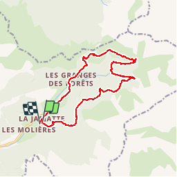

10.5 km | 20 km-effort


User


FREE GPS app for hiking
 SityTrail
IGN / Geographical institutes
SityTrail World
The world is yours!
Trail Walking of 15.8 km to be discovered at Auvergne-Rhône-Alpes, Drôme, Lus-la-Croix-Haute. This trail is proposed by pb07.
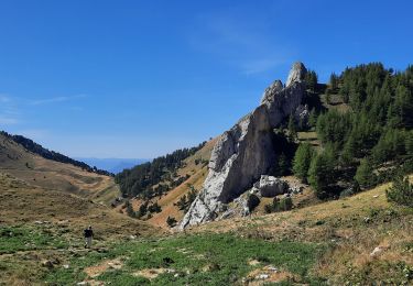
Randonnée de moyenne altitude, d'abord sur le versant Nord frais et boisé puis sur le versant sud dans les pâturages.
Le pont sur le Buech avant le Ravin du Fleytard a été détruit. La traversée peut être impraticable par hautes eaux.

Walking

Walking

Walking

Walking

Walking

Walking

Walking

Walking
Walking