![](/images/other/stat-length.png)
![Trail Walking The Municipal District of Cahir — Cashel - Cahir Scaragh Wood Trail 3 - Photo](https://media.geolcdn.com/t/1900/400/ext.pjpeg?maxdim=2&url=https%3A%2F%2Fservices.sitytrail.com%2FGeolivesWS%2FDownloadMedia.ashx%3FTrailID%3D47054%26Media%3Dimage5.jpg)
Cahir Scaragh Wood Trail 3
johnkeating
User
![Length](/images/other/stat-length.png)
Length
6.4 km
![Max alt](https://static1.geolcdn.com/siteimages/upload/files/1508320355ic_sort_altitude_max_24dp.png)
Max alt
299 m
![Uphill gradient](https://static1.geolcdn.com/siteimages/upload/files/1508320355ic_sort_den_pos_24dp.png)
Uphill gradient
220 m
![Km-Effort](/images/other/stat-length.png)
Km-Effort
9.4 km
![Min alt](https://static1.geolcdn.com/siteimages/upload/files/1508320355ic_sort_altitude_min_24dp.png)
Min alt
99 m
![Downhill gradient](https://static1.geolcdn.com/siteimages/upload/files/1508320355ic_sort_den_neg_24dp.png)
Downhill gradient
225 m
![Boucle](https://static1.geolcdn.com/siteimages/upload/files/16400158638029165_repeat_loop_refresh_sync_direction_icon.png)
Boucle
Yes
Creation date :
2014-12-10 00:00:00.0
Updated on :
2014-12-10 00:00:00.0
![Walking](https://static1.geolcdn.com/sitytour/trail-icons/101.png)
1h35
Difficulty : Unknown
![Scan this QR Code to open this trail in the SityTrail application](https://capi.geolives.com/qq0zvz2zws4bq2lad0pu/sitytour/trails/47054/qr.png?size=200)
FREE GPS app for hiking
About
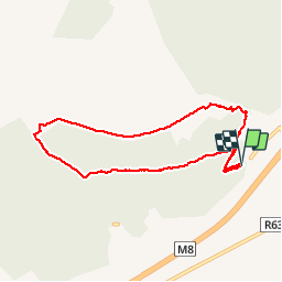
Trail Walking of 6.4 km to be discovered at Unknown, County Tipperary, The Municipal District of Cahir — Cashel. This trail is proposed by johnkeating.
Description
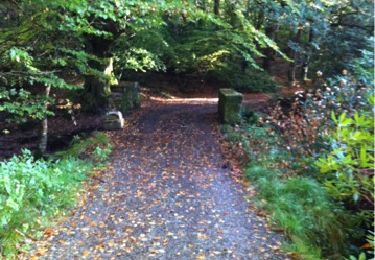
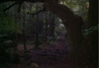
Park 50 metres from Mountain Road entrace to Scaragh Wood. Trail follows forest tracks upwards to open mountain. Remains above tree line with excellent views of Cahir, Knockmealdowns, Comeraghs and Slievnamon. Descends via forest track and small paths.
Positioning
Country:
Ireland
Region :
Unknown
Department/Province :
County Tipperary
Municipality :
The Municipal District of Cahir — Cashel
Location:
Kilcommon
Start:(Dec)
Start:(UTM)
570883 ; 5803432 (29U) N.
Comments
Trails nearby
![Trail Walking The Municipal District of Cahir — Cashel - Cahir Scaragh Wood Trail 2 - Photo](https://media.geolcdn.com/t/375/260/ext.jpg?maxdim=2&url=https%3A%2F%2Fservices.sitytrail.com%2FGeolivesWS%2FDownloadMedia.ashx%3FTrailID%3D47228%26Media%3Dimage7.jpg)
![Walking Walking](https://static1.geolcdn.com/sitytour/trail-icons/101.png)
Cahir Scaragh Wood Trail 2
Walking
Very easy
The Municipal District of Cahir — Cashel,
Unknown,
County Tipperary,
Ireland
![](/images/other/stat-length.png)
5.5 km | 7.4 km-effort
1h 15min
![](https://static1.geolcdn.com/siteimages/upload/files/16400158638029165_repeat_loop_refresh_sync_direction_icon.png)
Yes
![Trail Walking The Municipal District of Cahir — Cashel - Cahir Scaragh Wood Trail 1 - Photo](https://media.geolcdn.com/t/375/260/ext.jpg?maxdim=2&url=https%3A%2F%2Fservices.sitytrail.com%2FGeolivesWS%2FDownloadMedia.ashx%3FTrailID%3D47126%26Media%3Dimage2.jpg)
![Walking Walking](https://static1.geolcdn.com/sitytour/trail-icons/101.png)
Cahir Scaragh Wood Trail 1
Walking
Very easy
The Municipal District of Cahir — Cashel,
Unknown,
County Tipperary,
Ireland
![](/images/other/stat-length.png)
4.6 km | 5.9 km-effort
1h 0min
![](https://static1.geolcdn.com/siteimages/upload/files/16400158638029165_repeat_loop_refresh_sync_direction_icon.png)
Yes