![](/images/other/stat-length.png)
![Trail Walking Charbonnières-les-Vieilles - Les moulins de la Morge - Photo](https://media.geolcdn.com/t/1900/400/ext.pjpeg?maxdim=2&url=https%3A%2F%2Fservices.sitytrail.com%2FGeolivesWS%2FDownloadMedia.ashx%3FTrailID%3D461599%26Media%3D4b9d2982-8e5c-4ba4-8986-dbe9a3f80cf7.jpg)
Les moulins de la Morge
Gegetop
User
![Length](/images/other/stat-length.png)
Length
14.3 km
![Max alt](https://static1.geolcdn.com/siteimages/upload/files/1508320355ic_sort_altitude_max_24dp.png)
Max alt
713 m
![Uphill gradient](https://static1.geolcdn.com/siteimages/upload/files/1508320355ic_sort_den_pos_24dp.png)
Uphill gradient
362 m
![Km-Effort](/images/other/stat-length.png)
Km-Effort
19.1 km
![Min alt](https://static1.geolcdn.com/siteimages/upload/files/1508320355ic_sort_altitude_min_24dp.png)
Min alt
513 m
![Downhill gradient](https://static1.geolcdn.com/siteimages/upload/files/1508320355ic_sort_den_neg_24dp.png)
Downhill gradient
362 m
![Boucle](https://static1.geolcdn.com/siteimages/upload/files/16400158638029165_repeat_loop_refresh_sync_direction_icon.png)
Boucle
Yes
Creation date :
2015-08-20 00:00:00.0
Updated on :
2015-08-20 00:00:00.0
![Walking](https://static1.geolcdn.com/sitytour/trail-icons/101.png)
3h15
Difficulty : Medium
![Scan this QR Code to open this trail in the SityTrail application](https://capi.geolives.com/qq0zvz2zws4bq2lad0pu/sitytour/trails/461599/qr.png?size=200)
FREE GPS app for hiking
About
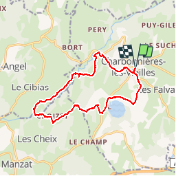
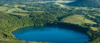
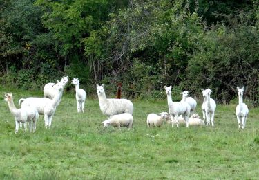
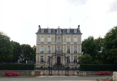
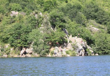
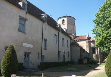
Trail Walking of 14.3 km to be discovered at Auvergne-Rhône-Alpes, Puy-de-Dôme, Charbonnières-les-Vieilles. This trail is proposed by Gegetop.
Description
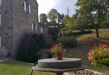
Vous trouverez cette randonnée n°16 dans le guide Chamina La chaine des Puys.
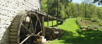
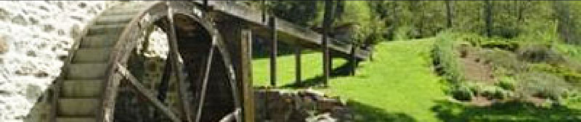
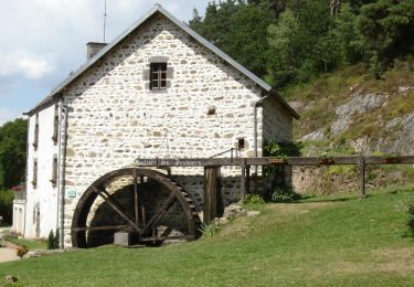
Attention le circuit à été modifié, il est maintenant balisé en jaune et le tracé change à partir du moulin des Desniers.
Positioning
Country:
France
Region :
Auvergne-Rhône-Alpes
Department/Province :
Puy-de-Dôme
Municipality :
Charbonnières-les-Vieilles
Location:
Unknown
Start:(Dec)
Start:(UTM)
500051 ; 5093550 (31T) N.
Comments
Trails nearby
![Trail Walking Blot-l'Église - Blot_Eglise_Pery - Photo](https://media.geolcdn.com/t/375/260/d9de8da0-8f81-48e6-a962-7e78784a81e9.jpg&format=jpg&maxdim=2)
![Walking Walking](https://static1.geolcdn.com/sitytour/trail-icons/101.png)
Blot_Eglise_Pery
Walking
Easy
(2)
Blot-l'Église,
Auvergne-Rhône-Alpes,
Puy-de-Dôme,
France
![](/images/other/stat-length.png)
9.8 km | 12.1 km-effort
3h 0min
![](https://static1.geolcdn.com/siteimages/upload/files/16400158638029165_repeat_loop_refresh_sync_direction_icon.png)
Yes
![Trail Walking Charbonnières-les-Vieilles - Charbonnieres_Moulins_Morge_1 - Photo](https://media.geolcdn.com/t/375/260/216388d8-dbb2-4bb2-b898-ee7654baad1a.jpg&format=jpg&maxdim=2)
![Walking Walking](https://static1.geolcdn.com/sitytour/trail-icons/101.png)
Charbonnieres_Moulins_Morge_1
Walking
Medium
(1)
Charbonnières-les-Vieilles,
Auvergne-Rhône-Alpes,
Puy-de-Dôme,
France
![](/images/other/stat-length.png)
10.7 km | 14.8 km-effort
3h 15min
![](https://static1.geolcdn.com/siteimages/upload/files/16400158638029165_repeat_loop_refresh_sync_direction_icon.png)
Yes
![Trail Walking Charbonnières-les-Vieilles - Les moulins de la Morge - Photo](https://media.geolcdn.com/t/375/260/ext.jpg?maxdim=2&url=https%3A%2F%2Fservices.sitytrail.com%2FGeolivesWS%2FDownloadMedia.ashx%3FTrailID%3D104209%26Media%3D7360_2.jpg)
![Walking Walking](https://static1.geolcdn.com/sitytour/trail-icons/101.png)
Les moulins de la Morge
Walking
Medium
(1)
Charbonnières-les-Vieilles,
Auvergne-Rhône-Alpes,
Puy-de-Dôme,
France
![](/images/other/stat-length.png)
14.5 km | 19.4 km-effort
3h 49min
![](https://static1.geolcdn.com/siteimages/upload/files/16400158638029165_repeat_loop_refresh_sync_direction_icon.png)
Yes
![Trail On foot Charbonnières-les-Vieilles - Le Gour de Tazenat - circuit bleu - Photo](https://media.geolcdn.com/t/375/260/8230f2b0-ccfb-4cd9-8aa4-51b5081b9b49.jpeg&format=jpg&maxdim=2)
![On foot On foot](https://static1.geolcdn.com/sitytour/trail-icons/100.png)
Le Gour de Tazenat - circuit bleu
On foot
Easy
Charbonnières-les-Vieilles,
Auvergne-Rhône-Alpes,
Puy-de-Dôme,
France
![](/images/other/stat-length.png)
6.4 km | 8.3 km-effort
1h 53min
![](https://static1.geolcdn.com/siteimages/upload/files/16400158638029165_repeat_loop_refresh_sync_direction_icon.png)
Yes
![Trail On foot Charbonnières-les-Vieilles - Les Moulins de la Morge - Photo](https://media.geolcdn.com/t/375/260/fd60b4fe-8fad-4d1f-8b92-5e106d478719.jpeg&format=jpg&maxdim=2)
![On foot On foot](https://static1.geolcdn.com/sitytour/trail-icons/100.png)
Les Moulins de la Morge
On foot
Easy
Charbonnières-les-Vieilles,
Auvergne-Rhône-Alpes,
Puy-de-Dôme,
France
![](/images/other/stat-length.png)
13.3 km | 18.2 km-effort
4h 8min
![](https://static1.geolcdn.com/siteimages/upload/files/16400158638029165_repeat_loop_refresh_sync_direction_icon.png)
Yes
![Trail On foot Charbonnières-les-Vieilles - Le Gour de Tazenat - Photo](https://media.geolcdn.com/t/375/260/20ada79d-32ef-4fe6-85b1-bd8631813a01.jpeg&format=jpg&maxdim=2)
![On foot On foot](https://static1.geolcdn.com/sitytour/trail-icons/100.png)
Le Gour de Tazenat
On foot
Easy
Charbonnières-les-Vieilles,
Auvergne-Rhône-Alpes,
Puy-de-Dôme,
France
![](/images/other/stat-length.png)
3.9 km | 5.2 km-effort
1h 11min
![](https://static1.geolcdn.com/siteimages/upload/files/16400158638029165_repeat_loop_refresh_sync_direction_icon.png)
Yes
![Trail Mountain bike Saint-Angel - St-Angel_Sioule_35 - Photo](https://media.geolcdn.com/t/375/260/ext.jpg?maxdim=2&url=https%3A%2F%2Fstatic1.geolcdn.com%2Fsiteimages%2Fupload%2Ffiles%2F1524743154velo.jpg)
![Mountain bike Mountain bike](https://static1.geolcdn.com/sitytour/trail-icons/202.png)
St-Angel_Sioule_35
Mountain bike
Difficult
(1)
Saint-Angel,
Auvergne-Rhône-Alpes,
Puy-de-Dôme,
France
![](/images/other/stat-length.png)
35 km | 49 km-effort
3h 23min
![](https://static1.geolcdn.com/siteimages/upload/files/16400158638029165_repeat_loop_refresh_sync_direction_icon.png)
Yes
![Trail Walking Charbonnières-les-Vieilles - Charbonnieres_Moulins_Morge_2 - Photo](https://media.geolcdn.com/t/375/260/60602926-61d2-45cb-9eca-e95f5972816a.jpg&format=jpg&maxdim=2)
![Walking Walking](https://static1.geolcdn.com/sitytour/trail-icons/101.png)
Charbonnieres_Moulins_Morge_2
Walking
Medium
Charbonnières-les-Vieilles,
Auvergne-Rhône-Alpes,
Puy-de-Dôme,
France
![](/images/other/stat-length.png)
13.5 km | 18.2 km-effort
4h 0min
![](https://static1.geolcdn.com/siteimages/upload/files/16400158638029165_repeat_loop_refresh_sync_direction_icon.png)
Yes
![Trail On foot Saint-Hilaire-la-Croix - Entre Sep et la Morge - Photo](https://media.geolcdn.com/t/375/260/d8630e1e-c93b-4470-bf2e-68dbd7e69a82.jpeg&format=jpg&maxdim=2)
![On foot On foot](https://static1.geolcdn.com/sitytour/trail-icons/100.png)
Entre Sep et la Morge
On foot
Easy
Saint-Hilaire-la-Croix,
Auvergne-Rhône-Alpes,
Puy-de-Dôme,
France
![](/images/other/stat-length.png)
14 km | 19.1 km-effort
4h 20min
![](https://static1.geolcdn.com/siteimages/upload/files/16400158638029165_repeat_loop_refresh_sync_direction_icon.png)
Yes