![](/images/other/stat-length.png)
![Trail Walking Saint-Chamond - St Chamond - Photo](https://media.geolcdn.com/t/1900/400/ext.pjpeg?maxdim=2&url=https%3A%2F%2Fservices.sitytrail.com%2FGeolivesWS%2FDownloadMedia.ashx%3FTrailID%3D457994%26Media%3D20150812122158.jpg)
St Chamond
GPit42
User
![Length](/images/other/stat-length.png)
Length
13.2 km
![Max alt](https://static1.geolcdn.com/siteimages/upload/files/1508320355ic_sort_altitude_max_24dp.png)
Max alt
830 m
![Uphill gradient](https://static1.geolcdn.com/siteimages/upload/files/1508320355ic_sort_den_pos_24dp.png)
Uphill gradient
491 m
![Km-Effort](/images/other/stat-length.png)
Km-Effort
19.8 km
![Min alt](https://static1.geolcdn.com/siteimages/upload/files/1508320355ic_sort_altitude_min_24dp.png)
Min alt
489 m
![Downhill gradient](https://static1.geolcdn.com/siteimages/upload/files/1508320355ic_sort_den_neg_24dp.png)
Downhill gradient
491 m
![Boucle](https://static1.geolcdn.com/siteimages/upload/files/16400158638029165_repeat_loop_refresh_sync_direction_icon.png)
Boucle
Yes
Creation date :
2015-08-12 00:00:00.0
Updated on :
2015-08-12 00:00:00.0
![Walking](https://static1.geolcdn.com/sitytour/trail-icons/101.png)
4h07
Difficulty : Easy
![Scan this QR Code to open this trail in the SityTrail application](https://capi.geolives.com/qq0zvz2zws4bq2lad0pu/sitytour/trails/457994/qr.png?size=200)
FREE GPS app for hiking
About
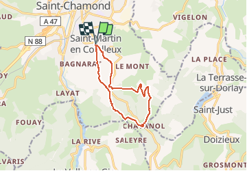
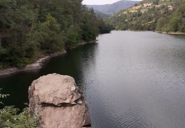
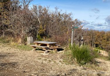
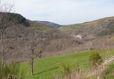
Trail Walking of 13.2 km to be discovered at Auvergne-Rhône-Alpes, Loire, Saint-Chamond. This trail is proposed by GPit42.
Description
balade 8 du guide de St Chamond
donnée pour 10,5kms et 3H15
la distance relevé sur un autre GPS 11,67Kms me semble plus précise que celle indiquée ici 13,2Kms
Positioning
Country:
France
Region :
Auvergne-Rhône-Alpes
Department/Province :
Loire
Municipality :
Saint-Chamond
Location:
Unknown
Start:(Dec)
Start:(UTM)
618960 ; 5035307 (31T) N.
Comments
Trails nearby
![Trail Walking La Valla-en-Gier - 42 valla en gier - Photo](https://media.geolcdn.com/t/375/260/eb5a7ce3-ce83-4d46-9cc9-f2c7dfee832c.jpg&format=jpg&maxdim=2)
![Walking Walking](https://static1.geolcdn.com/sitytour/trail-icons/101.png)
42 valla en gier
Walking
Easy
La Valla-en-Gier,
Auvergne-Rhône-Alpes,
Loire,
France
![](/images/other/stat-length.png)
10.1 km | 13 km-effort
4h 22min
![](https://static1.geolcdn.com/siteimages/upload/files/16400158638029165_repeat_loop_refresh_sync_direction_icon.png)
Yes
![Trail Walking La Valla-en-Gier - 42 valla en giers - Photo](https://media.geolcdn.com/t/375/260/afca84ff-87d0-4dc0-b647-e7250167aed8.jpg&format=jpg&maxdim=2)
![Walking Walking](https://static1.geolcdn.com/sitytour/trail-icons/101.png)
42 valla en giers
Walking
Easy
La Valla-en-Gier,
Auvergne-Rhône-Alpes,
Loire,
France
![](/images/other/stat-length.png)
9.3 km | 14.5 km-effort
3h 43min
![](https://static1.geolcdn.com/siteimages/upload/files/16400158638029165_repeat_loop_refresh_sync_direction_icon.png)
No
![Trail Cycle Saint-Chamond - samedi 13 août 22 - Photo](https://media.geolcdn.com/t/375/260/ext.jpg?maxdim=2&url=https%3A%2F%2Fstatic1.geolcdn.com%2Fsiteimages%2Fupload%2Ffiles%2F1524743154velo.jpg)
![Cycle Cycle](https://static1.geolcdn.com/sitytour/trail-icons/200.png)
samedi 13 août 22
Cycle
Medium
(1)
Saint-Chamond,
Auvergne-Rhône-Alpes,
Loire,
France
![](/images/other/stat-length.png)
60 km | 73 km-effort
Unknown
![](https://static1.geolcdn.com/siteimages/upload/files/16400158638029165_repeat_loop_refresh_sync_direction_icon.png)
Yes
![Trail Walking La Valla-en-Gier - Le Chirat Le Bâcha. Rosillol La Rivoire. - Photo](https://media.geolcdn.com/t/375/260/5b15e76a-0174-4fc8-8ce1-14b387fdd206.jpg&format=jpg&maxdim=2)
![Walking Walking](https://static1.geolcdn.com/sitytour/trail-icons/101.png)
Le Chirat Le Bâcha. Rosillol La Rivoire.
Walking
Medium
La Valla-en-Gier,
Auvergne-Rhône-Alpes,
Loire,
France
![](/images/other/stat-length.png)
11.6 km | 19.1 km-effort
2h 44min
![](https://static1.geolcdn.com/siteimages/upload/files/16400158638029165_repeat_loop_refresh_sync_direction_icon.png)
Yes
![Trail Walking Saint-Chamond - Marche de st martin en coualleux - Photo](https://media.geolcdn.com/t/375/260/ext.jpg?maxdim=2&url=https%3A%2F%2Fservices.sitytrail.com%2FGeolivesWS%2FDownloadMedia.ashx%3FTrailID%3D983958%26Media%3Dfix__20180429140000.jpg)
![Walking Walking](https://static1.geolcdn.com/sitytour/trail-icons/101.png)
Marche de st martin en coualleux
Walking
Medium
Saint-Chamond,
Auvergne-Rhône-Alpes,
Loire,
France
![](/images/other/stat-length.png)
21 km | 31 km-effort
5h 30min
![](https://static1.geolcdn.com/siteimages/upload/files/16400158638029165_repeat_loop_refresh_sync_direction_icon.png)
Yes
![Trail Walking La Valla-en-Gier - la Valla en Gier 42 - Photo](https://media.geolcdn.com/t/375/260/1ad3427a-3d4d-4f84-8afa-e2da4f3b66b4.jpg&format=jpg&maxdim=2)
![Walking Walking](https://static1.geolcdn.com/sitytour/trail-icons/101.png)
la Valla en Gier 42
Walking
Easy
La Valla-en-Gier,
Auvergne-Rhône-Alpes,
Loire,
France
![](/images/other/stat-length.png)
10 km | 13.2 km-effort
3h 32min
![](https://static1.geolcdn.com/siteimages/upload/files/16400158638029165_repeat_loop_refresh_sync_direction_icon.png)
Yes
![Trail Walking La Grand-Croix - La voie de la Galoche au départ de Grand Croix - Photo](https://media.geolcdn.com/t/375/260/d1e2e12f-9992-48f7-a12f-9acde252c00b.jpg&format=jpg&maxdim=2)
![Walking Walking](https://static1.geolcdn.com/sitytour/trail-icons/101.png)
La voie de la Galoche au départ de Grand Croix
Walking
Medium
La Grand-Croix,
Auvergne-Rhône-Alpes,
Loire,
France
![](/images/other/stat-length.png)
21 km | 28 km-effort
4h 56min
![](https://static1.geolcdn.com/siteimages/upload/files/16400158638029165_repeat_loop_refresh_sync_direction_icon.png)
Yes
![Trail Walking La Valla-en-Gier - La Rive Piney Soleyres - Photo](https://media.geolcdn.com/t/375/260/3ca27144-3044-4d6e-aa84-ad0b536c8526.jpg&format=jpg&maxdim=2)
![Walking Walking](https://static1.geolcdn.com/sitytour/trail-icons/101.png)
La Rive Piney Soleyres
Walking
Medium
La Valla-en-Gier,
Auvergne-Rhône-Alpes,
Loire,
France
![](/images/other/stat-length.png)
8.4 km | 13.3 km-effort
3h 32min
![](https://static1.geolcdn.com/siteimages/upload/files/16400158638029165_repeat_loop_refresh_sync_direction_icon.png)
Yes
![Trail Walking L'Horme - balade 3 - Photo](https://media.geolcdn.com/t/375/260/93b8c69a-c0e6-436d-bcd2-e559076b40b1.jpg&format=jpg&maxdim=2)
![Walking Walking](https://static1.geolcdn.com/sitytour/trail-icons/101.png)
balade 3
Walking
Very easy
L'Horme,
Auvergne-Rhône-Alpes,
Loire,
France
![](/images/other/stat-length.png)
6.1 km | 8.1 km-effort
1h 36min
![](https://static1.geolcdn.com/siteimages/upload/files/16400158638029165_repeat_loop_refresh_sync_direction_icon.png)
Yes