


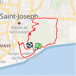


3.4 km | 3.8 km-effort


User


FREE GPS app for hiking
 SityTrail
IGN / Geographical institutes
SityTrail World
The world is yours!
Trail Walking of 3.2 km to be discovered at Réunion, Unknown, Saint-Joseph. This trail is proposed by olive2b.
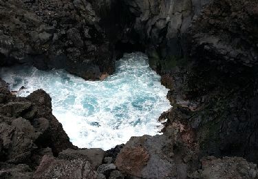
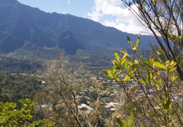
Petite sortie sue Saint-Joseph. La partie par la route pour contourner le piton n'est pas du plus agréable. Petit coin agréable au sommet avec vue sur l'océan.


28 photos in total. Please click on a photo to see them all in the gallery.

Walking
Walking
Walking

Mountain bike

Walking
Walking
Walking
Walking


sport