


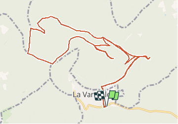

18.4 km | 27 km-effort


User


FREE GPS app for hiking
 SityTrail
IGN / Geographical institutes
SityTrail World
The world is yours!
Trail Equestrian of 14.4 km to be discovered at Grand Est, Bas-Rhin, La Vancelle. This trail is proposed by cavaliersdurieds.
Départ La Vancelle
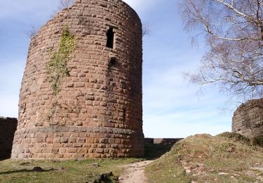
Arrivé au château du Frankenbourg
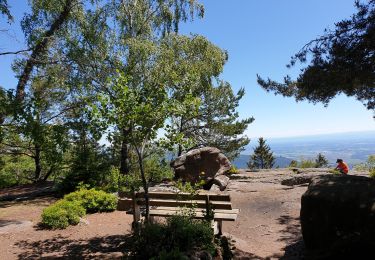
Passage au rocher du Coucou
Passage à la roche des Fées
et au Rondes Roches

Mountain bike

Walking

Walking
Walking
Walking

Walking

Walking
Walking
Walking