![](/images/other/stat-length.png)
![Trail Walking Les Avirons - La Réunion - Boucle au Tevelave par le Sentier Grande Terre - Photo](https://media.geolcdn.com/t/1900/400/ext.pjpeg?maxdim=2&url=https%3A%2F%2Fservices.sitytrail.com%2FGeolivesWS%2FDownloadMedia.ashx%3FTrailID%3D447253%26Media%3Dfix__20150719113959.jpg)
La Réunion - Boucle au Tevelave par le Sentier Grande Terre
olive2b
User
![Length](/images/other/stat-length.png)
![Max alt](https://static1.geolcdn.com/siteimages/upload/files/1508320355ic_sort_altitude_max_24dp.png)
![Uphill gradient](https://static1.geolcdn.com/siteimages/upload/files/1508320355ic_sort_den_pos_24dp.png)
![Km-Effort](/images/other/stat-length.png)
![Min alt](https://static1.geolcdn.com/siteimages/upload/files/1508320355ic_sort_altitude_min_24dp.png)
![Downhill gradient](https://static1.geolcdn.com/siteimages/upload/files/1508320355ic_sort_den_neg_24dp.png)
![Boucle](https://static1.geolcdn.com/siteimages/upload/files/16400158638029165_repeat_loop_refresh_sync_direction_icon.png)
![Walking](https://static1.geolcdn.com/sitytour/trail-icons/101.png)
4h01
Difficulty : Easy
![Scan this QR Code to open this trail in the SityTrail application](https://capi.geolives.com/qq0zvz2zws4bq2lad0pu/sitytour/trails/447253/qr.png?size=200)
FREE GPS app for hiking
About
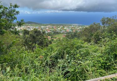
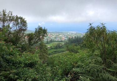
Trail Walking of 11.2 km to be discovered at Réunion, Unknown, Les Avirons. This trail is proposed by olive2b.
Description
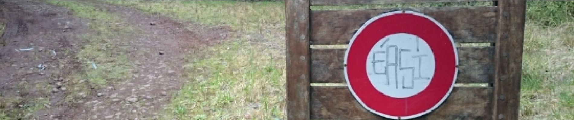
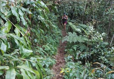
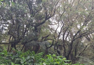
Randonnée agréable dans les sous-bois pour la première partie. Au Kiosque (au niveau de la RF des Tamarins), prendre le sentier Mario, car le sentier des Tamarins est envahi par le végétation.
Pour accéder facilement à la Caverne Tabac, emprunter la piste à gauche (point 1778 sur la carte IGN 1.25000) et aller jusqu'au gué. La caverne de trouve à notre droite; à 01 heures, derrière quelques arbres).
Lors du passage d'une praire (RF des Camélias) où se trouve des vaches, il faut passer des barrières (ne pas oublier de bien refermer derrière). Respectez les lieux.
A l sortie de la praire, suivre la route Vaudeville, jusqu'à la piste des Longoses (à gauche) qui nous ramène au point de départ.
BONNE BALADE.
Positioning
Comments
Trails nearby
![Trail Walking Saint-Louis - Sentier découverte des Makes - Photo](https://media.geolcdn.com/t/375/260/e0a2a7b6-7fb4-493b-b407-5bd5656a61ed.jpg&format=jpg&maxdim=2)
![Walking Walking](https://static1.geolcdn.com/sitytour/trail-icons/101.png)
Walking
![](/images/other/stat-length.png)
![](https://static1.geolcdn.com/siteimages/upload/files/16400158638029165_repeat_loop_refresh_sync_direction_icon.png)
![Trail Walking Les Avirons - Sur la route forestière de Tévelave - Photo](https://media.geolcdn.com/t/375/260/109dccb4-07aa-4f7e-9cbd-0938a0d048ec.jpg&format=jpg&maxdim=2)
![Walking Walking](https://static1.geolcdn.com/sitytour/trail-icons/101.png)
Walking
![](/images/other/stat-length.png)
![](https://static1.geolcdn.com/siteimages/upload/files/16400158638029165_repeat_loop_refresh_sync_direction_icon.png)
![Trail Walking Saint-Louis - 11840720-makes/petit mapou par 11e ligne - Photo](https://media.geolcdn.com/t/375/260/ec2689fe-b6ab-4eb5-a4db-eec5e368e542.jpg&format=jpg&maxdim=2)
![Walking Walking](https://static1.geolcdn.com/sitytour/trail-icons/101.png)
Walking
![](/images/other/stat-length.png)
![](https://static1.geolcdn.com/siteimages/upload/files/16400158638029165_repeat_loop_refresh_sync_direction_icon.png)
![Trail Walking Les Avirons - sentier des ouvriers - Photo](https://media.geolcdn.com/t/375/260/c581b641-d6b2-425a-875b-a73ca70de4af.jpg&format=jpg&maxdim=2)
![Walking Walking](https://static1.geolcdn.com/sitytour/trail-icons/101.png)
Walking
![](/images/other/stat-length.png)
![](https://static1.geolcdn.com/siteimages/upload/files/16400158638029165_repeat_loop_refresh_sync_direction_icon.png)
![Trail Walking Les Avirons - Sentier des ouvriers 20190224 - Photo](https://media.geolcdn.com/t/375/260/869a0788-b6f9-4f1f-8850-e496527cea81.jpg&format=jpg&maxdim=2)
![Walking Walking](https://static1.geolcdn.com/sitytour/trail-icons/101.png)
Walking
![](/images/other/stat-length.png)
![](https://static1.geolcdn.com/siteimages/upload/files/16400158638029165_repeat_loop_refresh_sync_direction_icon.png)
![Trail Walking Les Avirons - La Réunion - Observatoire des Papangues - Photo](https://media.geolcdn.com/t/375/260/ext.jpg?maxdim=2&url=https%3A%2F%2Fservices.sitytrail.com%2FGeolivesWS%2FDownloadMedia.ashx%3FTrailID%3D447254%26Media%3De84d0fc0-7cd0-4b5e-a43f-300302b83197.jpg)
![Walking Walking](https://static1.geolcdn.com/sitytour/trail-icons/101.png)
Walking
![](/images/other/stat-length.png)
![](https://static1.geolcdn.com/siteimages/upload/files/16400158638029165_repeat_loop_refresh_sync_direction_icon.png)
![Trail Walking Saint-Louis - La boucle des Makes - Photo](https://media.geolcdn.com/t/375/260/ext.jpg?maxdim=2&url=https%3A%2F%2Fstatic1.geolcdn.com%2Fsiteimages%2Fupload%2Ffiles%2F1553511878bg_sport_marche.png)
![Walking Walking](https://static1.geolcdn.com/sitytour/trail-icons/101.png)
Walking
![](/images/other/stat-length.png)
![](https://static1.geolcdn.com/siteimages/upload/files/16400158638029165_repeat_loop_refresh_sync_direction_icon.png)
![Trail Walking Saint-Leu - TEST - Photo](https://media.geolcdn.com/t/375/260/ext.jpg?maxdim=2&url=https%3A%2F%2Fstatic1.geolcdn.com%2Fsiteimages%2Fupload%2Ffiles%2F1553511878bg_sport_marche.png)
![Walking Walking](https://static1.geolcdn.com/sitytour/trail-icons/101.png)
![Trail Walking Les Avirons - Sentier des tamarins, vue sur les Makes - Photo](https://media.geolcdn.com/t/375/260/ext.jpg?maxdim=2&url=https%3A%2F%2Fstatic1.geolcdn.com%2Fsiteimages%2Fupload%2Ffiles%2F1553511878bg_sport_marche.png)
![Walking Walking](https://static1.geolcdn.com/sitytour/trail-icons/101.png)
Walking
![](/images/other/stat-length.png)
![](https://static1.geolcdn.com/siteimages/upload/files/16400158638029165_repeat_loop_refresh_sync_direction_icon.png)