


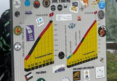
6.4 km | 9.2 km-effort


User


FREE GPS app for hiking
 SityTrail
IGN / Geographical institutes
SityTrail World
The world is yours!
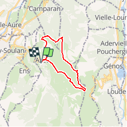
Trail Walking of 10.6 km to be discovered at Occitania, Hautespyrenees, Azet. This trail is proposed by frizou83.

Walking

Walking

Walking

Walking
Walking
Walking
Walking
Walking
Walking
Un grand merci pour la trace car sans elle les 2-3 derniers km auraient été hasardeux. En effet plus de trace visible du chemin jusqu'à la cabane. Même après on est en pleine fougères.