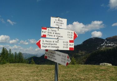
Trail Other activity Campo (Vallemaggia) - Valle di Campo - Valle di Vergeletto - 2. Tag - Photo

Valle di Campo - Valle di Vergeletto - 2. Tag

© OpenStreetMap contributors
Length
Length
15.8 km
Max alt
Max alt
1979 m
Uphill gradient
Uphill gradient
909 m
Km-Effort
Km-Effort  
30 km
Min alt
Min alt
910 m
Downhill gradient
Downhill gradient
1408 m
Boucle
Boucle
No
Creation date :
2014-12-10 00:00:00.0
Updated on :
2014-12-10 00:00:00.0

(0 Reviews)

Other activity
Other activity
--
Difficulty : Unknown

Scan this QR Code to open this trail in the SityTrail application

FREE GPS app for hiking

Logo SityTrail SityTrail

IGN / Geographical institutes

Download SityTrail from the App Store Download SityTrail from Google Play

Logo SityTrail SityTrail World

The world is yours!

Download SityTrail from the App Store Download SityTrail from Google Play Download SityTrail on Huawei AppGallery

About

Trail Other activity of 15.8 km to be discovered at Ticino, Distretto di Vallemaggia, Campo (Vallemaggia). This trail is proposed by alternatives-wandern.

Description

die Beschreibung der Wanderung finden sie unter :
www.alternatives-wandern.ch/touren/trekking/bosco_gurin.htm

Elevation profile

Positioning

Country:
Switzerland
Region :
Ticino
Department/Province :
Distretto di Vallemaggia
Municipality :
Campo (Vallemaggia)
Location:
Unknown
Start:(UTM)
460327 ; 5122506 (32T) N.

Trails nearby

Trail On foot Santa Maria Maggiore - (SI E66) Alpe Cortevecchio (Rifugio Bonasson) - Bivacco Greppi - Photo
On foot
GUIDE+

On foot

Easy
Santa Maria Maggiore, Piemont, Verbano-Cusio-Ossola, Italy
10.9 km | 19.3 km-effort
4h 23min
No
Trail On foot Campo (Vallemaggia) - (SI E64) Campo di Vallemaggia - Alpe Lago (Bivacco Sironi) - Photo
On foot
GUIDE+

On foot

Medium
Campo (Vallemaggia), Ticino, Distretto di Vallemaggia, Switzerland
13.9 km | 29 km-effort
6h 28min
No
Trail Other activity Campo (Vallemaggia) - Bosco Gurin - Photo
Other activity
lroux

Other activity

Very easy
Campo (Vallemaggia), Ticino, Distretto di Vallemaggia, Switzerland
5.2 km | 12.1 km-effort
Unknown
No
Trail Other activity Onsernone - Munzelüm - Photo
Other activity
Dgubler

Other activity

Very easy
Onsernone, Ticino, Distretto di Locarno, Switzerland
2.2 km | 3.2 km-effort
Unknown
No


Close
My subscriptions