Trail Walking Bordes-Uchentein - Boucle du Mont Valier via les Estagnous et les Etangs de Millouga - Photo

Boucle du Mont Valier via les Estagnous et les Etangs de Millouga

© OpenStreetMap contributors
Length
Length
19.8 km
Max alt
Max alt
2814 m
Uphill gradient
Uphill gradient
2130 m
Km-Effort
Km-Effort  
48 km
Min alt
Min alt
931 m
Downhill gradient
Downhill gradient
2137 m
Boucle
Boucle
Yes
Creation date :
2019-04-14 17:15:12.731
Updated on :
2019-04-14 17:15:13.577

(0 Reviews)

Walking
Walking
9h40
Difficulty : Very difficult

Scan this QR Code to open this trail in the SityTrail application

FREE GPS app for hiking

Logo SityTrail SityTrail

IGN / Geographical institutes

Download SityTrail from the App Store Download SityTrail from Google Play

Logo SityTrail SityTrail World

The world is yours!

Download SityTrail from the App Store Download SityTrail from Google Play Download SityTrail on Huawei AppGallery

About

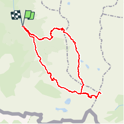
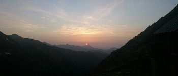
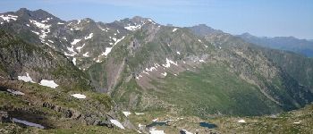
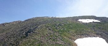
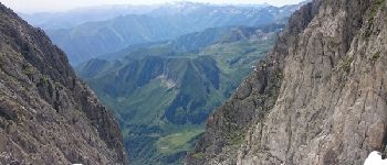
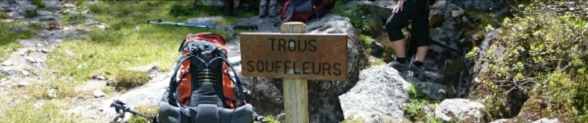
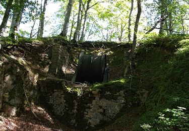
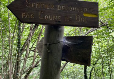
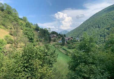
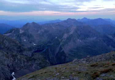
Trail Walking of 19.8 km to be discovered at Occitania, Ariège, Bordes-Uchentein. This trail is proposed by petit-pied.

Elevation profile

Photos

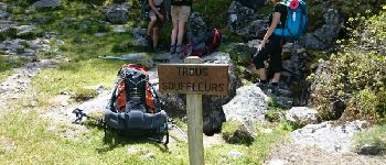
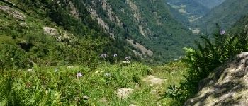
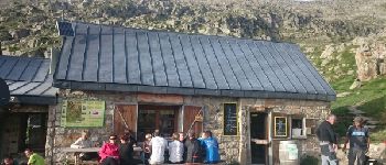
61 photos in total. Please click on a photo to see them all in the gallery.

Points of interest

Point of interest Bordes-Uchentein - Trou Soufleur - Photo
petit-pied
BORDES-UCHENTEIN 
Point of interest Bordes-Uchentein - Cascade Nerech - Photo
petit-pied
BORDES-UCHENTEIN 
Point of interest Bordes-Uchentein - Cascade Nerech - Photo
petit-pied
BORDES-UCHENTEIN 
Point of interest Bordes-Uchentein - Point 4 - Photo
petit-pied
BORDES-UCHENTEIN 
Point of interest Bordes-Uchentein - Point 5 - Photo
petit-pied
BORDES-UCHENTEIN 
Point of interest Bordes-Uchentein - Vallée du Riberot - Photo
petit-pied
BORDES-UCHENTEIN 
Point of interest Bordes-Uchentein - Refuge des Estagnous - Photo
petit-pied
BORDES-UCHENTEIN 
Point of interest Bordes-Uchentein - Etang Long - Photo
petit-pied
BORDES-UCHENTEIN 
Point of interest Bordes-Uchentein - Coucher de soleil depuis les Estagnous - Photo
petit-pied
Point of interest Bordes-Uchentein - Etang Long - Photo
petit-pied
BORDES-UCHENTEIN 
Point of interest Bordes-Uchentein - Glacier d'Arcouzan - Photo
petit-pied
BORDES-UCHENTEIN 
Point of interest Bordes-Uchentein - Conte au Col Faustin - Photo
petit-pied
BORDES-UCHENTEIN 
Point of interest Bordes-Uchentein - Mont Valier - Photo
petit-pied
BORDES-UCHENTEIN 
Point of interest Bordes-Uchentein - Col Faustin - Photo
petit-pied
BORDES-UCHENTEIN 
Point of interest Bordes-Uchentein - Col Faustin - Photo
petit-pied
BORDES-UCHENTEIN 
Point of interest Bordes-Uchentein - Point 67 - Photo
petit-pied
BORDES-UCHENTEIN 
Point of interest Bordes-Uchentein - Point 69 - Photo
petit-pied
BORDES-UCHENTEIN 
Point of interest Bordes-Uchentein - Point 71 - Photo
petit-pied
BORDES-UCHENTEIN 

Positioning

Country:
France
Region :
Occitania
Department/Province :
Ariège
Municipality :
Bordes-Uchentein
Location:
Les Bordes-sur-Lez
Start:(UTM)
339096 ; 4744095 (31T) N.

Trails nearby

Trail Walking Bethmale - Bethmale - Photo
Walking
Gepeto_22

Walking

Medium
(2)
Bethmale, Occitania, Ariège, France
5.4 km | 8.8 km-effort
2h 20min
Yes
Trail Walking Bethmale -  Circuit des cinq étangs (2237m) - Photo
Walking
tigrou31

Walking

Difficult
(3)
Bethmale, Occitania, Ariège, France
18.1 km | 33 km-effort
Unknown
Yes
Trail Walking Bordes-Uchentein - Pic de la Pale de la Clauère - Photo
Walking
beautrix

Walking

Very difficult
(1)
Bordes-Uchentein, Occitania, Ariège, France
7.7 km | 20 km-effort
4h 1min
Yes
Trail Walking Bonac-Irazein - Pic de Courbayran et cabane de Roques - Photo
Walking
chrisgps

Walking

Very difficult
Bonac-Irazein, Occitania, Ariège, France
15.9 km | 29 km-effort
6h 37min
Yes
Trail Walking Bonac-Irazein - tunnels du Biros ou sentier Decauville - Photo
Walking
chrisgps

Walking

Very difficult
Bonac-Irazein, Occitania, Ariège, France
17.8 km | 29 km-effort
6h 35min
Yes
Trail Walking Bonac-Irazein - Sentier du port d’Orle - col du Tuc - Photo
Walking
altaya

Walking

Easy
Bonac-Irazein, Occitania, Ariège, France
13.7 km | 27 km-effort
6h 20min
Yes
Trail Walking Bordes-Uchentein - 2022 TRANSPYRÉNÉENNE - refuge du Valier -refuge d’Esbints - Photo
Walking
LEGUE

Walking

Very difficult
Bordes-Uchentein, Occitania, Ariège, France
18.5 km | 35 km-effort
5h 25min
No
Trail On foot Bethmale - Grand circuit dans la Réserve Naturelle du Mont Valier - Photo
On foot
GUIDE+

On foot

Easy
Bethmale, Occitania, Ariège, France
9.5 km | 19.6 km-effort
4h 26min
No
Trail On foot Bordes-Uchentein - Étangs Long et Rond - Photo
On foot
GUIDE+

On foot

Difficult
Bordes-Uchentein, Occitania, Ariège, France
15.8 km | 36 km-effort
8h 7min
No


Close
My subscriptions