![](/images/other/stat-length.png)
![Trail Walking Orbaizeta - IRABIA 1 par sommets forêt primitive 1 Irabia Iraty par Kontrasario et casa forestal - Photo](https://media.geolcdn.com/t/1900/400/ext.pjpeg?maxdim=2&url=https%3A%2F%2Fstatic1.geolcdn.com%2Fsiteimages%2Fupload%2Ffiles%2F1553511878bg_sport_marche.png)
IRABIA 1 par sommets forêt primitive 1 Irabia Iraty par Kontrasario et casa forestal
DECHAMPD
User
![Length](/images/other/stat-length.png)
Length
13.6 km
![Max alt](https://static1.geolcdn.com/siteimages/upload/files/1508320355ic_sort_altitude_max_24dp.png)
Max alt
1196 m
![Uphill gradient](https://static1.geolcdn.com/siteimages/upload/files/1508320355ic_sort_den_pos_24dp.png)
Uphill gradient
617 m
![Km-Effort](/images/other/stat-length.png)
Km-Effort
22 km
![Min alt](https://static1.geolcdn.com/siteimages/upload/files/1508320355ic_sort_altitude_min_24dp.png)
Min alt
820 m
![Downhill gradient](https://static1.geolcdn.com/siteimages/upload/files/1508320355ic_sort_den_neg_24dp.png)
Downhill gradient
616 m
![Boucle](https://static1.geolcdn.com/siteimages/upload/files/16400158638029165_repeat_loop_refresh_sync_direction_icon.png)
Boucle
Yes
Creation date :
2019-01-14 17:34:08.185
Updated on :
2019-01-14 17:34:08.242
![Walking](https://static1.geolcdn.com/sitytour/trail-icons/101.png)
4h38
Difficulty : Medium
![Scan this QR Code to open this trail in the SityTrail application](https://capi.geolives.com/qq0zvz2zws4bq2lad0pu/sitytour/trails/440655/qr.png?size=200)
FREE GPS app for hiking
About
Trail Walking of 13.6 km to be discovered at Navarre, Unknown, Orbaizeta. This trail is proposed by DECHAMPD.
Description
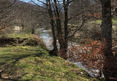
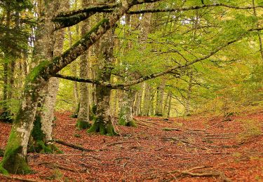
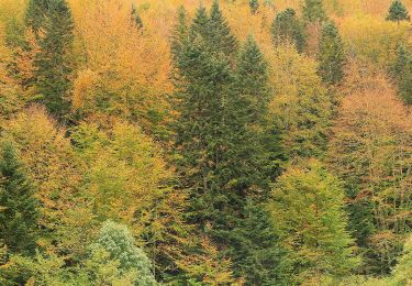
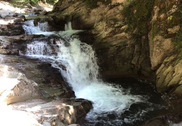
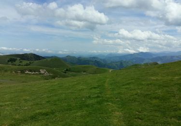
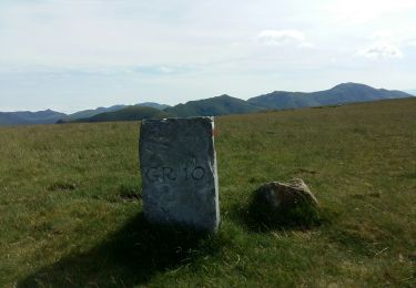
forêt primitive Irabia Iraty par Kontrasario 1198m El Cubo, rio iraty jusqu'à la maison forestière du lac en suivant le GR 11 jusqu'au Puente de la Cuestion et la borne frontière 225 après le gué.
Positioning
Country:
Spain
Region :
Navarre
Department/Province :
Unknown
Municipality :
Orbaizeta
Location:
Unknown
Start:(Dec)
Start:(UTM)
651440 ; 4763471 (30T) N.
Comments
Trails nearby
![Trail On foot Ochagavía/Otsagabia - Beuntza Plazako Bidea - Photo](https://media.geolcdn.com/t/375/260/6b03533b-8ee5-40c6-8273-538bc37d3b3d.jpeg&format=jpg&maxdim=2)
![On foot On foot](https://static1.geolcdn.com/sitytour/trail-icons/100.png)
Beuntza Plazako Bidea
On foot
Easy
Ochagavía/Otsagabia,
Navarre,
Unknown,
Spain
![](/images/other/stat-length.png)
3.5 km | 4.8 km-effort
1h 5min
![](https://static1.geolcdn.com/siteimages/upload/files/16400158638029165_repeat_loop_refresh_sync_direction_icon.png)
Yes
![Trail On foot Ochagavía/Otsagabia - Zabaletako oihaneko bide-zaharra / Sendero del bosque de Zabaleta - Photo](https://media.geolcdn.com/t/375/260/202713c9-3093-41eb-a5c0-ca8d123dcc85.jpeg&format=jpg&maxdim=2)
![On foot On foot](https://static1.geolcdn.com/sitytour/trail-icons/100.png)
Zabaletako oihaneko bide-zaharra / Sendero del bosque de Zabaleta
On foot
Easy
Ochagavía/Otsagabia,
Navarre,
Unknown,
Spain
![](/images/other/stat-length.png)
7.8 km | 11.4 km-effort
2h 34min
![](https://static1.geolcdn.com/siteimages/upload/files/16400158638029165_repeat_loop_refresh_sync_direction_icon.png)
Yes
![Trail Walking Lecumberry - IRATY Pantano de Irabia Boucle courte - Photo](https://media.geolcdn.com/t/375/260/90e781f7-5f6a-44ca-9b42-ab8081c80bf3.jpg&format=jpg&maxdim=2)
![Walking Walking](https://static1.geolcdn.com/sitytour/trail-icons/101.png)
IRATY Pantano de Irabia Boucle courte
Walking
Very easy
Lecumberry,
New Aquitaine,
Pyrénées-Atlantiques,
France
![](/images/other/stat-length.png)
13.6 km | 20 km-effort
5h 7min
![](https://static1.geolcdn.com/siteimages/upload/files/16400158638029165_repeat_loop_refresh_sync_direction_icon.png)
Yes
![Trail Walking Lecumberry - gr10t - Photo](https://media.geolcdn.com/t/375/260/c8d19437-af0a-44a4-afe9-85d3418a077b.jpg&format=jpg&maxdim=2)
![Walking Walking](https://static1.geolcdn.com/sitytour/trail-icons/101.png)
gr10t
Walking
Very difficult
Lecumberry,
New Aquitaine,
Pyrénées-Atlantiques,
France
![](/images/other/stat-length.png)
12 km | 19.6 km-effort
6h 40min
![](https://static1.geolcdn.com/siteimages/upload/files/16400158638029165_repeat_loop_refresh_sync_direction_icon.png)
No
![Trail Walking Lecumberry - okabe - Photo](https://media.geolcdn.com/t/375/260/95f8aa94-d97b-45bf-8dc1-fdbfa64b9b90.jpg&format=jpg&maxdim=2)
![Walking Walking](https://static1.geolcdn.com/sitytour/trail-icons/101.png)
okabe
Walking
Very difficult
Lecumberry,
New Aquitaine,
Pyrénées-Atlantiques,
France
![](/images/other/stat-length.png)
12 km | 19.6 km-effort
2h 27min
![](https://static1.geolcdn.com/siteimages/upload/files/16400158638029165_repeat_loop_refresh_sync_direction_icon.png)
No
![Trail Walking Lecumberry - Okabe magique - Photo](https://media.geolcdn.com/t/375/260/072c8693-4101-429d-bd0b-7f3d41337b96.jpg&format=jpg&maxdim=2)
![Walking Walking](https://static1.geolcdn.com/sitytour/trail-icons/101.png)
Okabe magique
Walking
Difficult
Lecumberry,
New Aquitaine,
Pyrénées-Atlantiques,
France
![](/images/other/stat-length.png)
15.2 km | 25 km-effort
5h 31min
![](https://static1.geolcdn.com/siteimages/upload/files/16400158638029165_repeat_loop_refresh_sync_direction_icon.png)
Yes
![Trail Walking Larrau - IRATY Chapelle Notre Dame des Neiges et Casas de Irati - Photo](https://media.geolcdn.com/t/375/260/4820dd3f-a315-4e52-ac6d-42397795308f.jpg&format=jpg&maxdim=2)
![Walking Walking](https://static1.geolcdn.com/sitytour/trail-icons/101.png)
IRATY Chapelle Notre Dame des Neiges et Casas de Irati
Walking
Easy
Larrau,
New Aquitaine,
Pyrénées-Atlantiques,
France
![](/images/other/stat-length.png)
22 km | 33 km-effort
6h 22min
![](https://static1.geolcdn.com/siteimages/upload/files/16400158638029165_repeat_loop_refresh_sync_direction_icon.png)
Yes
![Trail Walking Lecumberry - Irabia pantano boucle par gr11 - Photo](https://media.geolcdn.com/t/375/260/caf3f193-3b74-42e5-a88e-7b86b53f8978.jpg&format=jpg&maxdim=2)
![Walking Walking](https://static1.geolcdn.com/sitytour/trail-icons/101.png)
Irabia pantano boucle par gr11
Walking
Medium
Lecumberry,
New Aquitaine,
Pyrénées-Atlantiques,
France
![](/images/other/stat-length.png)
18.2 km | 27 km-effort
6h 27min
![](https://static1.geolcdn.com/siteimages/upload/files/16400158638029165_repeat_loop_refresh_sync_direction_icon.png)
Yes
![Trail Walking Orbaizeta - pantano - Photo](https://media.geolcdn.com/t/375/260/ext.jpg?maxdim=2&url=https%3A%2F%2Fservices.sitytrail.com%2FGeolivesWS%2FDownloadMedia.ashx%3FTrailID%3D729781%26Media%3D20170409150000.jpg)
![Walking Walking](https://static1.geolcdn.com/sitytour/trail-icons/101.png)