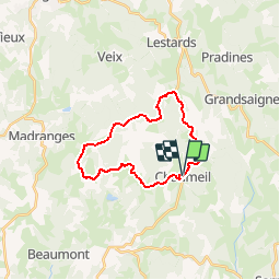
![](/images/other/stat-length.png)
![Trail Cycle Chaumeil - Bol d'or des Monédières (19) - Photo](https://media.geolcdn.com/t/1900/400/ext.pjpeg?maxdim=2&url=https%3A%2F%2Fservices.sitytrail.com%2FGeolivesWS%2FDownloadMedia.ashx%3FTrailID%3D437515%26Media%3D054b3f2b-a5cd-41a8-bb49-5c6201e23832.jpg)
Bol d'or des Monédières (19)
claude19
User
![Length](/images/other/stat-length.png)
![Max alt](https://static1.geolcdn.com/siteimages/upload/files/1508320355ic_sort_altitude_max_24dp.png)
![Uphill gradient](https://static1.geolcdn.com/siteimages/upload/files/1508320355ic_sort_den_pos_24dp.png)
![Km-Effort](/images/other/stat-length.png)
![Min alt](https://static1.geolcdn.com/siteimages/upload/files/1508320355ic_sort_altitude_min_24dp.png)
![Downhill gradient](https://static1.geolcdn.com/siteimages/upload/files/1508320355ic_sort_den_neg_24dp.png)
![Boucle](https://static1.geolcdn.com/siteimages/upload/files/16400158638029165_repeat_loop_refresh_sync_direction_icon.png)
![Cycle](https://static1.geolcdn.com/sitytour/trail-icons/200.png)
59m
Difficulty : Medium
![Scan this QR Code to open this trail in the SityTrail application](https://capi.geolives.com/qq0zvz2zws4bq2lad0pu/sitytour/trails/437515/qr.png?size=200)
FREE GPS app for hiking
About
Trail Cycle of 21 km to be discovered at New Aquitaine, Corrèze, Chaumeil. This trail is proposed by claude19.
Description
Circuit se sur lequel se courait autrefois début août un critérium convoité où se sont illustrés des grands noms du cyclisme français dont une figure régionale : Raymond POULIDOR. Par la suite, la dernière étape de l'ex course cycliste "Paris/Corrèze", initié par le regretté Laurent FIGNON, s'achevait par plusieurs tours de ce même circuit.
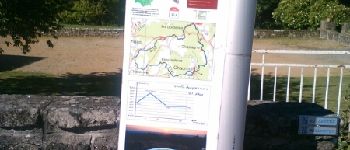
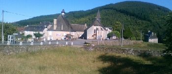
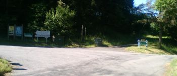
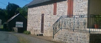
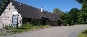
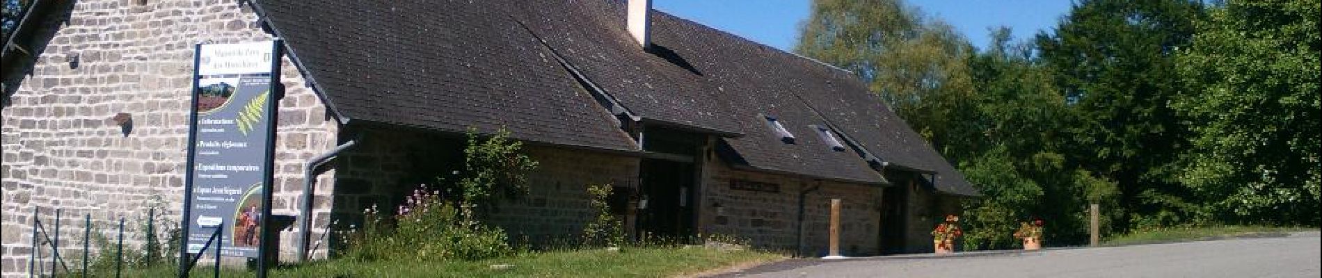
Le départ se fait dans le bourg de CHAUMEIL au niveau de la borne d'information du conseil général.
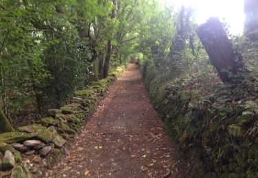
La première partie du circuit vous amènera au col des Géants avec une pente régulière, une route assez large et un bon revêtement hormis le premier kilomètre plus difficile pour s'extraire du bourg.
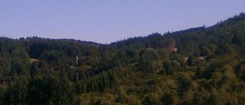
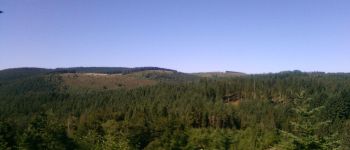
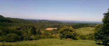
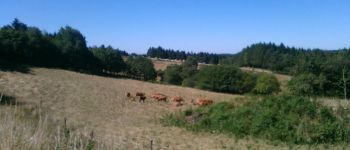
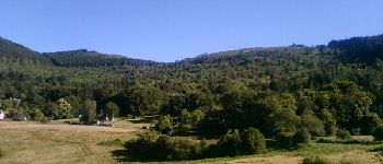
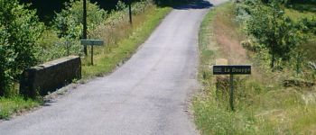
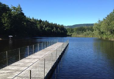
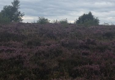
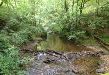
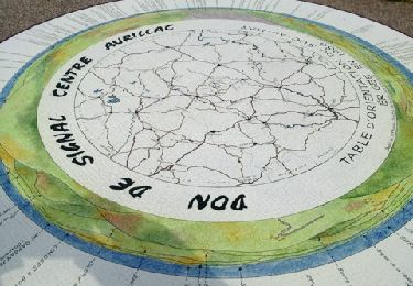
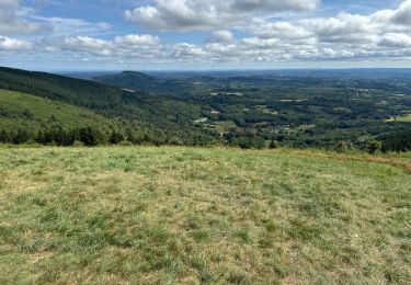
Après avoir viré à gauche au col des Géants, vous allez emprunter une route plus étroite et granuleuse pour vous diriger vers le col du Bos. Vous laisserez alors sur votre gauche la route d'accès à la table d'orientation du "Suc au May" pour vous lancer tout droit dans la descente technique de ce col (prudence) direction la prochaine difficulté, la côte de Chauzeix, que vous ne pourrez pas rater (aïe les jambes !). Puis avant la fin du parcours, vous traverserez "Freysseline" dont vous pourrez admirer la vue sur le cirque (plus jolie l'automne à mon goût grâce aux contrastes des couleurs). Sitôt passée "la Croix sous l'arbre", vous aurez en visuel le bourg de CHAUMEIL avant l'ascension utltime du dernier kilomètre après avoir franchit le pont enjambant la rivière "Douyge" vous permettant de rallier l'arrivée.
Conseil : Si vous restez sur votre faim (sportivement parlant) après ce petit échauffement, lancez vous sur les traces des pros (eux faisaient 7 tours) en enchaînant plusieurs boucles à allure soutenue, vous vous rendrez compte que ce circuit qui parait simple sur le papier est rendu "casse pattes" par la répétition des bosses.
Points of interest
Positioning
Comments
Trails nearby
![Trail Mountain bike Saint-Augustin - Corrèze Monedieres - Photo](https://media.geolcdn.com/t/375/260/ext.jpg?maxdim=2&url=https%3A%2F%2Fservices.sitytrail.com%2FGeolivesWS%2FDownloadMedia.ashx%3FTrailID%3D147974%26Media%3D20120816172954.jpg)
![Mountain bike Mountain bike](https://static1.geolcdn.com/sitytour/trail-icons/202.png)
Mountain bike
![](/images/other/stat-length.png)
![](https://static1.geolcdn.com/siteimages/upload/files/16400158638029165_repeat_loop_refresh_sync_direction_icon.png)
![Trail Walking Saint-Augustin - Bruno 100815 Corrèze - Photo](https://media.geolcdn.com/t/375/260/ext.jpg?maxdim=2&url=https%3A%2F%2Fstatic1.geolcdn.com%2Fsiteimages%2Fupload%2Ffiles%2F1553511878bg_sport_marche.png)
![Walking Walking](https://static1.geolcdn.com/sitytour/trail-icons/101.png)
Walking
![](/images/other/stat-length.png)
![](https://static1.geolcdn.com/siteimages/upload/files/16400158638029165_repeat_loop_refresh_sync_direction_icon.png)
![Trail Walking Chaumeil - petit tour du did - Photo](https://media.geolcdn.com/t/375/260/0fd72dc9-ff58-4f59-94f0-9fa970f8e0fd.jpg&format=jpg&maxdim=2)
![Walking Walking](https://static1.geolcdn.com/sitytour/trail-icons/101.png)
Walking
![](/images/other/stat-length.png)
![](https://static1.geolcdn.com/siteimages/upload/files/16400158638029165_repeat_loop_refresh_sync_direction_icon.png)
![Trail Walking Saint-Augustin - landes et bruyères des monedières - Photo](https://media.geolcdn.com/t/375/260/ext.jpg?maxdim=2&url=https%3A%2F%2Fstatic1.geolcdn.com%2Fsiteimages%2Fupload%2Ffiles%2F1553511878bg_sport_marche.png)
![Walking Walking](https://static1.geolcdn.com/sitytour/trail-icons/101.png)
Walking
![](/images/other/stat-length.png)
![](https://static1.geolcdn.com/siteimages/upload/files/16400158638029165_repeat_loop_refresh_sync_direction_icon.png)
![Trail Mountain bike Saint-Augustin - Bruno 05 août 2016 Correze - Photo](https://media.geolcdn.com/t/375/260/ext.jpg?maxdim=2&url=https%3A%2F%2Fservices.sitytrail.com%2FGeolivesWS%2FDownloadMedia.ashx%3FTrailID%3D609288%26Media%3D20160805202645.jpg)
![Mountain bike Mountain bike](https://static1.geolcdn.com/sitytour/trail-icons/202.png)
Mountain bike
![](/images/other/stat-length.png)
![](https://static1.geolcdn.com/siteimages/upload/files/16400158638029165_repeat_loop_refresh_sync_direction_icon.png)
![Trail Mountain bike Saint-Augustin - Bruno 170815 les Monedieres - Photo](https://media.geolcdn.com/t/375/260/ext.jpg?maxdim=2&url=https%3A%2F%2Fservices.sitytrail.com%2FGeolivesWS%2FDownloadMedia.ashx%3FTrailID%3D460685%26Media%3D20150817154502.jpg)
![Mountain bike Mountain bike](https://static1.geolcdn.com/sitytour/trail-icons/202.png)
Mountain bike
![](/images/other/stat-length.png)
![](https://static1.geolcdn.com/siteimages/upload/files/16400158638029165_repeat_loop_refresh_sync_direction_icon.png)
![Trail Walking Saint-Augustin - Bruno300714 - Photo](https://media.geolcdn.com/t/375/260/ext.jpg?maxdim=2&url=https%3A%2F%2Fservices.sitytrail.com%2FGeolivesWS%2FDownloadMedia.ashx%3FTrailID%3D329452%26Media%3D20140730161507.jpg)
![Walking Walking](https://static1.geolcdn.com/sitytour/trail-icons/101.png)
Walking
![](/images/other/stat-length.png)
![](https://static1.geolcdn.com/siteimages/upload/files/16400158638029165_repeat_loop_refresh_sync_direction_icon.png)
![Trail Mountain bike Saint-Augustin - Bruno Corrèze 2 - Photo](https://media.geolcdn.com/t/375/260/ext.jpg?maxdim=2&url=https%3A%2F%2Fservices.sitytrail.com%2FGeolivesWS%2FDownloadMedia.ashx%3FTrailID%3D210895%26Media%3D20130805165747.jpg)
![Mountain bike Mountain bike](https://static1.geolcdn.com/sitytour/trail-icons/202.png)
Mountain bike
![](/images/other/stat-length.png)
![](https://static1.geolcdn.com/siteimages/upload/files/16400158638029165_repeat_loop_refresh_sync_direction_icon.png)
![Trail sport Chaumeil - F 2024 Moneliete Correze - Photo](https://media.geolcdn.com/t/375/260/3703e1bb-382c-4e94-843a-36b61c831152.jpg&format=jpg&maxdim=2)
sport
![](/images/other/stat-length.png)
![](https://static1.geolcdn.com/siteimages/upload/files/16400158638029165_repeat_loop_refresh_sync_direction_icon.png)