![](/images/other/stat-length.png)
![Trail Walking La Londe-les-Maures - Valcros - Photo](https://media.geolcdn.com/t/1900/400/6e8bf789-3bce-4b6d-a02e-bc7b394812c5.jpg&format=pjpeg&maxdim=2)
Valcros
FSantoni
User
![Length](/images/other/stat-length.png)
![Max alt](https://static1.geolcdn.com/siteimages/upload/files/1508320355ic_sort_altitude_max_24dp.png)
![Uphill gradient](https://static1.geolcdn.com/siteimages/upload/files/1508320355ic_sort_den_pos_24dp.png)
![Km-Effort](/images/other/stat-length.png)
![Min alt](https://static1.geolcdn.com/siteimages/upload/files/1508320355ic_sort_altitude_min_24dp.png)
![Downhill gradient](https://static1.geolcdn.com/siteimages/upload/files/1508320355ic_sort_den_neg_24dp.png)
![Boucle](https://static1.geolcdn.com/siteimages/upload/files/16400158638029165_repeat_loop_refresh_sync_direction_icon.png)
![Walking](https://static1.geolcdn.com/sitytour/trail-icons/101.png)
6h07
Difficulty : Very difficult
![Scan this QR Code to open this trail in the SityTrail application](https://capi.geolives.com/qq0zvz2zws4bq2lad0pu/sitytour/trails/4348313/qr.png?size=200)
FREE GPS app for hiking
About
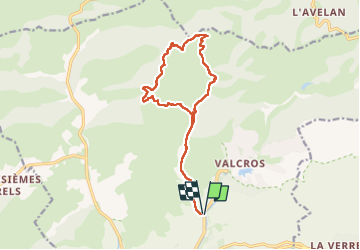
Trail Walking of 16.2 km to be discovered at Provence-Alpes-Côte d'Azur, Var, La Londe-les-Maures. This trail is proposed by FSantoni.
Description
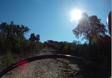
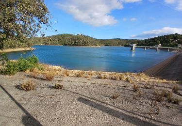
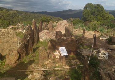
Après les bonnes pluies de ces derniers jours, une promenade sans difficultés mais vraiment trés agréable dans les Maures dans le secteur de Valcros.
Attention, le passage entre les points 9,5 et 12,5 km n'est pas mentionné sur Sity trail alors que ce chemin est en parfait état... Cette application a des lacunes.
Positioning
Comments
Trails nearby
![Trail Walking La Londe-les-Maures - SityTrail - Notre Dame des Maures-12-02-21 - Photo](https://media.geolcdn.com/t/375/260/0b9959c2-5f7c-4a9a-9278-b73c6a0d11e2.jpg&format=jpg&maxdim=2)
![Walking Walking](https://static1.geolcdn.com/sitytour/trail-icons/101.png)
Walking
![](/images/other/stat-length.png)
![](https://static1.geolcdn.com/siteimages/upload/files/16400158638029165_repeat_loop_refresh_sync_direction_icon.png)
![Trail Walking La Londe-les-Maures - la londe des maures- fort de bregancon - Photo](https://media.geolcdn.com/t/375/260/ext.jpg?maxdim=2&url=https%3A%2F%2Fservices.sitytrail.com%2FGeolivesWS%2FDownloadMedia.ashx%3FTrailID%3D174341%26Media%3D20130208144246.jpeg)
![Walking Walking](https://static1.geolcdn.com/sitytour/trail-icons/101.png)
Walking
![](/images/other/stat-length.png)
![](https://static1.geolcdn.com/siteimages/upload/files/16400158638029165_repeat_loop_refresh_sync_direction_icon.png)
![Trail Walking Bormes-les-Mimosas - SityTrail - Barrage du Trapan - Estagnol - Pellegrin - Photo](https://media.geolcdn.com/t/375/260/ebe11e5b-c00f-4172-b479-00c30bf032ed.jpg&format=jpg&maxdim=2)
![Walking Walking](https://static1.geolcdn.com/sitytour/trail-icons/101.png)
Walking
![](/images/other/stat-length.png)
![](https://static1.geolcdn.com/siteimages/upload/files/16400158638029165_repeat_loop_refresh_sync_direction_icon.png)
![Trail Walking Bormes-les-Mimosas - SityTrail - Bormes les Mimosas - Cap Léoube - Photo](https://media.geolcdn.com/t/375/260/313e00c8-6453-4b42-83e0-fd33fc6b49b0.jpg&format=jpg&maxdim=2)
![Walking Walking](https://static1.geolcdn.com/sitytour/trail-icons/101.png)
Walking
![](/images/other/stat-length.png)
![](https://static1.geolcdn.com/siteimages/upload/files/16400158638029165_repeat_loop_refresh_sync_direction_icon.png)
![Trail Walking La Londe-les-Maures - sentier du littoral Lalonde les Maures /Borne les mimosas - Photo](https://media.geolcdn.com/t/375/260/d209c0ef-542c-40b6-8173-c2ec0a0a71bb.jpg&format=jpg&maxdim=2)
![Walking Walking](https://static1.geolcdn.com/sitytour/trail-icons/101.png)
Walking
![](/images/other/stat-length.png)
![](https://static1.geolcdn.com/siteimages/upload/files/16400158638029165_repeat_loop_refresh_sync_direction_icon.png)
![Trail Walking La Londe-les-Maures - dolmen de gautabry - Photo](https://media.geolcdn.com/t/375/260/ext.jpg?maxdim=2&url=https%3A%2F%2Fstatic1.geolcdn.com%2Fsiteimages%2Fupload%2Ffiles%2F1553511878bg_sport_marche.png)
![Walking Walking](https://static1.geolcdn.com/sitytour/trail-icons/101.png)
Walking
![](/images/other/stat-length.png)
![](https://static1.geolcdn.com/siteimages/upload/files/16400158638029165_repeat_loop_refresh_sync_direction_icon.png)
![Trail Walking Bormes-les-Mimosas - Le lac du Trapan - Photo](https://media.geolcdn.com/t/375/260/ext.jpg?maxdim=2&url=https%3A%2F%2Fservices.sitytrail.com%2FGeolivesWS%2FDownloadMedia.ashx%3FTrailID%3D452325%26Media%3D9e2d6742-85b3-4012-991e-d22c6e0c5c2a.jpg)
![Walking Walking](https://static1.geolcdn.com/sitytour/trail-icons/101.png)
Walking
![](/images/other/stat-length.png)
![](https://static1.geolcdn.com/siteimages/upload/files/16400158638029165_repeat_loop_refresh_sync_direction_icon.png)
![Trail Walking Bormes-les-Mimosas - Barrage du Trapan 10-01-2025 - Photo](https://media.geolcdn.com/t/375/260/bbd7ee92-d814-40ba-8b63-839249d00720.jpg&format=jpg&maxdim=2)
![Walking Walking](https://static1.geolcdn.com/sitytour/trail-icons/101.png)
Walking
![](/images/other/stat-length.png)
![](https://static1.geolcdn.com/siteimages/upload/files/16400158638029165_repeat_loop_refresh_sync_direction_icon.png)
![Trail Walking La Londe-les-Maures - La Londe les Maures le col du merle et Dolmen de Gaoutabry - Photo](https://media.geolcdn.com/t/375/260/4dbfd1b5-cbc3-407d-9776-94c5824617c6.jpg&format=jpg&maxdim=2)
![Walking Walking](https://static1.geolcdn.com/sitytour/trail-icons/101.png)
Walking
![](/images/other/stat-length.png)
![](https://static1.geolcdn.com/siteimages/upload/files/16400158638029165_repeat_loop_refresh_sync_direction_icon.png)