


Mt Tumba

Jonathan Haughton
User

Length
13 km

Max alt
2137 m

Uphill gradient
464 m
Km-Effort
19.2 km

Min alt
1734 m

Downhill gradient
479 m
Boucle
No
Creation date :
2025-02-08 06:53:59.495
Updated on :
2025-02-08 10:50:51.174
3h56
Difficulty : Very difficult

FREE GPS app for hiking
 SityTrail
IGN / Geographical institutes
SityTrail World
The world is yours!
About
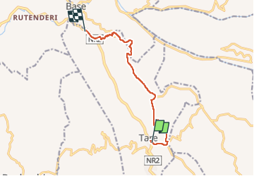
Trail Walking of 13 km to be discovered at Northern Province, Rulindo, Bushoki. This trail is proposed by Jonathan Haughton.
Description
Mt Tumba, Rwanda.
Positioning
Country:
Rwanda
Region :
Northern Province
Department/Province :
Rulindo
Municipality :
Bushoki
Location:
Unknown
Start:(Dec)
Start:(UTM)
824843 ; 9809891 (35M) S.
Comments
Trails nearby