


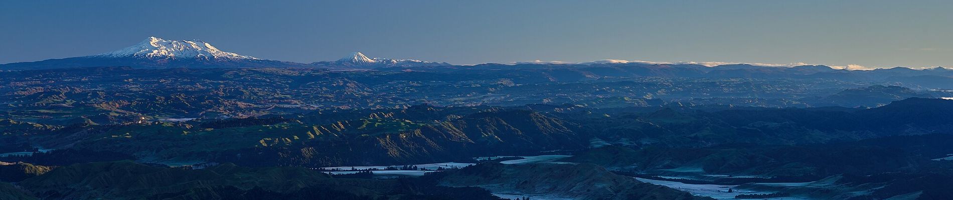
Rangiwahia Hut - Deadmans Track

SityTrail - itinéraires balisés pédestres
Tous les sentiers balisés d’Europe GUIDE+
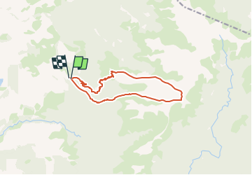

Length
12.8 km

Max alt
1569 m

Uphill gradient
907 m
Km-Effort
25 km

Min alt
844 m

Downhill gradient
925 m
Boucle
Yes

Signpost
Creation date :
2025-02-07 21:26:03.539
Updated on :
2025-02-07 21:26:03.539
5h40
Difficulty : Medium

FREE GPS app for hiking
 SityTrail
IGN / Geographical institutes
SityTrail World
The world is yours!
About
Trail On foot of 12.8 km to be discovered at Manawatu-Whanganui, Manawatū District. This trail is proposed by SityTrail - itinéraires balisés pédestres.
Description
Trail created by Department of Conservation.
Photos


Positioning
Country:
New Zealand
Region :
Manawatu-Whanganui
Department/Province :
Manawatū District
Municipality :
Unknown
Location:
Unknown
Start:(Dec)
Start:(UTM)
414376 ; 5583556 (60H) S.
Comments
Trails nearby