![](/images/other/stat-length.png)
![Trail On foot Prachatice - Goldsteig Verbindungsweg Černý Kříž - Prachatice - Photo](https://media.geolcdn.com/t/1900/400/c3c91cea-0a90-4fdc-abb9-2afc1597ecb3.jpeg&format=pjpeg&maxdim=2)
Goldsteig Verbindungsweg Černý Kříž - Prachatice
SityTrail - itinéraires balisés pédestres
Tous les sentiers balisés d’Europe GUIDE+
![Length](/images/other/stat-length.png)
Length
9.9 km
![Max alt](https://static1.geolcdn.com/siteimages/upload/files/1508320355ic_sort_altitude_max_24dp.png)
Max alt
961 m
![Uphill gradient](https://static1.geolcdn.com/siteimages/upload/files/1508320355ic_sort_den_pos_24dp.png)
Uphill gradient
236 m
![Km-Effort](/images/other/stat-length.png)
Km-Effort
13.2 km
![Min alt](https://static1.geolcdn.com/siteimages/upload/files/1508320355ic_sort_altitude_min_24dp.png)
Min alt
784 m
![Downhill gradient](https://static1.geolcdn.com/siteimages/upload/files/1508320355ic_sort_den_neg_24dp.png)
Downhill gradient
269 m
![Boucle](https://static1.geolcdn.com/siteimages/upload/files/16400158638029165_repeat_loop_refresh_sync_direction_icon.png)
Boucle
No
Signpost
Creation date :
2025-02-07 21:13:58.438
Updated on :
2025-02-07 21:13:58.438
![On foot](https://static1.geolcdn.com/sitytour/trail-icons/100.png)
2h59
Difficulty : Easy
![Scan this QR Code to open this trail in the SityTrail application](https://capi.geolives.com/qq0zvz2zws4bq2lad0pu/sitytour/trails/4346782/qr.png?size=200)
FREE GPS app for hiking
About
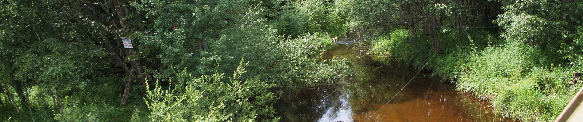
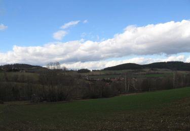
Trail On foot of 9.9 km to be discovered at Southwest, Jihočeský kraj, Prachatice. This trail is proposed by SityTrail - itinéraires balisés pédestres.
Description
Symbol: blauer, stilisierter s-förmiger Weg auf weißem, rechteckigen Grund
Website: https://zlatoustezkou.cz/route/cz10-cerny-kriz-prachatice
Positioning
Country:
Czech Republic
Region :
Southwest
Department/Province :
Jihočeský kraj
Municipality :
Prachatice
Location:
Unknown
Start:(Dec)
Start:(UTM)
425533 ; 5425949 (33U) N.
Comments
Trails nearby
![Trail On foot Prachatice - Vyhlídková stezka kolem Prachatic - Photo](https://media.geolcdn.com/t/375/260/732e7d9f-4905-45c1-bb77-9ba4d21e742a.jpeg&format=jpg&maxdim=2)
![On foot On foot](https://static1.geolcdn.com/sitytour/trail-icons/100.png)
Vyhlídková stezka kolem Prachatic
On foot
Medium
Prachatice,
Southwest,
Jihočeský kraj,
Czech Republic
![](/images/other/stat-length.png)
15.7 km | 22 km-effort
4h 55min
![](https://static1.geolcdn.com/siteimages/upload/files/16400158638029165_repeat_loop_refresh_sync_direction_icon.png)
Yes
![Trail On foot Prachatice - [Ž] U Sedýlka (rozc.) - Rohanov (žst.) - Photo](https://media.geolcdn.com/t/375/260/c1844b2d-a115-4c51-b2be-b07169883f4d.jpeg&format=jpg&maxdim=2)
![On foot On foot](https://static1.geolcdn.com/sitytour/trail-icons/100.png)
[Ž] U Sedýlka (rozc.) - Rohanov (žst.)
On foot
Easy
Prachatice,
Southwest,
Jihočeský kraj,
Czech Republic
![](/images/other/stat-length.png)
4.6 km | 6.6 km-effort
1h 30min
![](https://static1.geolcdn.com/siteimages/upload/files/16400158638029165_repeat_loop_refresh_sync_direction_icon.png)
No