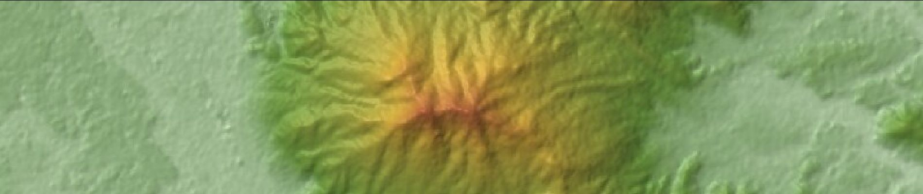
![Trail On foot Unknown - 筑波山頂めぐりの道 - Photo](https://media.geolcdn.com/t/1900/400/c0568851-b12b-4802-bb3e-be95a9029ba5.jpeg&format=pjpeg&maxdim=2)
筑波山頂めぐりの道
SityTrail - itinéraires balisés pédestres
Tous les sentiers balisés d’Europe GUIDE+
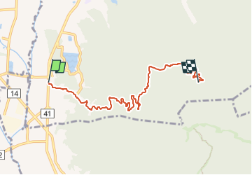
![Length](/images/other/stat-length.png)
Length
7.3 km
![Max alt](https://static1.geolcdn.com/siteimages/upload/files/1508320355ic_sort_altitude_max_24dp.png)
Max alt
555 m
![Uphill gradient](https://static1.geolcdn.com/siteimages/upload/files/1508320355ic_sort_den_pos_24dp.png)
Uphill gradient
563 m
![Km-Effort](/images/other/stat-length.png)
Km-Effort
13 km
![Min alt](https://static1.geolcdn.com/siteimages/upload/files/1508320355ic_sort_altitude_min_24dp.png)
Min alt
29 m
![Downhill gradient](https://static1.geolcdn.com/siteimages/upload/files/1508320355ic_sort_den_neg_24dp.png)
Downhill gradient
38 m
![Boucle](https://static1.geolcdn.com/siteimages/upload/files/16400158638029165_repeat_loop_refresh_sync_direction_icon.png)
Boucle
No
Signpost
Creation date :
2025-02-07 21:11:12.425
Updated on :
2025-02-07 21:11:12.425
![On foot](https://static1.geolcdn.com/sitytour/trail-icons/100.png)
2h57
Difficulty : Easy
![Scan this QR Code to open this trail in the SityTrail application](https://capi.geolives.com/qq0zvz2zws4bq2lad0pu/sitytour/trails/4346774/qr.png?size=200)
FREE GPS app for hiking
About
Trail On foot of 7.3 km to be discovered at Ibaraki Prefecture. This trail is proposed by SityTrail - itinéraires balisés pédestres.
Positioning
Country:
Japan
Region :
Ibaraki Prefecture
Department/Province :
Unknown
Municipality :
Unknown
Location:
Unknown
Start:(Dec)
Start:(UTM)
415992 ; 4010388 (54S) N.
Comments
Trails nearby