


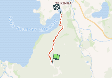
Mount Te Kinga Track/Ara O Te Kinga

SityTrail - itinéraires balisés pédestres
Tous les sentiers balisés d’Europe GUIDE+


2h04
Difficulty : Easy

FREE GPS app for hiking
 SityTrail
IGN / Geographical institutes
SityTrail World
The world is yours!
About
Trail On foot of 5.6 km to be discovered at West Coast, Grey District. This trail is proposed by SityTrail - itinéraires balisés pédestres.
Description
Climb to a lookout for spectacular views, or continue to the summit of Mount Te Kinga.
Website: https://www.doc.govt.nz/parks-and-recreation/places-to-go/west-coast/places/lake-brunner-area/things-to-do/tracks/mount-te-kinga-ara-o-te-kinga-track/
Photos


Positioning
Comments
Trails nearby