![](/images/other/stat-length.png)
![Trail On foot Jarov - Jarovská NS - Photo](https://media.geolcdn.com/t/1900/400/0d0f4706-2f6e-402e-8299-9ef4c982f824.jpeg&format=pjpeg&maxdim=2)
Jarovská NS
SityTrail - itinéraires balisés pédestres
Tous les sentiers balisés d’Europe GUIDE+
![Length](/images/other/stat-length.png)
Length
8.6 km
![Max alt](https://static1.geolcdn.com/siteimages/upload/files/1508320355ic_sort_altitude_max_24dp.png)
Max alt
459 m
![Uphill gradient](https://static1.geolcdn.com/siteimages/upload/files/1508320355ic_sort_den_pos_24dp.png)
Uphill gradient
174 m
![Km-Effort](/images/other/stat-length.png)
Km-Effort
11 km
![Min alt](https://static1.geolcdn.com/siteimages/upload/files/1508320355ic_sort_altitude_min_24dp.png)
Min alt
305 m
![Downhill gradient](https://static1.geolcdn.com/siteimages/upload/files/1508320355ic_sort_den_neg_24dp.png)
Downhill gradient
177 m
![Boucle](https://static1.geolcdn.com/siteimages/upload/files/16400158638029165_repeat_loop_refresh_sync_direction_icon.png)
Boucle
Yes
Signpost
Creation date :
2025-02-07 17:44:59.125
Updated on :
2025-02-07 17:44:59.125
![On foot](https://static1.geolcdn.com/sitytour/trail-icons/100.png)
2h29
Difficulty : Easy
![Scan this QR Code to open this trail in the SityTrail application](https://capi.geolives.com/qq0zvz2zws4bq2lad0pu/sitytour/trails/4346405/qr.png?size=200)
FREE GPS app for hiking
About
Trail On foot of 8.6 km to be discovered at Southwest, Plzeňský kraj, Jarov. This trail is proposed by SityTrail - itinéraires balisés pédestres.
Description
Trail created by MÚ Jarov.
Website: http://www.oujarov.cz/jarovska-naucna-stezka/
Positioning
Country:
Czech Republic
Region :
Southwest
Department/Province :
Plzeňský kraj
Municipality :
Jarov
Location:
Unknown
Start:(Dec)
Start:(UTM)
390375 ; 5525607 (33U) N.
Comments
Trails nearby
![Trail On foot Dobříč - NS Kaňonem Horní Berounky - Photo](https://media.geolcdn.com/t/375/260/2e6ab8bb-46bd-4085-a6c4-7e3f92c7f9af.jpeg&format=jpg&maxdim=2)
![On foot On foot](https://static1.geolcdn.com/sitytour/trail-icons/100.png)
NS Kaňonem Horní Berounky
On foot
Easy
Dobříč,
Southwest,
Plzeňský kraj,
Czech Republic
![](/images/other/stat-length.png)
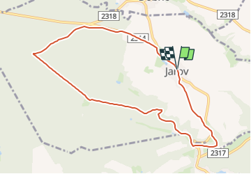
3.9 km | 5.2 km-effort
1h 10min
![](https://static1.geolcdn.com/siteimages/upload/files/16400158638029165_repeat_loop_refresh_sync_direction_icon.png)
No
![Trail On foot Jarov - Jarovská NS - varianta pro kočárky - Photo](https://media.geolcdn.com/t/375/260/e2c29d8c-0e7c-4a7e-b78b-a4d99d38e0f9.jpeg&format=jpg&maxdim=2)
![On foot On foot](https://static1.geolcdn.com/sitytour/trail-icons/100.png)
Jarovská NS - varianta pro kočárky
On foot
Easy
Jarov,
Southwest,
Plzeňský kraj,
Czech Republic
![](/images/other/stat-length.png)
8.2 km | 10.4 km-effort
2h 22min
![](https://static1.geolcdn.com/siteimages/upload/files/16400158638029165_repeat_loop_refresh_sync_direction_icon.png)
Yes
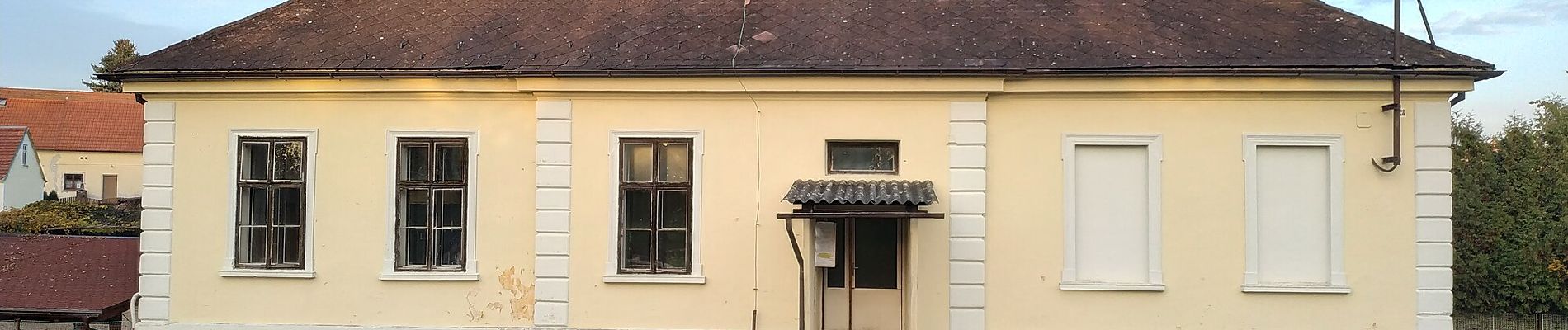
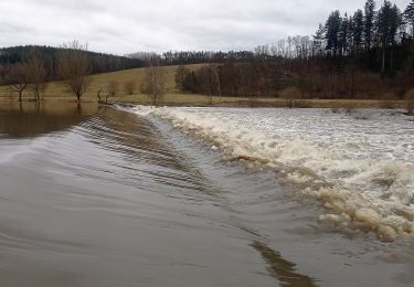
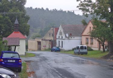
![Trail On foot Hromnice - [Z] trojúhelník - Photo](https://media.geolcdn.com/t/375/260/8244e9d1-3a7b-4319-ab21-6ff4aac17b89.jpeg&format=jpg&maxdim=2)
![On foot On foot](https://static1.geolcdn.com/sitytour/trail-icons/100.png)
[Z] trojúhelník
On foot
Easy
Hromnice,
Southwest,
Plzeňský kraj,
Czech Republic
![](/images/other/stat-length.png)
6.1 km | 7.8 km-effort
1h 45min
![](https://static1.geolcdn.com/siteimages/upload/files/16400158638029165_repeat_loop_refresh_sync_direction_icon.png)
No