![](/images/other/stat-length.png)
![Trail On foot Unknown - From Knin to Brezovac - Photo](https://media.geolcdn.com/t/1900/400/093a6e50-0cba-4ea6-8f57-cdfc99edf942.jpeg&format=pjpeg&maxdim=2)
From Knin to Brezovac
SityTrail - itinéraires balisés pédestres
Tous les sentiers balisés d’Europe GUIDE+
![Length](/images/other/stat-length.png)
![Max alt](https://static1.geolcdn.com/siteimages/upload/files/1508320355ic_sort_altitude_max_24dp.png)
![Uphill gradient](https://static1.geolcdn.com/siteimages/upload/files/1508320355ic_sort_den_pos_24dp.png)
![Km-Effort](/images/other/stat-length.png)
![Min alt](https://static1.geolcdn.com/siteimages/upload/files/1508320355ic_sort_altitude_min_24dp.png)
![Downhill gradient](https://static1.geolcdn.com/siteimages/upload/files/1508320355ic_sort_den_neg_24dp.png)
![Boucle](https://static1.geolcdn.com/siteimages/upload/files/16400158638029165_repeat_loop_refresh_sync_direction_icon.png)
![On foot](https://static1.geolcdn.com/sitytour/trail-icons/100.png)
5h59
Difficulty : Medium
![Scan this QR Code to open this trail in the SityTrail application](https://capi.geolives.com/qq0zvz2zws4bq2lad0pu/sitytour/trails/4346149/qr.png?size=200)
FREE GPS app for hiking
About
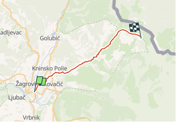
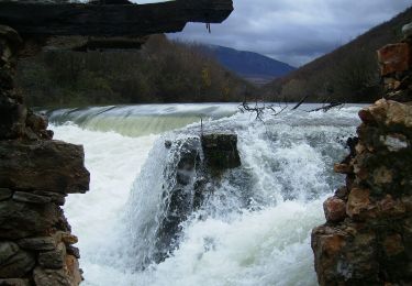
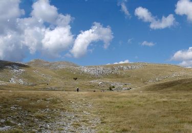
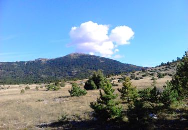
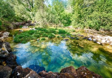
Trail On foot of 16.3 km to be discovered at Unknown, Šibenik-Knin County. This trail is proposed by SityTrail - itinéraires balisés pédestres.
Description
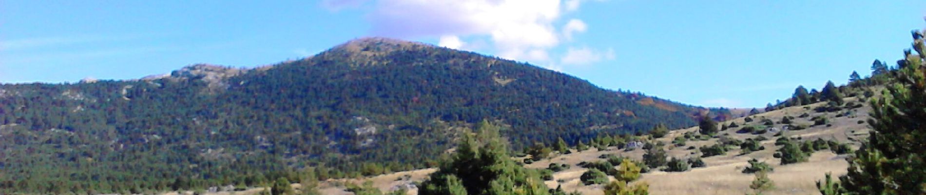
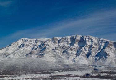
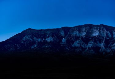
Dinara is the highest mountain in Croatia, and one of the most picturesque mountains in Dalmatia and in the Dalmatian hinterland. Even though it is not particularly high – not even exceeding the 2000-meter mark – it still represents one of the most impressive Croatian mountains with its shape ...
Website: https://trail.viadinarica.com/tour/hiking/15967323/
Positioning
Comments
Trails nearby
![Trail On foot - Educational Hiking Trail: Stinice - Roški slap - Oziđana pećina - Photo](https://media.geolcdn.com/t/375/260/b6990a43-e1bf-4ef4-a38f-bc0e9b07e7fa.jpeg&format=jpg&maxdim=2)
![On foot On foot](https://static1.geolcdn.com/sitytour/trail-icons/100.png)
On foot
![](/images/other/stat-length.png)
![](https://static1.geolcdn.com/siteimages/upload/files/16400158638029165_repeat_loop_refresh_sync_direction_icon.png)
![Trail On foot - Path across the peak of Dinara - Photo](https://media.geolcdn.com/t/375/260/d761895b-49a7-4b3b-8818-06c288ba4289.jpeg&format=jpg&maxdim=2)
![On foot On foot](https://static1.geolcdn.com/sitytour/trail-icons/100.png)
On foot
![](/images/other/stat-length.png)
![](https://static1.geolcdn.com/siteimages/upload/files/16400158638029165_repeat_loop_refresh_sync_direction_icon.png)
![Trail On foot - yogurt staza Mirkovići-Dinara - Photo](https://media.geolcdn.com/t/375/260/29a1aecf-36fc-498e-8743-c859be60c896.jpeg&format=jpg&maxdim=2)
![On foot On foot](https://static1.geolcdn.com/sitytour/trail-icons/100.png)
On foot
![](/images/other/stat-length.png)
![](https://static1.geolcdn.com/siteimages/upload/files/16400158638029165_repeat_loop_refresh_sync_direction_icon.png)
![Trail On foot - planinarska staza Mirkovići - Brezovac - Photo](https://media.geolcdn.com/t/375/260/6a972028-7138-496c-8b39-a194eaf01a7d.jpeg&format=jpg&maxdim=2)
![On foot On foot](https://static1.geolcdn.com/sitytour/trail-icons/100.png)
On foot
![](/images/other/stat-length.png)
![](https://static1.geolcdn.com/siteimages/upload/files/16400158638029165_repeat_loop_refresh_sync_direction_icon.png)
![Trail On foot - Glavaš-Dinara_brezovac - Photo](https://media.geolcdn.com/t/375/260/70028265-24e3-4592-9650-7b9a1d72b553.jpeg&format=jpg&maxdim=2)
![On foot On foot](https://static1.geolcdn.com/sitytour/trail-icons/100.png)
On foot
![](/images/other/stat-length.png)
![](https://static1.geolcdn.com/siteimages/upload/files/16400158638029165_repeat_loop_refresh_sync_direction_icon.png)
![Trail On foot - Guge-Brezovac - Photo](https://media.geolcdn.com/t/375/260/093a6e50-0cba-4ea6-8f57-cdfc99edf942.jpeg&format=jpg&maxdim=2)
![On foot On foot](https://static1.geolcdn.com/sitytour/trail-icons/100.png)
On foot
![](/images/other/stat-length.png)
![](https://static1.geolcdn.com/siteimages/upload/files/16400158638029165_repeat_loop_refresh_sync_direction_icon.png)
![Trail On foot - Cetina put Oluje - Photo](https://media.geolcdn.com/t/375/260/92a1d8af-a831-4030-94fd-b4e7c791cd61.jpeg&format=jpg&maxdim=2)
![On foot On foot](https://static1.geolcdn.com/sitytour/trail-icons/100.png)
On foot
![](/images/other/stat-length.png)
![](https://static1.geolcdn.com/siteimages/upload/files/16400158638029165_repeat_loop_refresh_sync_direction_icon.png)
![Trail On foot - Glavaš-Dinara - Photo](https://media.geolcdn.com/t/375/260/b5ccdf9b-e704-4365-8026-b13b6609237c.jpeg&format=jpg&maxdim=2)
![On foot On foot](https://static1.geolcdn.com/sitytour/trail-icons/100.png)
On foot
![](/images/other/stat-length.png)
![](https://static1.geolcdn.com/siteimages/upload/files/16400158638029165_repeat_loop_refresh_sync_direction_icon.png)
![Trail On foot - Martinove košare-Leurdovac-Dinara - Photo](https://media.geolcdn.com/t/375/260/b5ccdf9b-e704-4365-8026-b13b6609237c.jpeg&format=jpg&maxdim=2)
![On foot On foot](https://static1.geolcdn.com/sitytour/trail-icons/100.png)
On foot
![](/images/other/stat-length.png)
![](https://static1.geolcdn.com/siteimages/upload/files/16400158638029165_repeat_loop_refresh_sync_direction_icon.png)