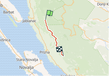
![](/images/other/stat-length.png)
![Trail On foot Unknown - From Alan to central Velebit - Photo](https://media.geolcdn.com/t/1900/400/b50048e4-e474-46a7-a25a-4ae1d255bec6.jpeg&format=pjpeg&maxdim=2)
From Alan to central Velebit
SityTrail - itinéraires balisés pédestres
Tous les sentiers balisés d’Europe GUIDE+
![Length](/images/other/stat-length.png)
![Max alt](https://static1.geolcdn.com/siteimages/upload/files/1508320355ic_sort_altitude_max_24dp.png)
![Uphill gradient](https://static1.geolcdn.com/siteimages/upload/files/1508320355ic_sort_den_pos_24dp.png)
![Km-Effort](/images/other/stat-length.png)
![Min alt](https://static1.geolcdn.com/siteimages/upload/files/1508320355ic_sort_altitude_min_24dp.png)
![Downhill gradient](https://static1.geolcdn.com/siteimages/upload/files/1508320355ic_sort_den_neg_24dp.png)
![Boucle](https://static1.geolcdn.com/siteimages/upload/files/16400158638029165_repeat_loop_refresh_sync_direction_icon.png)
![On foot](https://static1.geolcdn.com/sitytour/trail-icons/100.png)
5h02
Difficulty : Medium
![Scan this QR Code to open this trail in the SityTrail application](https://capi.geolives.com/qq0zvz2zws4bq2lad0pu/sitytour/trails/4346132/qr.png?size=200)
FREE GPS app for hiking
About
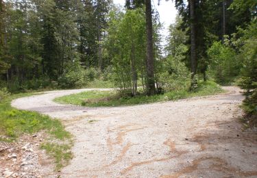
Trail On foot of 17.7 km to be discovered at Unknown, Lika-Senj County. This trail is proposed by SityTrail - itinéraires balisés pédestres.
Description
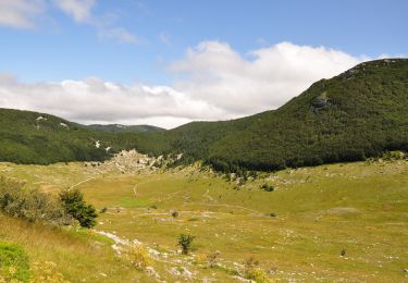
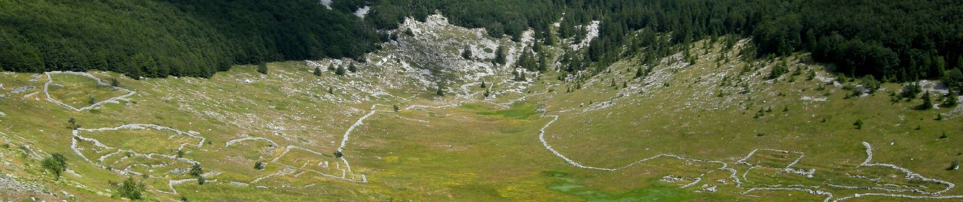
Rožanski kukovi and Hajdučki kukovi are a unique combination of rocky peaks in the middle of Northern Velebit, and one of the most beautiful karst areas in our country. This picturesque karst spectacle created by nature in this place is protected as a strict nature reserve – an even stricter ...
Website: https://trail.viadinarica.com/tour/hiking/15957577/
Positioning
Comments
Trails nearby
![Trail On foot - Northern Velebit National Park II - Rožanski kukovi - Photo](https://media.geolcdn.com/t/375/260/839d7b0c-a4d3-4f01-92a7-73e5a17dadd5.jpeg&format=jpg&maxdim=2)
![On foot On foot](https://static1.geolcdn.com/sitytour/trail-icons/100.png)
On foot
![](/images/other/stat-length.png)
![](https://static1.geolcdn.com/siteimages/upload/files/16400158638029165_repeat_loop_refresh_sync_direction_icon.png)
![Trail On foot - Lubenovačka vrata - Veliki Lubenovac - Photo](https://media.geolcdn.com/t/375/260/65c74730-43b0-4f36-850c-9de3a7385004.jpeg&format=jpg&maxdim=2)
![On foot On foot](https://static1.geolcdn.com/sitytour/trail-icons/100.png)
On foot
![](/images/other/stat-length.png)
![](https://static1.geolcdn.com/siteimages/upload/files/16400158638029165_repeat_loop_refresh_sync_direction_icon.png)
![Trail On foot - 11.23b HPS - Photo](https://media.geolcdn.com/t/375/260/84a24c8b-f5f1-4e87-b767-f0d81b1d5b21.jpeg&format=jpg&maxdim=2)
![On foot On foot](https://static1.geolcdn.com/sitytour/trail-icons/100.png)