![](/images/other/stat-length.png)
![Trail On foot Unknown - Senjsko bilo - Photo](https://media.geolcdn.com/t/1900/400/efde735e-5738-438d-a623-5e758ab78263.jpeg&format=pjpeg&maxdim=2)
Senjsko bilo
SityTrail - itinéraires balisés pédestres
Tous les sentiers balisés d’Europe GUIDE+
![Length](/images/other/stat-length.png)
![Max alt](https://static1.geolcdn.com/siteimages/upload/files/1508320355ic_sort_altitude_max_24dp.png)
![Uphill gradient](https://static1.geolcdn.com/siteimages/upload/files/1508320355ic_sort_den_pos_24dp.png)
![Km-Effort](/images/other/stat-length.png)
![Min alt](https://static1.geolcdn.com/siteimages/upload/files/1508320355ic_sort_altitude_min_24dp.png)
![Downhill gradient](https://static1.geolcdn.com/siteimages/upload/files/1508320355ic_sort_den_neg_24dp.png)
![Boucle](https://static1.geolcdn.com/siteimages/upload/files/16400158638029165_repeat_loop_refresh_sync_direction_icon.png)
![On foot](https://static1.geolcdn.com/sitytour/trail-icons/100.png)
3h47
Difficulty : Easy
![Scan this QR Code to open this trail in the SityTrail application](https://capi.geolives.com/qq0zvz2zws4bq2lad0pu/sitytour/trails/4346127/qr.png?size=200)
FREE GPS app for hiking
About
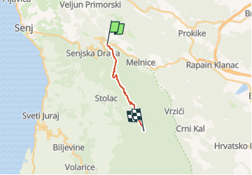
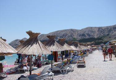
Trail On foot of 9 km to be discovered at Unknown, Lika-Senj County. This trail is proposed by SityTrail - itinéraires balisés pédestres.
Description
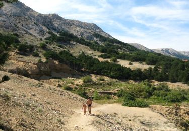
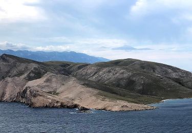
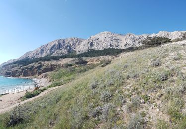
Northern Velebit extends from the mountain pass Vratnik with the Senj – Otočac road to the mountain pass V. Alan with the Jablanac – Krasno road, and it is 30 kilometers long. A typical perception of Velebit as a simple ridge that divides the continental region of Lika from the sea like a wall ...
Website: https://trail.viadinarica.com/tour/hiking/15957323/
Positioning
Comments
Trails nearby
![Trail On foot - Connecting trail Kapela - Velebit - Photo](https://media.geolcdn.com/t/375/260/f99b71b0-e87a-46c3-adc6-33e04715f498.jpeg&format=jpg&maxdim=2)
![On foot On foot](https://static1.geolcdn.com/sitytour/trail-icons/100.png)
On foot
![](/images/other/stat-length.png)
![](https://static1.geolcdn.com/siteimages/upload/files/16400158638029165_repeat_loop_refresh_sync_direction_icon.png)
![Trail On foot - Senj - Planinarska kuća Sijaset - Photo](https://media.geolcdn.com/t/375/260/f99b71b0-e87a-46c3-adc6-33e04715f498.jpeg&format=jpg&maxdim=2)
![On foot On foot](https://static1.geolcdn.com/sitytour/trail-icons/100.png)
On foot
![](/images/other/stat-length.png)
![](https://static1.geolcdn.com/siteimages/upload/files/16400158638029165_repeat_loop_refresh_sync_direction_icon.png)
![Trail On foot - Trag čovika - Photo](https://media.geolcdn.com/t/375/260/449dc2d7-4282-4465-8309-cbe7e18acc0a.jpeg&format=jpg&maxdim=2)
![On foot On foot](https://static1.geolcdn.com/sitytour/trail-icons/100.png)
![Trail On foot - Baška - Svet. Majke Božje Goričke - Photo](https://media.geolcdn.com/t/375/260/0ef93230-52fa-4091-9d85-323624a048d8.jpeg&format=jpg&maxdim=2)
![On foot On foot](https://static1.geolcdn.com/sitytour/trail-icons/100.png)
On foot
![](/images/other/stat-length.png)
![](https://static1.geolcdn.com/siteimages/upload/files/16400158638029165_repeat_loop_refresh_sync_direction_icon.png)
![Trail On foot - Baška - Vraca - Photo](https://media.geolcdn.com/t/375/260/e57550df-2760-4172-a36d-19a101d9b7bc.jpeg&format=jpg&maxdim=2)
![On foot On foot](https://static1.geolcdn.com/sitytour/trail-icons/100.png)
On foot
![](/images/other/stat-length.png)
![](https://static1.geolcdn.com/siteimages/upload/files/16400158638029165_repeat_loop_refresh_sync_direction_icon.png)
![Trail On foot - Baška - Rt. Škuljica - Photo](https://media.geolcdn.com/t/375/260/08a3a809-24b5-4b0c-8022-1df19dde8bb4.jpeg&format=jpg&maxdim=2)
![On foot On foot](https://static1.geolcdn.com/sitytour/trail-icons/100.png)
On foot
![](/images/other/stat-length.png)
![](https://static1.geolcdn.com/siteimages/upload/files/16400158638029165_repeat_loop_refresh_sync_direction_icon.png)
![Trail On foot - Baška - Vela Vrženica - Photo](https://media.geolcdn.com/t/375/260/0ef93230-52fa-4091-9d85-323624a048d8.jpeg&format=jpg&maxdim=2)
![On foot On foot](https://static1.geolcdn.com/sitytour/trail-icons/100.png)
On foot
![](/images/other/stat-length.png)
![](https://static1.geolcdn.com/siteimages/upload/files/16400158638029165_repeat_loop_refresh_sync_direction_icon.png)
![Trail On foot - Baška - Vela Luka - Photo](https://media.geolcdn.com/t/375/260/6fda427c-fd17-44c1-ab62-b105f6034a07.jpeg&format=jpg&maxdim=2)
![On foot On foot](https://static1.geolcdn.com/sitytour/trail-icons/100.png)
On foot
![](/images/other/stat-length.png)
![](https://static1.geolcdn.com/siteimages/upload/files/16400158638029165_repeat_loop_refresh_sync_direction_icon.png)
![Trail On foot - Baška - Zakam - Baška - Photo](https://media.geolcdn.com/t/375/260/6ad9b517-88a9-4ded-bb90-a9db2ea61105.jpeg&format=jpg&maxdim=2)
![On foot On foot](https://static1.geolcdn.com/sitytour/trail-icons/100.png)
On foot
![](/images/other/stat-length.png)
![](https://static1.geolcdn.com/siteimages/upload/files/16400158638029165_repeat_loop_refresh_sync_direction_icon.png)