Trail On foot Unknown - Connecting trail Kapela - Velebit - Photo

Connecting trail Kapela - Velebit

Tous les sentiers balisés d’Europe GUIDE+

© OpenStreetMap contributors
Length
Length
25 km
Max alt
Max alt
1090 m
Uphill gradient
Uphill gradient
822 m
Km-Effort
Km-Effort  
36 km
Min alt
Min alt
695 m
Downhill gradient
Downhill gradient
996 m
Boucle
Boucle
No
Signpost
Signpost
Creation date :
2025-02-07 16:05:48.435
Updated on :
2025-02-07 16:05:48.435

(0 Reviews)

On foot
On foot
8h15
Difficulty : Difficult

Scan this QR Code to open this trail in the SityTrail application

FREE GPS app for hiking

Logo SityTrail SityTrail

IGN / Geographical institutes

Download SityTrail from the App Store Download SityTrail from Google Play

Logo SityTrail SityTrail World

The world is yours!

Download SityTrail from the App Store Download SityTrail from Google Play Download SityTrail on Huawei AppGallery

About

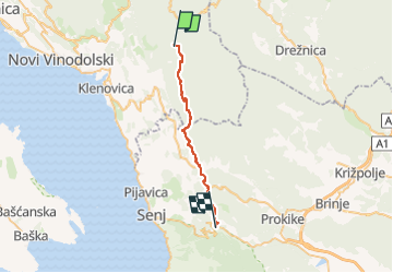
Trail On foot of 25 km to be discovered at Unknown, Primorje-Gorski Kotar County. This trail is proposed by SityTrail - itinéraires balisés pédestres.

Description

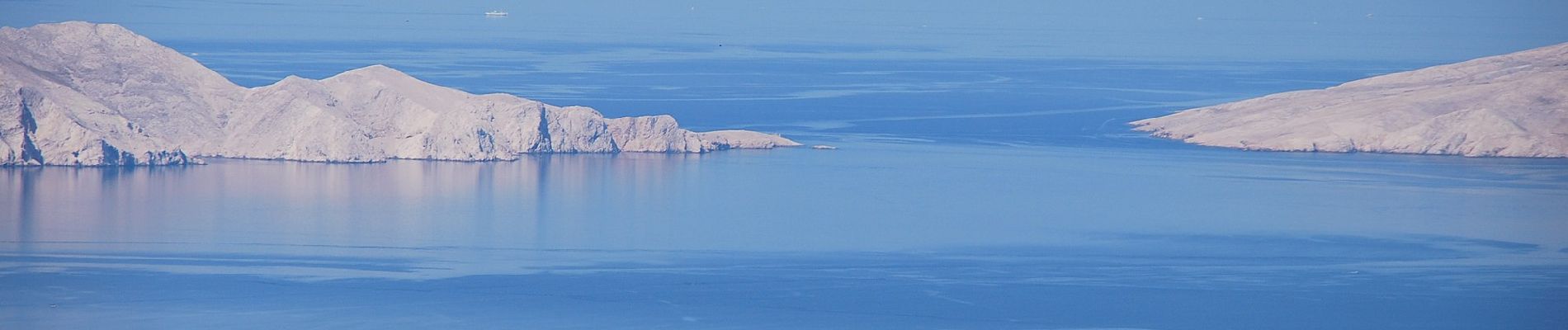
The most interesting phenomenon in this route stage is the group of rocks called Kolovratske stijene, offering a wonderful view towards the sea. The rocks of Kolovratske stijene extend south of the group of Samarske stijene and Bijele stijene, as a solitary ridge on the very edge of Velika ...

Website: https://trail.viadinarica.com/tour/hiking/15957274/

Elevation profile

Photos

Positioning

Country:
Croatia
Region :
Unknown
Department/Province :
Primorje-Gorski Kotar County
Municipality :
Unknown
Location:
Unknown
Start:(UTM)
494700 ; 4998548 (33T) N.

Trails nearby

Trail On foot  - Along Kapela Hiking Trail towards the Adriatic sea - Photo
On foot
GUIDE+

On foot

Medium
, Unknown, Primorje-Gorski Kotar County, Croatia
11.8 km | 21 km-effort
4h 41min
No


Close
My subscriptions