Trail On foot Unknown - Along Kapela Hiking Trail towards the Adriatic sea - Photo

Along Kapela Hiking Trail towards the Adriatic sea

Tous les sentiers balisés d’Europe GUIDE+

© OpenStreetMap contributors
Length
Length
11.8 km
Max alt
Max alt
1362 m
Uphill gradient
Uphill gradient
780 m
Km-Effort
Km-Effort  
21 km
Min alt
Min alt
755 m
Downhill gradient
Downhill gradient
294 m
Boucle
Boucle
No
Signpost
Signpost
Creation date :
2025-02-07 16:05:19.632
Updated on :
2025-02-07 16:05:19.632

(0 Reviews)

On foot
On foot
4h41
Difficulty : Medium

Scan this QR Code to open this trail in the SityTrail application

FREE GPS app for hiking

Logo SityTrail SityTrail

IGN / Geographical institutes

Download SityTrail from the App Store Download SityTrail from Google Play

Logo SityTrail SityTrail World

The world is yours!

Download SityTrail from the App Store Download SityTrail from Google Play Download SityTrail on Huawei AppGallery

About

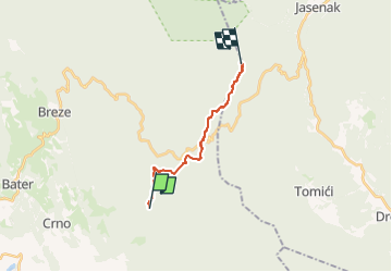
Trail On foot of 11.8 km to be discovered at Unknown, Primorje-Gorski Kotar County. This trail is proposed by SityTrail - itinéraires balisés pédestres.

Description

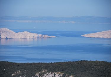
In the area where Velika Kapela approaches the sea, we come across one of the largest forest expanses in Croatia. There are no settlements in the area from Bjelolasica and the sites of Bijele stijene and Samarske stijene to the edge of the regions of Gorski kotar and Primorje, and the entire ...

Website: https://trail.viadinarica.com/tour/hiking/15957187/

Elevation profile

Positioning

Country:
Croatia
Region :
Unknown
Department/Province :
Primorje-Gorski Kotar County
Municipality :
Unknown
Location:
Unknown
Start:(UTM)
494700 ; 4998548 (33T) N.

Trails nearby

Trail On foot  - Connecting trail Kapela - Velebit - Photo
On foot
GUIDE+

On foot

Difficult
, Unknown, Primorje-Gorski Kotar County, Croatia
25 km | 36 km-effort
8h 15min
No


Close
My subscriptions