![Trail On foot Unknown - Mt Alford Track - Photo](https://media.geolcdn.com/t/1900/400/fc0bfddc-d7f3-4414-98f8-a1476089ffff.jpeg&format=pjpeg&maxdim=2)
Mt Alford Track
SityTrail - itinéraires balisés pédestres
Tous les sentiers balisés d’Europe GUIDE+
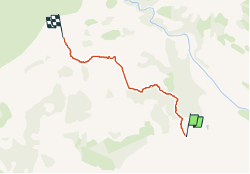
![Length](/images/other/stat-length.png)
Length
4.3 km
![Max alt](https://static1.geolcdn.com/siteimages/upload/files/1508320355ic_sort_altitude_max_24dp.png)
Max alt
1171 m
![Uphill gradient](https://static1.geolcdn.com/siteimages/upload/files/1508320355ic_sort_den_pos_24dp.png)
Uphill gradient
707 m
![Km-Effort](/images/other/stat-length.png)
Km-Effort
11.4 km
![Min alt](https://static1.geolcdn.com/siteimages/upload/files/1508320355ic_sort_altitude_min_24dp.png)
Min alt
462 m
![Downhill gradient](https://static1.geolcdn.com/siteimages/upload/files/1508320355ic_sort_den_neg_24dp.png)
Downhill gradient
3 m
![Boucle](https://static1.geolcdn.com/siteimages/upload/files/16400158638029165_repeat_loop_refresh_sync_direction_icon.png)
Boucle
No
Signpost
Creation date :
2025-02-07 15:31:21.434
Updated on :
2025-02-07 15:31:21.434
![On foot](https://static1.geolcdn.com/sitytour/trail-icons/100.png)
2h35
Difficulty : Easy
![Scan this QR Code to open this trail in the SityTrail application](https://capi.geolives.com/qq0zvz2zws4bq2lad0pu/sitytour/trails/4346019/qr.png?size=200)
FREE GPS app for hiking
About
Trail On foot of 4.3 km to be discovered at Canterbury, Ashburton District. This trail is proposed by SityTrail - itinéraires balisés pédestres.
Description
Trail created by Department of Conservation.
Positioning
Country:
New Zealand
Region :
Canterbury
Department/Province :
Ashburton District
Municipality :
Unknown
Location:
Unknown
Start:(Dec)
Start:(UTM)
540609 ; 5172437 (59G) S.
Comments
Trails nearby