Trail On foot Křivoklát - žlutý místní okruh Křivoklát - Photo

žlutý místní okruh Křivoklát

Tous les sentiers balisés d’Europe GUIDE+

© OpenStreetMap contributors
Length
Length
3.2 km
Max alt
Max alt
359 m
Uphill gradient
Uphill gradient
121 m
Km-Effort
Km-Effort  
4.8 km
Min alt
Min alt
266 m
Downhill gradient
Downhill gradient
113 m
Boucle
Boucle
Yes
Signpost
Signpost
Creation date :
2025-02-07 15:19:41.541
Updated on :
2025-02-07 15:19:41.541

(0 Reviews)

On foot
On foot
1h05
Difficulty : Easy

Scan this QR Code to open this trail in the SityTrail application

FREE GPS app for hiking

Logo SityTrail SityTrail

IGN / Geographical institutes

Download SityTrail from the App Store Download SityTrail from Google Play

Logo SityTrail SityTrail World

The world is yours!

Download SityTrail from the App Store Download SityTrail from Google Play Download SityTrail on Huawei AppGallery

About

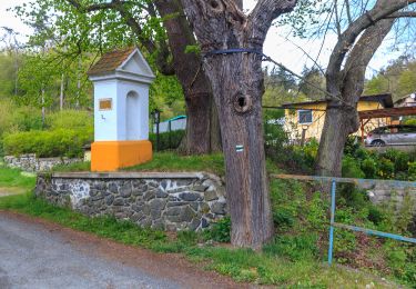
Trail On foot of 3.2 km to be discovered at Central Bohemia, Unknown, Křivoklát. This trail is proposed by SityTrail - itinéraires balisés pédestres.

Description

Trail created by cz:KČT.

Elevation profile

Photos

Positioning

Country:
Czech Republic
Region :
Central Bohemia
Department/Province :
Unknown
Municipality :
Křivoklát
Location:
Unknown
Start:(UTM)
418996 ; 5542733 (33U) N.

Trails nearby

Trail On foot Roztoky - [Ž] Krivoklát žst - Roztoky - Photo
On foot
GUIDE+

On foot

Easy
Roztoky, Central Bohemia, Unknown, Czech Republic
4.1 km | 5.6 km-effort
1h 16min
No
Trail On foot Račice - [Ž] Račice - Pod Beraníkem - Photo
On foot
GUIDE+

On foot

Easy
Račice, Central Bohemia, Unknown, Czech Republic
4.8 km | 7.7 km-effort
1h 44min
No
Trail On foot Zbečno - [Z] Písky - Zbečno - Photo
On foot
GUIDE+

On foot

Easy
Zbečno, Central Bohemia, Unknown, Czech Republic
3.3 km | 4.9 km-effort
1h 7min
No
Trail On foot Křivoklát - NS Brdatka - Photo
On foot
GUIDE+

On foot

Easy
Křivoklát, Central Bohemia, Unknown, Czech Republic
4.5 km | 5.7 km-effort
1h 17min
No


Close
My subscriptions