


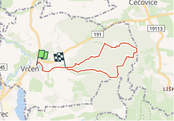

4.7 km | 5.7 km-effort

Tous les sentiers balisés d’Europe GUIDE+


FREE GPS app for hiking
 SityTrail
IGN / Geographical institutes
SityTrail World
The world is yours!
Trail On foot of 5.9 km to be discovered at Southwest, Plzeňský kraj, Vrčeň. This trail is proposed by SityTrail - itinéraires balisés pédestres.
Trail created by cz:KČT.


On foot
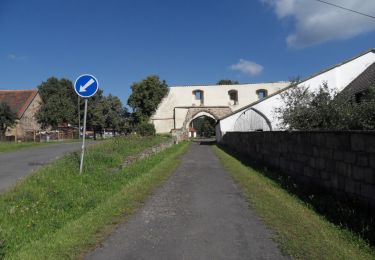
![Trail On foot Čížkov - [Ž] Pod Korálkou - Čížkov - Photo](https://media.geolcdn.com/t/375/260/93fa220f-10db-4424-b7ef-af29593f564b.jpeg&format=jpg&maxdim=2)
On foot