Trail On foot Litovel - NS Luhy Litovelskeho Pomoravi - Photo

NS Luhy Litovelskeho Pomoravi

Tous les sentiers balisés d’Europe GUIDE+

© OpenStreetMap contributors
Length
Length
11.2 km
Max alt
Max alt
240 m
Uphill gradient
Uphill gradient
79 m
Km-Effort
Km-Effort  
12.3 km
Min alt
Min alt
218 m
Downhill gradient
Downhill gradient
88 m
Boucle
Boucle
No
Signpost
Signpost
Creation date :
2025-02-07 13:19:00.634
Updated on :
2025-02-07 13:19:00.634

(0 Reviews)

On foot
On foot
2h47
Difficulty : Easy

Scan this QR Code to open this trail in the SityTrail application

FREE GPS app for hiking

Logo SityTrail SityTrail

IGN / Geographical institutes

Download SityTrail from the App Store Download SityTrail from Google Play

Logo SityTrail SityTrail World

The world is yours!

Download SityTrail from the App Store Download SityTrail from Google Play Download SityTrail on Huawei AppGallery

About

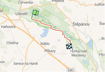
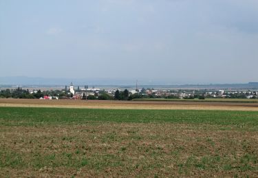
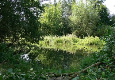
Trail On foot of 11.2 km to be discovered at Central Moravia, Olomouc Region, Litovel. This trail is proposed by SityTrail - itinéraires balisés pédestres.

Description

Trail created by cz:KČT.

Elevation profile

Photos

Positioning

Country:
Czech Republic
Region :
Central Moravia
Department/Province :
Olomouc Region
Municipality :
Litovel
Location:
Unknown
Start:(UTM)
651503 ; 5506534 (33U) N.

Trails nearby

Trail On foot Olomouc - žlutý místní okruh Svatý kopeček - Photo
On foot
GUIDE+

On foot

Easy
Olomouc, Central Moravia, Olomouc Region, Czech Republic
3.2 km | 4.1 km-effort
56min
Yes
Trail On foot Olomouc - zelený místní okruh Svatý kopeček - Photo
On foot
GUIDE+

On foot

Easy
Olomouc, Central Moravia, Olomouc Region, Czech Republic
7.2 km | 9.6 km-effort
2h 10min
Yes
Trail On foot Olomouc - místní okruh Mariánské údolí - Velká Bystřice - Svatý kopeček - Photo
On foot
GUIDE+

On foot

Medium
Olomouc, Central Moravia, Olomouc Region, Czech Republic
16.8 km | 22 km-effort
4h 58min
Yes
Trail On foot Senice na Hané - NS Elišky z Kunštátu - Photo
On foot
GUIDE+

On foot

Easy
Senice na Hané, Central Moravia, Olomouc Region, Czech Republic
10.4 km | 12.4 km-effort
2h 48min
No
Trail On foot Konice - [Z] Runářov - Konice - Photo
On foot
GUIDE+

On foot

Easy
Konice, Central Moravia, Olomouc Region, Czech Republic
4.3 km | 5.5 km-effort
1h 14min
No
Trail On foot Lipina - červený místní okruh okolo Dolního žlebu - Photo
On foot
GUIDE+

On foot

Easy
Lipina, Central Moravia, Olomouc Region, Czech Republic
5.9 km | 8.8 km-effort
1h 59min
No
Trail On foot Olomouc - Naučná stezka Kol-kolem Olomouce - Photo
On foot
GUIDE+

On foot

Easy
Olomouc, Central Moravia, Olomouc Region, Czech Republic
7.1 km | 7.6 km-effort
1h 43min
No
Trail On foot Velký Týnec - CZ-yellow - Photo
On foot
GUIDE+

On foot

Easy
Velký Týnec, Central Moravia, Olomouc Region, Czech Republic
4.7 km | 5.3 km-effort
1h 12min
No
Trail On foot Bílá Lhota - Naučná stezka romantický areál Nové Zámky - Photo
On foot
GUIDE+

On foot

Easy
Bílá Lhota, Central Moravia, Olomouc Region, Czech Republic
8.5 km | 9.8 km-effort
2h 13min
No


Close
My subscriptions