


4 km | 5.2 km-effort
![Trail On foot Dešenice - [Ž] Větrovec - Hamry - Photo](https://media.geolcdn.com/t/1900/400/51ea904a-671c-4a0a-8879-f69ab0fffe7e.jpeg&format=pjpeg&maxdim=2)

Tous les sentiers balisés d’Europe GUIDE+


FREE GPS app for hiking
 SityTrail
IGN / Geographical institutes
SityTrail World
The world is yours!
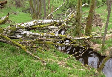
Trail On foot of 8 km to be discovered at Southwest, Plzeňský kraj, Dešenice. This trail is proposed by SityTrail - itinéraires balisés pédestres.
Trail created by cz:KČT.
![Trail On foot Dešenice - [Ž] Větrovec - Hamry - Photo 1](https://media.geolcdn.com/t/2048/auto/b39f95ba-4d84-4c00-85e4-9a48b1c8127e.jpeg&format=jpg&maxdim=0 "Trail On foot Dešenice - [Ž] Větrovec - Hamry - Photo 1")
![Trail On foot Dešenice - [Ž] Větrovec - Hamry - Photo 2](https://media.geolcdn.com/t/2048/auto/3b91759b-0ca9-4c4f-ae27-801ca0c7a1b8.jpeg&format=jpg&maxdim=0 "Trail On foot Dešenice - [Ž] Větrovec - Hamry - Photo 2")
![Trail On foot Dešenice - [Ž] Větrovec - Hamry - Photo 3](https://media.geolcdn.com/t/2048/auto/d8cc1402-5d70-4171-98e0-d51e4b03e1d6.jpeg&format=jpg&maxdim=0 "Trail On foot Dešenice - [Ž] Větrovec - Hamry - Photo 3")
![Trail On foot Dešenice - [Ž] Větrovec - Hamry - Photo 4](https://media.geolcdn.com/t/2048/auto/b9f38aa4-86f6-4bdc-808a-534ff38255b9.jpeg&format=jpg&maxdim=0 "Trail On foot Dešenice - [Ž] Větrovec - Hamry - Photo 4")
![Trail On foot Dešenice - [Ž] Větrovec - Hamry - Photo 5](https://media.geolcdn.com/t/2048/auto/50968ab4-1467-450b-9ff9-e1d0c334e4f4.jpeg&format=jpg&maxdim=0 "Trail On foot Dešenice - [Ž] Větrovec - Hamry - Photo 5")
![Trail On foot Dešenice - [Ž] Větrovec - Hamry - Photo 6](https://media.geolcdn.com/t/2048/auto/ec9aa77c-8f69-447b-b471-b0bc6160416d.jpeg&format=jpg&maxdim=0 "Trail On foot Dešenice - [Ž] Větrovec - Hamry - Photo 6")
![Trail On foot Dešenice - [Ž] Větrovec - Hamry - Photo 7](https://media.geolcdn.com/t/2048/auto/b69d8933-f542-48b4-b635-5ef020bdc6bb.jpeg&format=jpg&maxdim=0 "Trail On foot Dešenice - [Ž] Větrovec - Hamry - Photo 7")
![Trail On foot Dešenice - [Ž] Větrovec - Hamry - Photo 8](https://media.geolcdn.com/t/2048/auto/283871f7-53b2-4270-868b-25692f796065.jpeg&format=jpg&maxdim=0 "Trail On foot Dešenice - [Ž] Větrovec - Hamry - Photo 8")
![Trail On foot Dešenice - [Ž] Větrovec - Hamry - Photo 9](https://media.geolcdn.com/t/2048/auto/51ea904a-671c-4a0a-8879-f69ab0fffe7e.jpeg&format=jpg&maxdim=0 "Trail On foot Dešenice - [Ž] Větrovec - Hamry - Photo 9")
![Trail On foot Dešenice - [Ž] Větrovec - Hamry - Photo 10](https://media.geolcdn.com/t/2048/auto/1934f338-8a5b-4f6e-a7ec-973c35e06263.jpeg&format=jpg&maxdim=0 "Trail On foot Dešenice - [Ž] Větrovec - Hamry - Photo 10")
On foot
On foot
![Trail On foot Dešenice - [Ž] Děšenice - pod Prenetem - Photo](https://media.geolcdn.com/t/375/260/54336d74-2339-4e8c-a21d-0e714f45047e.jpeg&format=jpg&maxdim=2)
On foot
![Trail On foot Hamry - [M] Nýrsko - U Zadních chalup - Photo](https://media.geolcdn.com/t/375/260/b0f51d5c-6d8f-4cc1-a603-97fa4a19a981.jpeg&format=jpg&maxdim=2)
On foot