Trail On foot Křinice - NS Proč chodit daleko - Photo

Tous les sentiers balisés d’Europe GUIDE+

© OpenStreetMap contributors
Length
Length
12.5 km
Max alt
Max alt
571 m
Uphill gradient
Uphill gradient
228 m
Km-Effort
Km-Effort  
15.5 km
Min alt
Min alt
386 m
Downhill gradient
Downhill gradient
212 m
Boucle
Boucle
No
Signpost
Signpost
Creation date :
2025-02-07 12:07:35.523
Updated on :
2025-02-07 12:07:35.523

(0 Reviews)

On foot
On foot
3h30
Difficulty : Easy

Scan this QR Code to open this trail in the SityTrail application

FREE GPS app for hiking

Logo SityTrail SityTrail

IGN / Geographical institutes

Download SityTrail from the App Store Download SityTrail from Google Play

Logo SityTrail SityTrail World

The world is yours!

Download SityTrail from the App Store Download SityTrail from Google Play Download SityTrail on Huawei AppGallery

About

Trail On foot of 12.5 km to be discovered at Northeast, Královéhradecký kraj, Křinice. This trail is proposed by SityTrail - itinéraires balisés pédestres.

Description

Trail created by cz:KČT.

Elevation profile

Photos

Positioning

Country:
Czech Republic
Region :
Northeast
Department/Province :
Královéhradecký kraj
Municipality :
Křinice
Location:
Unknown
Start:(UTM)
591633 ; 5601621 (33U) N.

Trails nearby

Trail On foot Police nad Metují - CZ-7239 - Photo
On foot
GUIDE+

On foot

Easy
Police nad Metují, Northeast, Královéhradecký kraj, Czech Republic
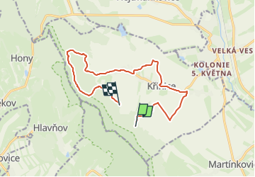
7.6 km | 11.4 km-effort
2h 35min
No
Trail On foot Martínkovice - [Z] Broumov - Zaječí rokle - Photo
On foot
GUIDE+

On foot

Easy
Martínkovice, Northeast, Královéhradecký kraj, Czech Republic
7.1 km | 8.7 km-effort
1h 59min
No


Close
My subscriptions