


3.6 km | 5.5 km-effort
![Trail On foot Pačlavice - [Ž] Nad Kozojedskem - Lhota u Pačlavic - Photo](https://media.geolcdn.com/t/1900/400/2ea20ab0-bb88-4be4-8f66-358c0e08b97e.jpeg&format=pjpeg&maxdim=2)

Tous les sentiers balisés d’Europe GUIDE+


FREE GPS app for hiking
 SityTrail
IGN / Geographical institutes
SityTrail World
The world is yours!
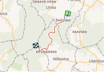
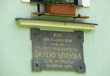
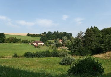
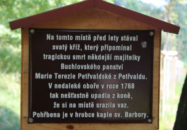
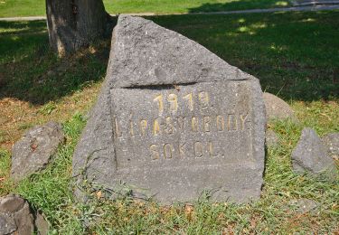
Trail On foot of 4.6 km to be discovered at Central Moravia, Zlínský kraj, Pačlavice. This trail is proposed by SityTrail - itinéraires balisés pédestres.
Trail created by cz:KČT.
![Trail On foot Pačlavice - [Ž] Nad Kozojedskem - Lhota u Pačlavic - Photo 1](https://media.geolcdn.com/t/2048/auto/0880fd15-5028-49e3-9933-3008ea146eed.jpeg&format=jpg&maxdim=0 "Trail On foot Pačlavice - [Ž] Nad Kozojedskem - Lhota u Pačlavic - Photo 1")
![Trail On foot Pačlavice - [Ž] Nad Kozojedskem - Lhota u Pačlavic - Photo 2](https://media.geolcdn.com/t/2048/auto/76ca39eb-b433-4dda-98af-61d3e5dd2389.jpeg&format=jpg&maxdim=0 "Trail On foot Pačlavice - [Ž] Nad Kozojedskem - Lhota u Pačlavic - Photo 2")
![Trail On foot Pačlavice - [Ž] Nad Kozojedskem - Lhota u Pačlavic - Photo 3](https://media.geolcdn.com/t/2048/auto/25869cdf-6f16-4916-b430-1a82d0460e69.jpeg&format=jpg&maxdim=0 "Trail On foot Pačlavice - [Ž] Nad Kozojedskem - Lhota u Pačlavic - Photo 3")
![Trail On foot Pačlavice - [Ž] Nad Kozojedskem - Lhota u Pačlavic - Photo 4](https://media.geolcdn.com/t/2048/auto/8ceb6fd3-7fdf-476a-b8ec-b21f9277a8d5.jpeg&format=jpg&maxdim=0 "Trail On foot Pačlavice - [Ž] Nad Kozojedskem - Lhota u Pačlavic - Photo 4")
![Trail On foot Pačlavice - [Ž] Nad Kozojedskem - Lhota u Pačlavic - Photo 5](https://media.geolcdn.com/t/2048/auto/0678618c-ee8a-47d6-a122-664b174a3add.jpeg&format=jpg&maxdim=0 "Trail On foot Pačlavice - [Ž] Nad Kozojedskem - Lhota u Pačlavic - Photo 5")
![Trail On foot Pačlavice - [Ž] Nad Kozojedskem - Lhota u Pačlavic - Photo 6](https://media.geolcdn.com/t/2048/auto/707e9570-eb3e-4b54-8ab3-ff274aee82c8.jpeg&format=jpg&maxdim=0 "Trail On foot Pačlavice - [Ž] Nad Kozojedskem - Lhota u Pačlavic - Photo 6")
![Trail On foot Pačlavice - [Ž] Nad Kozojedskem - Lhota u Pačlavic - Photo 7](https://media.geolcdn.com/t/2048/auto/63d3905c-d8c3-4df3-a9d6-957d82f7f113.jpeg&format=jpg&maxdim=0 "Trail On foot Pačlavice - [Ž] Nad Kozojedskem - Lhota u Pačlavic - Photo 7")
![Trail On foot Pačlavice - [Ž] Nad Kozojedskem - Lhota u Pačlavic - Photo 8](https://media.geolcdn.com/t/2048/auto/d1b5a573-a4c2-48f4-ae9b-b40aa86e0464.jpeg&format=jpg&maxdim=0 "Trail On foot Pačlavice - [Ž] Nad Kozojedskem - Lhota u Pačlavic - Photo 8")
![Trail On foot Pačlavice - [Ž] Nad Kozojedskem - Lhota u Pačlavic - Photo 9](https://media.geolcdn.com/t/2048/auto/a8a86807-2a1e-4881-b7b0-2ab7dba60adb.jpeg&format=jpg&maxdim=0 "Trail On foot Pačlavice - [Ž] Nad Kozojedskem - Lhota u Pačlavic - Photo 9")
![Trail On foot Pačlavice - [Ž] Nad Kozojedskem - Lhota u Pačlavic - Photo 10](https://media.geolcdn.com/t/2048/auto/2ea20ab0-bb88-4be4-8f66-358c0e08b97e.jpeg&format=jpg&maxdim=0 "Trail On foot Pačlavice - [Ž] Nad Kozojedskem - Lhota u Pačlavic - Photo 10")
On foot
On foot
On foot
On foot
On foot
On foot
On foot
On foot
![Trail On foot Brankovice - [Č] Brankovice - Švábenice - Photo](https://media.geolcdn.com/t/375/260/e8fb4ecb-25ca-4aad-b7f0-202984a811e1.jpeg&format=jpg&maxdim=2)
On foot