![](/images/other/stat-length.png)
![Trail On foot Samobor - Samobor (Hamor) - Slani dol - Photo](https://media.geolcdn.com/t/1900/400/287cd65b-9650-4adb-ad52-53091d2e9f31.jpeg&format=pjpeg&maxdim=2)
Samobor (Hamor) - Slani dol
SityTrail - itinéraires balisés pédestres
Tous les sentiers balisés d’Europe GUIDE+
![Length](/images/other/stat-length.png)
Length
4.5 km
![Max alt](https://static1.geolcdn.com/siteimages/upload/files/1508320355ic_sort_altitude_max_24dp.png)
Max alt
480 m
![Uphill gradient](https://static1.geolcdn.com/siteimages/upload/files/1508320355ic_sort_den_pos_24dp.png)
Uphill gradient
318 m
![Km-Effort](/images/other/stat-length.png)
Km-Effort
7.8 km
![Min alt](https://static1.geolcdn.com/siteimages/upload/files/1508320355ic_sort_altitude_min_24dp.png)
Min alt
195 m
![Downhill gradient](https://static1.geolcdn.com/siteimages/upload/files/1508320355ic_sort_den_neg_24dp.png)
Downhill gradient
45 m
![Boucle](https://static1.geolcdn.com/siteimages/upload/files/16400158638029165_repeat_loop_refresh_sync_direction_icon.png)
Boucle
No
Signpost
Creation date :
2025-02-07 10:41:59.236
Updated on :
2025-02-07 10:41:59.236
![On foot](https://static1.geolcdn.com/sitytour/trail-icons/100.png)
1h46
Difficulty : Easy
![Scan this QR Code to open this trail in the SityTrail application](https://capi.geolives.com/qq0zvz2zws4bq2lad0pu/sitytour/trails/4345319/qr.png?size=200)
FREE GPS app for hiking
About
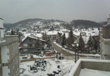
Trail On foot of 4.5 km to be discovered at Unknown, Zagreb County, Samobor. This trail is proposed by SityTrail - itinéraires balisés pédestres.
Description
Trail created by HPD Japetić, Samobo.
Samobor - a.p. Hamor (2,5 km od Samobora) - Gradišće - Draganje Selo - Slani dol (a.p.)
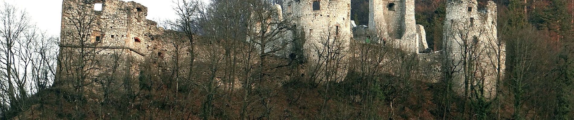
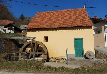
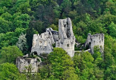
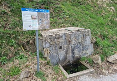
Positioning
Country:
Croatia
Region :
Unknown
Department/Province :
Zagreb County
Municipality :
Samobor
Location:
Unknown
Start:(Dec)
Start:(UTM)
552768 ; 5071991 (33T) N.
Comments
Trails nearby
![Trail On foot Samobor - Samobor - Veliki dol - Photo](https://media.geolcdn.com/t/375/260/21b94185-510f-4546-991c-c62af1c7bf3f.jpeg&format=jpg&maxdim=2)
![On foot On foot](https://static1.geolcdn.com/sitytour/trail-icons/100.png)
Samobor - Veliki dol
On foot
Easy
Samobor,
Unknown,
Zagreb County,
Croatia
![](/images/other/stat-length.png)
6.8 km | 11.4 km-effort
2h 35min
![](https://static1.geolcdn.com/siteimages/upload/files/16400158638029165_repeat_loop_refresh_sync_direction_icon.png)
No
![Trail On foot - Grgosova špilja - Slani dol - Photo](https://media.geolcdn.com/t/375/260/e1d74823-4105-4a56-acd7-4a4d2d506da5.jpeg&format=jpg&maxdim=2)
![On foot On foot](https://static1.geolcdn.com/sitytour/trail-icons/100.png)
Grgosova špilja - Slani dol
On foot
Easy
,
Unknown,
Zagreb County,
Croatia
![](/images/other/stat-length.png)
6.9 km | 9.4 km-effort
2h 7min
![](https://static1.geolcdn.com/siteimages/upload/files/16400158638029165_repeat_loop_refresh_sync_direction_icon.png)
No
![Trail On foot - Rude - Plešivica - Photo](https://media.geolcdn.com/t/375/260/64d55e2e-dd75-4144-9e92-e25a189ac92c.jpeg&format=jpg&maxdim=2)
![On foot On foot](https://static1.geolcdn.com/sitytour/trail-icons/100.png)
![Trail On foot Samobor - Samobor - Grgosova špilja - Photo](https://media.geolcdn.com/t/375/260/8fc87167-64f8-4dce-99f6-168edd44cd77.jpeg&format=jpg&maxdim=2)
![On foot On foot](https://static1.geolcdn.com/sitytour/trail-icons/100.png)
Samobor - Grgosova špilja
On foot
Easy
Samobor,
Unknown,
Zagreb County,
Croatia
![](/images/other/stat-length.png)
4.3 km | 6.6 km-effort
1h 29min
![](https://static1.geolcdn.com/siteimages/upload/files/16400158638029165_repeat_loop_refresh_sync_direction_icon.png)
No
![Trail On foot - Šoićeva kuća - Sv. Bernard - Photo](https://media.geolcdn.com/t/375/260/c97b8dc0-0e3a-4e26-bef6-8556ac70acf5.jpeg&format=jpg&maxdim=2)
![On foot On foot](https://static1.geolcdn.com/sitytour/trail-icons/100.png)
Šoićeva kuća - Sv. Bernard
On foot
Easy
,
Unknown,
Zagreb County,
Croatia
![](/images/other/stat-length.png)
3.4 km | 5.7 km-effort
1h 17min
![](https://static1.geolcdn.com/siteimages/upload/files/16400158638029165_repeat_loop_refresh_sync_direction_icon.png)
No