


4.5 km | 5.3 km-effort
![Trail On foot Brandýs nad Orlicí - [Ž] Brandýs nad Orlicí - okruh - Photo](https://media.geolcdn.com/t/1900/400/a13f2b27-51e8-4d6a-a5e1-59cd4671df46.jpeg&format=pjpeg&maxdim=2)

Tous les sentiers balisés d’Europe GUIDE+


FREE GPS app for hiking
 SityTrail
IGN / Geographical institutes
SityTrail World
The world is yours!
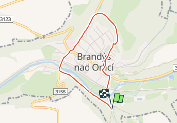
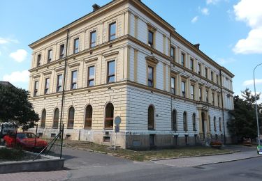
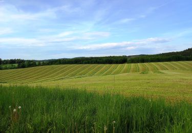
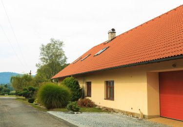
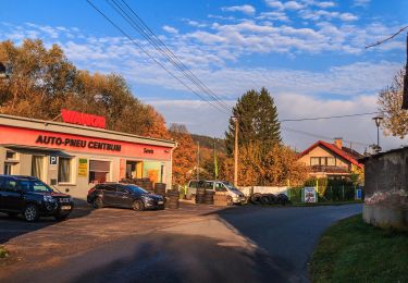
Trail On foot of 3.2 km to be discovered at Northeast, Pardubický kraj, Brandýs nad Orlicí. This trail is proposed by SityTrail - itinéraires balisés pédestres.
Trail created by cz:KČT.
![Trail On foot Brandýs nad Orlicí - [Ž] Brandýs nad Orlicí - okruh - Photo 1](https://media.geolcdn.com/t/2048/auto/dc5f67f7-9514-475e-8d8e-6c5fe71c50e3.jpeg&format=jpg&maxdim=0 "Trail On foot Brandýs nad Orlicí - [Ž] Brandýs nad Orlicí - okruh - Photo 1")
![Trail On foot Brandýs nad Orlicí - [Ž] Brandýs nad Orlicí - okruh - Photo 2](https://media.geolcdn.com/t/2048/auto/bb983b6d-b7f1-4c22-8319-b211392ddffc.jpeg&format=jpg&maxdim=0 "Trail On foot Brandýs nad Orlicí - [Ž] Brandýs nad Orlicí - okruh - Photo 2")
![Trail On foot Brandýs nad Orlicí - [Ž] Brandýs nad Orlicí - okruh - Photo 3](https://media.geolcdn.com/t/2048/auto/ac201bc1-d11f-4ac3-91c2-ef49101a89d0.jpeg&format=jpg&maxdim=0 "Trail On foot Brandýs nad Orlicí - [Ž] Brandýs nad Orlicí - okruh - Photo 3")
![Trail On foot Brandýs nad Orlicí - [Ž] Brandýs nad Orlicí - okruh - Photo 4](https://media.geolcdn.com/t/2048/auto/a70d5ddc-21f1-4e06-982f-a735257ee57a.jpeg&format=jpg&maxdim=0 "Trail On foot Brandýs nad Orlicí - [Ž] Brandýs nad Orlicí - okruh - Photo 4")
![Trail On foot Brandýs nad Orlicí - [Ž] Brandýs nad Orlicí - okruh - Photo 5](https://media.geolcdn.com/t/2048/auto/90140799-8584-406f-b691-6aafdb79fa3e.jpeg&format=jpg&maxdim=0 "Trail On foot Brandýs nad Orlicí - [Ž] Brandýs nad Orlicí - okruh - Photo 5")
![Trail On foot Brandýs nad Orlicí - [Ž] Brandýs nad Orlicí - okruh - Photo 6](https://media.geolcdn.com/t/2048/auto/91325995-ad4a-4826-a046-a7d18a0e7a9b.jpeg&format=jpg&maxdim=0 "Trail On foot Brandýs nad Orlicí - [Ž] Brandýs nad Orlicí - okruh - Photo 6")
![Trail On foot Brandýs nad Orlicí - [Ž] Brandýs nad Orlicí - okruh - Photo 7](https://media.geolcdn.com/t/2048/auto/c56bae0f-b2ae-4e9d-acfd-3640eedea476.jpeg&format=jpg&maxdim=0 "Trail On foot Brandýs nad Orlicí - [Ž] Brandýs nad Orlicí - okruh - Photo 7")
![Trail On foot Brandýs nad Orlicí - [Ž] Brandýs nad Orlicí - okruh - Photo 8](https://media.geolcdn.com/t/2048/auto/8e884f2e-8036-4e3a-8b40-78b0a786ab0d.jpeg&format=jpg&maxdim=0 "Trail On foot Brandýs nad Orlicí - [Ž] Brandýs nad Orlicí - okruh - Photo 8")
![Trail On foot Brandýs nad Orlicí - [Ž] Brandýs nad Orlicí - okruh - Photo 9](https://media.geolcdn.com/t/2048/auto/295c0a04-0615-415e-b2bc-811adb1032a6.jpeg&format=jpg&maxdim=0 "Trail On foot Brandýs nad Orlicí - [Ž] Brandýs nad Orlicí - okruh - Photo 9")
![Trail On foot Brandýs nad Orlicí - [Ž] Brandýs nad Orlicí - okruh - Photo 10](https://media.geolcdn.com/t/2048/auto/a13f2b27-51e8-4d6a-a5e1-59cd4671df46.jpeg&format=jpg&maxdim=0 "Trail On foot Brandýs nad Orlicí - [Ž] Brandýs nad Orlicí - okruh - Photo 10")
On foot
![Trail On foot Záchlumí - [M] Litice nad Orlicí - Žamberk - Photo](https://media.geolcdn.com/t/375/260/06e32d5b-ad68-47cd-bbfd-bb17859dd844.jpeg&format=jpg&maxdim=2)
On foot
On foot
On foot
On foot
On foot
On foot
On foot
![Trail On foot Česká Třebová - [Ž] Pod Kozlovcem - Pod Skuhrovem - Photo](https://media.geolcdn.com/t/375/260/e10c881f-a244-44ac-b766-3afd8215abfb.jpeg&format=jpg&maxdim=2)
On foot