![](/images/other/stat-length.png)
![Trail On foot Rokytnice v Orlických horách - [Ž] Rokytnice v Orl. h - Žampach - Photo](https://media.geolcdn.com/t/1900/400/ext.pjpeg?maxdim=2&url=https%3A%2F%2Fstatic1.geolcdn.com%2Fsiteimages%2Fupload%2Ffiles%2F1545311037marcheuse_200dpi.jpg)
[Ž] Rokytnice v Orl. h - Žampach
SityTrail - itinéraires balisés pédestres
Tous les sentiers balisés d’Europe GUIDE+
![Length](/images/other/stat-length.png)
Length
34 km
![Max alt](https://static1.geolcdn.com/siteimages/upload/files/1508320355ic_sort_altitude_max_24dp.png)
Max alt
571 m
![Uphill gradient](https://static1.geolcdn.com/siteimages/upload/files/1508320355ic_sort_den_pos_24dp.png)
Uphill gradient
879 m
![Km-Effort](/images/other/stat-length.png)
Km-Effort
46 km
![Min alt](https://static1.geolcdn.com/siteimages/upload/files/1508320355ic_sort_altitude_min_24dp.png)
Min alt
318 m
![Downhill gradient](https://static1.geolcdn.com/siteimages/upload/files/1508320355ic_sort_den_neg_24dp.png)
Downhill gradient
880 m
![Boucle](https://static1.geolcdn.com/siteimages/upload/files/16400158638029165_repeat_loop_refresh_sync_direction_icon.png)
Boucle
No
Signpost
Creation date :
2025-02-07 09:10:47.235
Updated on :
2025-02-07 09:10:47.235
![On foot](https://static1.geolcdn.com/sitytour/trail-icons/100.png)
10h28
Difficulty : Very difficult
![Scan this QR Code to open this trail in the SityTrail application](https://capi.geolives.com/qq0zvz2zws4bq2lad0pu/sitytour/trails/4345043/qr.png?size=200)
FREE GPS app for hiking
About
Trail On foot of 34 km to be discovered at Northeast, Královéhradecký kraj, Rokytnice v Orlických horách. This trail is proposed by SityTrail - itinéraires balisés pédestres.
Description
Trail created by cz:KČT.
Rokytnice v Orlických horách - Žamberk - Žampach
Positioning
Country:
Czech Republic
Region :
Northeast
Department/Province :
Královéhradecký kraj
Municipality :
Rokytnice v Orlických horách
Location:
Unknown
Start:(Dec)
Start:(UTM)
604667 ; 5557651 (33U) N.
Comments
Trails nearby
![Trail On foot Rokytnice v Orlických horách - NS Opevnění Rokytnicka - Photo](https://media.geolcdn.com/t/375/260/a0c96dca-eb28-4f93-abc6-4ce39ab56662.jpeg&format=jpg&maxdim=2)
![On foot On foot](https://static1.geolcdn.com/sitytour/trail-icons/100.png)
NS Opevnění Rokytnicka
On foot
Easy
Rokytnice v Orlických horách,
Northeast,
Královéhradecký kraj,
Czech Republic
![](/images/other/stat-length.png)
4.5 km | 6.9 km-effort
1h 34min
![](https://static1.geolcdn.com/siteimages/upload/files/16400158638029165_repeat_loop_refresh_sync_direction_icon.png)
No
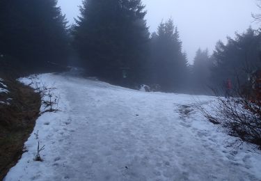
![Trail On foot Rokytnice v Orlických horách - [Z] Říčky v Orl. h. - Horní Rokytnice - Photo](https://media.geolcdn.com/t/375/260/ee733087-daf8-4ced-ba45-cb70cdb3ebdb.jpeg&format=jpg&maxdim=2)
![On foot On foot](https://static1.geolcdn.com/sitytour/trail-icons/100.png)
[Z] Říčky v Orl. h. - Horní Rokytnice
On foot
Easy
Rokytnice v Orlických horách,
Northeast,
Královéhradecký kraj,
Czech Republic
![](/images/other/stat-length.png)
4.7 km | 7.6 km-effort
1h 43min
![](https://static1.geolcdn.com/siteimages/upload/files/16400158638029165_repeat_loop_refresh_sync_direction_icon.png)
No
![Trail On foot Bartošovice v Orlických horách - [Ž] Hadinec - Niemojów - Photo](https://media.geolcdn.com/t/375/260/e001e748-2d96-4376-b819-e791ec49cc03.jpeg&format=jpg&maxdim=2)
![On foot On foot](https://static1.geolcdn.com/sitytour/trail-icons/100.png)
[Ž] Hadinec - Niemojów
On foot
Easy
Bartošovice v Orlických horách,
Northeast,
Královéhradecký kraj,
Czech Republic
![](/images/other/stat-length.png)
6.3 km | 7.2 km-effort
1h 38min
![](https://static1.geolcdn.com/siteimages/upload/files/16400158638029165_repeat_loop_refresh_sync_direction_icon.png)
No