![](/images/other/stat-length.png)
![Trail On foot Bukovka - NS Pernštejnskými rybníky - Photo](https://media.geolcdn.com/t/1900/400/3013e944-2fad-4351-b5a7-a469140d5b86.jpeg&format=pjpeg&maxdim=2)
NS Pernštejnskými rybníky
SityTrail - itinéraires balisés pédestres
Tous les sentiers balisés d’Europe GUIDE+
![Length](/images/other/stat-length.png)
Length
3.5 km
![Max alt](https://static1.geolcdn.com/siteimages/upload/files/1508320355ic_sort_altitude_max_24dp.png)
Max alt
252 m
![Uphill gradient](https://static1.geolcdn.com/siteimages/upload/files/1508320355ic_sort_den_pos_24dp.png)
Uphill gradient
51 m
![Km-Effort](/images/other/stat-length.png)
Km-Effort
4.1 km
![Min alt](https://static1.geolcdn.com/siteimages/upload/files/1508320355ic_sort_altitude_min_24dp.png)
Min alt
227 m
![Downhill gradient](https://static1.geolcdn.com/siteimages/upload/files/1508320355ic_sort_den_neg_24dp.png)
Downhill gradient
41 m
![Boucle](https://static1.geolcdn.com/siteimages/upload/files/16400158638029165_repeat_loop_refresh_sync_direction_icon.png)
Boucle
No
Signpost
Creation date :
2025-02-07 08:20:06.642
Updated on :
2025-02-07 08:20:06.642
![On foot](https://static1.geolcdn.com/sitytour/trail-icons/100.png)
56m
Difficulty : Easy
![Scan this QR Code to open this trail in the SityTrail application](https://capi.geolives.com/qq0zvz2zws4bq2lad0pu/sitytour/trails/4344932/qr.png?size=200)
FREE GPS app for hiking
About
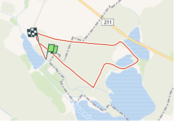
Trail On foot of 3.5 km to be discovered at Northeast, Pardubický kraj, Bukovka. This trail is proposed by SityTrail - itinéraires balisés pédestres.
Description
Trail created by Občanské sdružení pro obnovu a rozvoj obce Neratova a Novinska.
Positioning
Country:
Czech Republic
Region :
Northeast
Department/Province :
Pardubický kraj
Municipality :
Bukovka
Location:
Unknown
Start:(Dec)
Start:(UTM)
544731 ; 5549103 (33U) N.
Comments
Trails nearby
![Trail On foot Lázně Bohdaneč - naučná stezka Gočárův okruh - Photo](https://media.geolcdn.com/t/375/260/c0ef8400-48c7-4e67-9c7f-4d6928bff27a.jpeg&format=jpg&maxdim=2)
![On foot On foot](https://static1.geolcdn.com/sitytour/trail-icons/100.png)
naučná stezka Gočárův okruh
On foot
Easy
Lázně Bohdaneč,
Northeast,
Pardubický kraj,
Czech Republic
![](/images/other/stat-length.png)
5 km | 5.6 km-effort
1h 16min
![](https://static1.geolcdn.com/siteimages/upload/files/16400158638029165_repeat_loop_refresh_sync_direction_icon.png)
Yes
![Trail On foot Břehy - [Ž] Černý Nadýmač - okruh - Photo](https://media.geolcdn.com/t/375/260/479c30b1-2ae0-479c-bb59-7778ea6d1886.jpeg&format=jpg&maxdim=2)
![On foot On foot](https://static1.geolcdn.com/sitytour/trail-icons/100.png)
[Ž] Černý Nadýmač - okruh
On foot
Easy
Břehy,
Northeast,
Pardubický kraj,
Czech Republic
![](/images/other/stat-length.png)
6.5 km | 7.4 km-effort
1h 40min
![](https://static1.geolcdn.com/siteimages/upload/files/16400158638029165_repeat_loop_refresh_sync_direction_icon.png)
Yes