


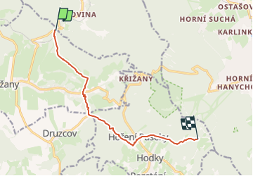

4.1 km | 5.4 km-effort
![Trail On foot Křižany - [Ž] Křižanské sedlo - Pláně - U transformátoru - Photo](https://media.geolcdn.com/t/1900/400/230f4213-a76e-4d3c-808d-692d7ae9c340.jpeg&format=pjpeg&maxdim=2)

Tous les sentiers balisés d’Europe GUIDE+


FREE GPS app for hiking
 SityTrail
IGN / Geographical institutes
SityTrail World
The world is yours!
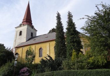
Trail On foot of 8.3 km to be discovered at Northeast, Liberecký kraj, Křižany. This trail is proposed by SityTrail - itinéraires balisés pédestres.
Trail created by cz:KČT.
změna vedení trasy 2014-11-18
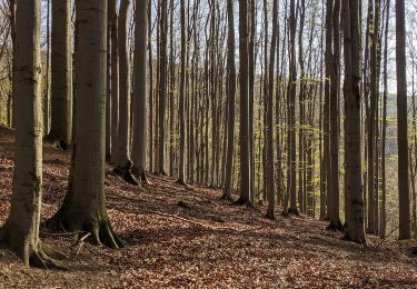
![Trail On foot Křižany - [Ž] Křižanské sedlo - Pláně - U transformátoru - Photo 1](https://media.geolcdn.com/t/2048/auto/9048db78-c786-471a-a920-9cd1bb6fa0ca.jpeg&format=jpg&maxdim=0 "Trail On foot Křižany - [Ž] Křižanské sedlo - Pláně - U transformátoru - Photo 1")
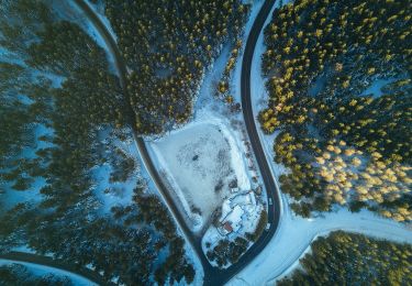
![Trail On foot Křižany - [Ž] Křižanské sedlo - Pláně - U transformátoru - Photo 2](https://media.geolcdn.com/t/2048/auto/3296bfc7-c13f-4a92-8416-89a0328fced2.jpeg&format=jpg&maxdim=0 "Trail On foot Křižany - [Ž] Křižanské sedlo - Pláně - U transformátoru - Photo 2")
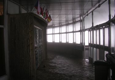
![Trail On foot Křižany - [Ž] Křižanské sedlo - Pláně - U transformátoru - Photo 3](https://media.geolcdn.com/t/2048/auto/c1216722-a3fb-40b9-9fba-25208b436785.jpeg&format=jpg&maxdim=0 "Trail On foot Křižany - [Ž] Křižanské sedlo - Pláně - U transformátoru - Photo 3")
![Trail On foot Křižany - [Ž] Křižanské sedlo - Pláně - U transformátoru - Photo 4](https://media.geolcdn.com/t/2048/auto/59ae8e67-540b-4dbc-aadd-c199847ef930.jpeg&format=jpg&maxdim=0 "Trail On foot Křižany - [Ž] Křižanské sedlo - Pláně - U transformátoru - Photo 4")
![Trail On foot Křižany - [Ž] Křižanské sedlo - Pláně - U transformátoru - Photo 5](https://media.geolcdn.com/t/2048/auto/2f11e9d5-f503-4f55-8fb0-cfc6f569268b.jpeg&format=jpg&maxdim=0 "Trail On foot Křižany - [Ž] Křižanské sedlo - Pláně - U transformátoru - Photo 5")
![Trail On foot Křižany - [Ž] Křižanské sedlo - Pláně - U transformátoru - Photo 6](https://media.geolcdn.com/t/2048/auto/9f6edceb-37ff-457b-8bdd-fe04c7791541.jpeg&format=jpg&maxdim=0 "Trail On foot Křižany - [Ž] Křižanské sedlo - Pláně - U transformátoru - Photo 6")
![Trail On foot Křižany - [Ž] Křižanské sedlo - Pláně - U transformátoru - Photo 7](https://media.geolcdn.com/t/2048/auto/0a0173a7-62a4-425b-b74a-94d76a0f49ca.jpeg&format=jpg&maxdim=0 "Trail On foot Křižany - [Ž] Křižanské sedlo - Pláně - U transformátoru - Photo 7")
![Trail On foot Křižany - [Ž] Křižanské sedlo - Pláně - U transformátoru - Photo 8](https://media.geolcdn.com/t/2048/auto/71803f80-2c0c-496d-ad1d-7e0e8f6a53b1.jpeg&format=jpg&maxdim=0 "Trail On foot Křižany - [Ž] Křižanské sedlo - Pláně - U transformátoru - Photo 8")
![Trail On foot Křižany - [Ž] Křižanské sedlo - Pláně - U transformátoru - Photo 9](https://media.geolcdn.com/t/2048/auto/33eb3903-089a-4904-bbf2-56a562d6273d.jpeg&format=jpg&maxdim=0 "Trail On foot Křižany - [Ž] Křižanské sedlo - Pláně - U transformátoru - Photo 9")
![Trail On foot Křižany - [Ž] Křižanské sedlo - Pláně - U transformátoru - Photo 10](https://media.geolcdn.com/t/2048/auto/230f4213-a76e-4d3c-808d-692d7ae9c340.jpeg&format=jpg&maxdim=0 "Trail On foot Křižany - [Ž] Křižanské sedlo - Pláně - U transformátoru - Photo 10")
![Trail On foot Kryštofovo Údolí - [M] Výpřež - Novina - Photo](https://media.geolcdn.com/t/375/260/71803f80-2c0c-496d-ad1d-7e0e8f6a53b1.jpeg&format=jpg&maxdim=2)
On foot
![Trail On foot Liberec - [Z] Machnín - Výpřež - Photo](https://media.geolcdn.com/t/375/260/6c4e39a9-4192-4f95-a548-5d74e5c76113.jpeg&format=jpg&maxdim=2)
On foot
![Trail On foot Zdislava - [Ž] Trávník-Pod Roimundem - Photo](https://media.geolcdn.com/t/375/260/c7b1925b-2e9f-49a3-b671-082298ba5d4b.jpeg&format=jpg&maxdim=2)
On foot
On foot
On foot
On foot
On foot