


4.5 km | 6.1 km-effort
![Trail On foot Červená Voda - [Ž] - Photo](https://media.geolcdn.com/t/1900/400/5135ffe1-02cb-47c6-a0a0-f14f79e7862e.jpeg&format=pjpeg&maxdim=2)

Tous les sentiers balisés d’Europe GUIDE+


FREE GPS app for hiking
 SityTrail
IGN / Geographical institutes
SityTrail World
The world is yours!
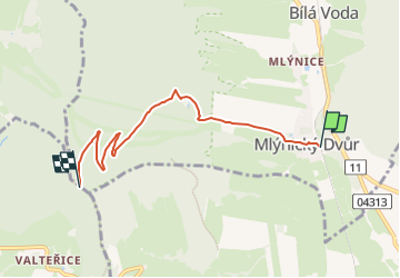
Trail On foot of 4.9 km to be discovered at Northeast, Pardubický kraj, Červená Voda. This trail is proposed by SityTrail - itinéraires balisés pédestres.
Trail created by cz:KČT.
![Trail On foot Červená Voda - [Ž] - Photo 1](https://media.geolcdn.com/t/2048/auto/5135ffe1-02cb-47c6-a0a0-f14f79e7862e.jpeg&format=jpg&maxdim=0 "Trail On foot Červená Voda - [Ž] - Photo 1")
![Trail On foot Písařov - [Ž] - Photo](https://media.geolcdn.com/t/375/260/d87fe63c-9d58-40a1-b18a-405c1995c936.jpeg&format=jpg&maxdim=2)
On foot