


9 km | 10.6 km-effort
![Trail On foot Hvožďany - [Z] Vacíkov - Třemšín - Photo](https://media.geolcdn.com/t/1900/400/f1b092e8-e85a-4488-b770-d743603f9f8f.jpeg&format=pjpeg&maxdim=2)

Tous les sentiers balisés d’Europe GUIDE+


FREE GPS app for hiking
 SityTrail
IGN / Geographical institutes
SityTrail World
The world is yours!
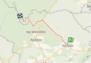
Trail On foot of 6.6 km to be discovered at Central Bohemia, Unknown, Hvožďany. This trail is proposed by SityTrail - itinéraires balisés pédestres.
Trail created by cz:KČT.
![Trail On foot Hvožďany - [Z] Vacíkov - Třemšín - Photo 1](https://media.geolcdn.com/t/2048/auto/c2d7abf7-8a45-4285-bc8c-89c881255ca5.jpeg&format=jpg&maxdim=0 "Trail On foot Hvožďany - [Z] Vacíkov - Třemšín - Photo 1")
![Trail On foot Hvožďany - [Z] Vacíkov - Třemšín - Photo 2](https://media.geolcdn.com/t/2048/auto/961cddf9-05eb-471e-8204-b9707171c83f.jpeg&format=jpg&maxdim=0 "Trail On foot Hvožďany - [Z] Vacíkov - Třemšín - Photo 2")
![Trail On foot Hvožďany - [Z] Vacíkov - Třemšín - Photo 3](https://media.geolcdn.com/t/2048/auto/1385021a-4443-4f95-a490-28a7d7456e82.jpeg&format=jpg&maxdim=0 "Trail On foot Hvožďany - [Z] Vacíkov - Třemšín - Photo 3")
![Trail On foot Hvožďany - [Z] Vacíkov - Třemšín - Photo 4](https://media.geolcdn.com/t/2048/auto/3568cb31-d7c6-473e-bac7-9f366e79ca50.jpeg&format=jpg&maxdim=0 "Trail On foot Hvožďany - [Z] Vacíkov - Třemšín - Photo 4")
![Trail On foot Hvožďany - [Z] Vacíkov - Třemšín - Photo 5](https://media.geolcdn.com/t/2048/auto/312cc7f7-3c45-41b2-a611-6124299aab18.jpeg&format=jpg&maxdim=0 "Trail On foot Hvožďany - [Z] Vacíkov - Třemšín - Photo 5")
![Trail On foot Hvožďany - [Z] Vacíkov - Třemšín - Photo 6](https://media.geolcdn.com/t/2048/auto/ab0b3b1e-9b3f-4fca-86f7-62f1fd5bcd5c.jpeg&format=jpg&maxdim=0 "Trail On foot Hvožďany - [Z] Vacíkov - Třemšín - Photo 6")
![Trail On foot Hvožďany - [Z] Vacíkov - Třemšín - Photo 7](https://media.geolcdn.com/t/2048/auto/b995ae81-ae87-4485-8f77-c910c4afadeb.jpeg&format=jpg&maxdim=0 "Trail On foot Hvožďany - [Z] Vacíkov - Třemšín - Photo 7")
![Trail On foot Hvožďany - [Z] Vacíkov - Třemšín - Photo 8](https://media.geolcdn.com/t/2048/auto/6f926565-3e7c-43c5-b469-a118f30a5743.jpeg&format=jpg&maxdim=0 "Trail On foot Hvožďany - [Z] Vacíkov - Třemšín - Photo 8")
![Trail On foot Hvožďany - [Z] Vacíkov - Třemšín - Photo 9](https://media.geolcdn.com/t/2048/auto/ce1a854d-3ec8-4e7c-a363-0327884dc3cb.jpeg&format=jpg&maxdim=0 "Trail On foot Hvožďany - [Z] Vacíkov - Třemšín - Photo 9")
![Trail On foot Hvožďany - [Z] Vacíkov - Třemšín - Photo 10](https://media.geolcdn.com/t/2048/auto/f1b092e8-e85a-4488-b770-d743603f9f8f.jpeg&format=jpg&maxdim=0 "Trail On foot Hvožďany - [Z] Vacíkov - Třemšín - Photo 10")
![Trail On foot Rožmitál pod Třemšínem - [Č] Rožmitál p. T. - Třemšín - Photo](https://media.geolcdn.com/t/375/260/0689d70f-e711-4fe9-af24-fb32614d9884.jpeg&format=jpg&maxdim=2)
On foot