


9.3 km | 14.2 km-effort
![Trail On foot Teplice - [Z] 3987 Okruh kolem Doubravky - Photo](https://media.geolcdn.com/t/1900/400/3cf74112-642d-4ebf-a1e3-d97f4e384318.jpeg&format=pjpeg&maxdim=2)

Tous les sentiers balisés d’Europe GUIDE+


FREE GPS app for hiking
 SityTrail
IGN / Geographical institutes
SityTrail World
The world is yours!
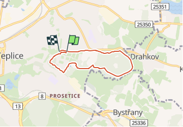
Trail On foot of 5.1 km to be discovered at Northwest, Ústecký kraj, Teplice. This trail is proposed by SityTrail - itinéraires balisés pédestres.
Trail created by cz:KČT.
Hadí lázně - Doubravská - Janáčkovy sady - Písečný vrch - Hvězdárna - Pod Doubravkou - Doubravská
Symbol: stripe
![Trail On foot Teplice - [Z] 3987 Okruh kolem Doubravky - Photo 1](https://media.geolcdn.com/t/2048/auto/4c876020-2258-444e-b8df-9729b3d577d3.jpeg&format=jpg&maxdim=0 "Trail On foot Teplice - [Z] 3987 Okruh kolem Doubravky - Photo 1")
![Trail On foot Teplice - [Z] 3987 Okruh kolem Doubravky - Photo 2](https://media.geolcdn.com/t/2048/auto/80f5c8b7-e65a-4022-b8d7-d4bf0aae74f6.jpeg&format=jpg&maxdim=0 "Trail On foot Teplice - [Z] 3987 Okruh kolem Doubravky - Photo 2")
![Trail On foot Teplice - [Z] 3987 Okruh kolem Doubravky - Photo 3](https://media.geolcdn.com/t/2048/auto/2b822b81-bdb5-4881-8db7-ee57dc70ae8c.jpeg&format=jpg&maxdim=0 "Trail On foot Teplice - [Z] 3987 Okruh kolem Doubravky - Photo 3")
![Trail On foot Teplice - [Z] 3987 Okruh kolem Doubravky - Photo 4](https://media.geolcdn.com/t/2048/auto/62eebd54-fa95-4a80-9c82-79b846fb8249.jpeg&format=jpg&maxdim=0 "Trail On foot Teplice - [Z] 3987 Okruh kolem Doubravky - Photo 4")
![Trail On foot Teplice - [Z] 3987 Okruh kolem Doubravky - Photo 5](https://media.geolcdn.com/t/2048/auto/c012d33e-6ff6-4406-939c-5fc8f627a259.jpeg&format=jpg&maxdim=0 "Trail On foot Teplice - [Z] 3987 Okruh kolem Doubravky - Photo 5")
![Trail On foot Teplice - [Z] 3987 Okruh kolem Doubravky - Photo 6](https://media.geolcdn.com/t/2048/auto/5d4477e9-f0da-4a23-be07-d74143f2608a.jpeg&format=jpg&maxdim=0 "Trail On foot Teplice - [Z] 3987 Okruh kolem Doubravky - Photo 6")
![Trail On foot Teplice - [Z] 3987 Okruh kolem Doubravky - Photo 7](https://media.geolcdn.com/t/2048/auto/a6b75536-c1ac-474c-bef1-3dc7eb5adf64.jpeg&format=jpg&maxdim=0 "Trail On foot Teplice - [Z] 3987 Okruh kolem Doubravky - Photo 7")
![Trail On foot Teplice - [Z] 3987 Okruh kolem Doubravky - Photo 8](https://media.geolcdn.com/t/2048/auto/9d4aae31-adbe-43cc-a290-0cf2cbfbed3c.jpeg&format=jpg&maxdim=0 "Trail On foot Teplice - [Z] 3987 Okruh kolem Doubravky - Photo 8")
![Trail On foot Teplice - [Z] 3987 Okruh kolem Doubravky - Photo 9](https://media.geolcdn.com/t/2048/auto/973d3f65-f346-4795-a74f-dbdb221fa8fd.jpeg&format=jpg&maxdim=0 "Trail On foot Teplice - [Z] 3987 Okruh kolem Doubravky - Photo 9")
![Trail On foot Teplice - [Z] 3987 Okruh kolem Doubravky - Photo 10](https://media.geolcdn.com/t/2048/auto/3cf74112-642d-4ebf-a1e3-d97f4e384318.jpeg&format=jpg&maxdim=0 "Trail On foot Teplice - [Z] 3987 Okruh kolem Doubravky - Photo 10")
![Trail On foot Dubí - [černá] Dubský Mikulovský okruh - Photo](https://media.geolcdn.com/t/375/260/51f015ee-3102-4ce3-8fc3-e9598c9230ee.jpeg&format=jpg&maxdim=2)
On foot
![Trail On foot Dubí - [O] Dubský západní okruh - Photo](https://media.geolcdn.com/t/375/260/4053a66a-61a3-4728-9c78-0f564a854477.jpeg&format=jpg&maxdim=2)
On foot
![Trail On foot Dubí - [Č] Dubský dolní lázeňský okruh - Photo](https://media.geolcdn.com/t/375/260/578f8f1d-780c-426d-828d-7daead75abe9.jpeg&format=jpg&maxdim=2)
On foot
![Trail On foot Dubí - [M] Dubský východní okruh - Photo](https://media.geolcdn.com/t/375/260/ea1a17e4-fa35-46cf-a917-1369a19b3e74.jpeg&format=jpg&maxdim=2)
On foot
![Trail On foot Teplice - [Č] 9302 Červený vycházkový okruh - Photo](https://media.geolcdn.com/t/375/260/ext.jpg?maxdim=2&url=https%3A%2F%2Fstatic1.geolcdn.com%2Fsiteimages%2Fupload%2Ffiles%2F1545311037marcheuse_200dpi.jpg)
On foot
On foot