


3.2 km | 4.1 km-effort
![Trail On foot Dolany - [Ž] Svatý kopeček - Pohořany - Photo](https://media.geolcdn.com/t/1900/400/82dc9e37-b126-4d08-b297-3d283d21421e.jpeg&format=pjpeg&maxdim=2)

Tous les sentiers balisés d’Europe GUIDE+


FREE GPS app for hiking
 SityTrail
IGN / Geographical institutes
SityTrail World
The world is yours!
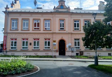
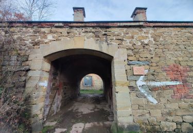
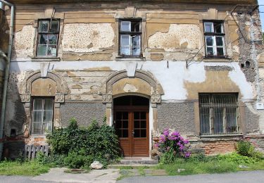
Trail On foot of 10.2 km to be discovered at Central Moravia, Olomouc Region, Dolany. This trail is proposed by SityTrail - itinéraires balisés pédestres.
Trail created by cz:KČT.
![Trail On foot Dolany - [Ž] Svatý kopeček - Pohořany - Photo 1](https://media.geolcdn.com/t/2048/auto/e2404fd4-e59d-4a28-968d-0ca74c9f2d7a.jpeg&format=jpg&maxdim=0 "Trail On foot Dolany - [Ž] Svatý kopeček - Pohořany - Photo 1")
![Trail On foot Dolany - [Ž] Svatý kopeček - Pohořany - Photo 2](https://media.geolcdn.com/t/2048/auto/8559da55-e8c6-48fe-ba1d-d3d028bd312a.jpeg&format=jpg&maxdim=0 "Trail On foot Dolany - [Ž] Svatý kopeček - Pohořany - Photo 2")
![Trail On foot Dolany - [Ž] Svatý kopeček - Pohořany - Photo 3](https://media.geolcdn.com/t/2048/auto/78dba137-0838-4da2-87f5-7e9ad7b06a85.jpeg&format=jpg&maxdim=0 "Trail On foot Dolany - [Ž] Svatý kopeček - Pohořany - Photo 3")
![Trail On foot Dolany - [Ž] Svatý kopeček - Pohořany - Photo 4](https://media.geolcdn.com/t/2048/auto/144e88f2-032b-4866-ac91-093aef56f073.jpeg&format=jpg&maxdim=0 "Trail On foot Dolany - [Ž] Svatý kopeček - Pohořany - Photo 4")
![Trail On foot Dolany - [Ž] Svatý kopeček - Pohořany - Photo 5](https://media.geolcdn.com/t/2048/auto/f3b3b302-f320-44b6-9358-96bf31dea465.jpeg&format=jpg&maxdim=0 "Trail On foot Dolany - [Ž] Svatý kopeček - Pohořany - Photo 5")
![Trail On foot Dolany - [Ž] Svatý kopeček - Pohořany - Photo 6](https://media.geolcdn.com/t/2048/auto/c6cb74da-6ab3-4fe0-a443-cf8ada5ba89e.jpeg&format=jpg&maxdim=0 "Trail On foot Dolany - [Ž] Svatý kopeček - Pohořany - Photo 6")
![Trail On foot Dolany - [Ž] Svatý kopeček - Pohořany - Photo 7](https://media.geolcdn.com/t/2048/auto/93255d7f-5ff7-4a75-adb5-9cd9c922b37a.jpeg&format=jpg&maxdim=0 "Trail On foot Dolany - [Ž] Svatý kopeček - Pohořany - Photo 7")
![Trail On foot Dolany - [Ž] Svatý kopeček - Pohořany - Photo 8](https://media.geolcdn.com/t/2048/auto/29bb0622-8746-4416-85d5-f50553af944d.jpeg&format=jpg&maxdim=0 "Trail On foot Dolany - [Ž] Svatý kopeček - Pohořany - Photo 8")
![Trail On foot Dolany - [Ž] Svatý kopeček - Pohořany - Photo 9](https://media.geolcdn.com/t/2048/auto/f7a36d51-1c4f-44e1-930d-c1288ffcb421.jpeg&format=jpg&maxdim=0 "Trail On foot Dolany - [Ž] Svatý kopeček - Pohořany - Photo 9")
![Trail On foot Dolany - [Ž] Svatý kopeček - Pohořany - Photo 10](https://media.geolcdn.com/t/2048/auto/82dc9e37-b126-4d08-b297-3d283d21421e.jpeg&format=jpg&maxdim=0 "Trail On foot Dolany - [Ž] Svatý kopeček - Pohořany - Photo 10")
On foot
On foot
On foot

On foot