


3.2 km | 4.1 km-effort
![Trail On foot Hlubočky - [Z] Mariánské údolí - Velká Bystřice - Photo](https://media.geolcdn.com/t/1900/400/7e9d1df7-de6a-498e-add7-e53e121b86d5.jpeg&format=pjpeg&maxdim=2)

Tous les sentiers balisés d’Europe GUIDE+


FREE GPS app for hiking
 SityTrail
IGN / Geographical institutes
SityTrail World
The world is yours!
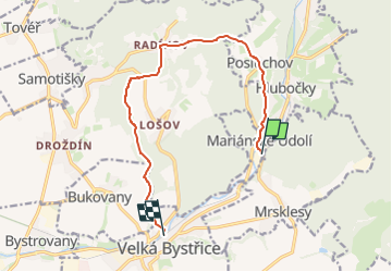
Trail On foot of 10.4 km to be discovered at Central Moravia, Olomouc Region, Hlubočky. This trail is proposed by SityTrail - itinéraires balisés pédestres.
Trail created by cz:KČT.
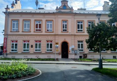
![Trail On foot Hlubočky - [Z] Mariánské údolí - Velká Bystřice - Photo 1](https://media.geolcdn.com/t/2048/auto/cbbf5b73-92b8-48f2-9636-c6bff2710d15.jpeg&format=jpg&maxdim=0 "Trail On foot Hlubočky - [Z] Mariánské údolí - Velká Bystřice - Photo 1")
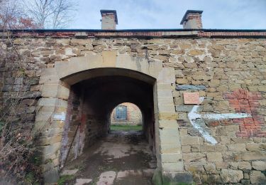
![Trail On foot Hlubočky - [Z] Mariánské údolí - Velká Bystřice - Photo 2](https://media.geolcdn.com/t/2048/auto/61a8a7ad-649c-404d-b615-aa5e0c663fb5.jpeg&format=jpg&maxdim=0 "Trail On foot Hlubočky - [Z] Mariánské údolí - Velká Bystřice - Photo 2")
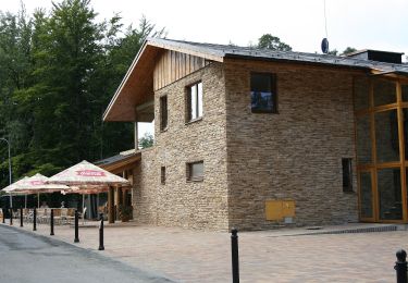
![Trail On foot Hlubočky - [Z] Mariánské údolí - Velká Bystřice - Photo 3](https://media.geolcdn.com/t/2048/auto/6cd7398a-029b-45ab-876f-0b3f4cc61684.jpeg&format=jpg&maxdim=0 "Trail On foot Hlubočky - [Z] Mariánské údolí - Velká Bystřice - Photo 3")
![Trail On foot Hlubočky - [Z] Mariánské údolí - Velká Bystřice - Photo 4](https://media.geolcdn.com/t/2048/auto/6dc4624a-537c-47bd-aa50-24753480994d.jpeg&format=jpg&maxdim=0 "Trail On foot Hlubočky - [Z] Mariánské údolí - Velká Bystřice - Photo 4")
![Trail On foot Hlubočky - [Z] Mariánské údolí - Velká Bystřice - Photo 5](https://media.geolcdn.com/t/2048/auto/65abe82c-8c46-4e66-8a75-1edf411a1a86.jpeg&format=jpg&maxdim=0 "Trail On foot Hlubočky - [Z] Mariánské údolí - Velká Bystřice - Photo 5")
![Trail On foot Hlubočky - [Z] Mariánské údolí - Velká Bystřice - Photo 6](https://media.geolcdn.com/t/2048/auto/2e3a671c-8086-4427-b917-60d74ea75866.jpeg&format=jpg&maxdim=0 "Trail On foot Hlubočky - [Z] Mariánské údolí - Velká Bystřice - Photo 6")
![Trail On foot Hlubočky - [Z] Mariánské údolí - Velká Bystřice - Photo 7](https://media.geolcdn.com/t/2048/auto/ce600c33-bd92-42e1-8e25-fbac1b339eb2.jpeg&format=jpg&maxdim=0 "Trail On foot Hlubočky - [Z] Mariánské údolí - Velká Bystřice - Photo 7")
![Trail On foot Hlubočky - [Z] Mariánské údolí - Velká Bystřice - Photo 8](https://media.geolcdn.com/t/2048/auto/329b5813-5f7a-4c71-9552-e0c041b12109.jpeg&format=jpg&maxdim=0 "Trail On foot Hlubočky - [Z] Mariánské údolí - Velká Bystřice - Photo 8")
![Trail On foot Hlubočky - [Z] Mariánské údolí - Velká Bystřice - Photo 9](https://media.geolcdn.com/t/2048/auto/7e9d1df7-de6a-498e-add7-e53e121b86d5.jpeg&format=jpg&maxdim=0 "Trail On foot Hlubočky - [Z] Mariánské údolí - Velká Bystřice - Photo 9")
![Trail On foot Hlubočky - [Z] Mariánské údolí - Velká Bystřice - Photo 10](https://media.geolcdn.com/t/2048/auto/8f5128f9-f189-4235-957a-d9f9034c02a4.jpeg&format=jpg&maxdim=0 "Trail On foot Hlubočky - [Z] Mariánské údolí - Velká Bystřice - Photo 10")
On foot
On foot
On foot
![Trail On foot Hlubočky - [Ž] Mariánské Údolí - Olomouc hl.n. - Photo](https://media.geolcdn.com/t/375/260/1f62cd43-3bfa-4839-90b3-12f580a35229.jpeg&format=jpg&maxdim=2)
On foot

On foot