


3.7 km | 4 km-effort
![Trail On foot Hradec - [Z] Hradec - Vytůň - Photo](https://media.geolcdn.com/t/1900/400/36372a90-b81a-4a71-9876-a3bf9f884ffe.jpeg&format=pjpeg&maxdim=2)

Tous les sentiers balisés d’Europe GUIDE+


FREE GPS app for hiking
 SityTrail
IGN / Geographical institutes
SityTrail World
The world is yours!
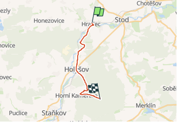
Trail On foot of 11.8 km to be discovered at Southwest, Plzeňský kraj, Hradec. This trail is proposed by SityTrail - itinéraires balisés pédestres.
Trail created by cz:KČT.
![Trail On foot Hradec - [Z] Hradec - Vytůň - Photo 1](https://media.geolcdn.com/t/2048/auto/37a342e5-1a03-413e-bac8-57c03303169b.jpeg&format=jpg&maxdim=0 "Trail On foot Hradec - [Z] Hradec - Vytůň - Photo 1")
![Trail On foot Hradec - [Z] Hradec - Vytůň - Photo 2](https://media.geolcdn.com/t/2048/auto/c0021375-7f17-4899-b24e-257650966cc8.jpeg&format=jpg&maxdim=0 "Trail On foot Hradec - [Z] Hradec - Vytůň - Photo 2")
![Trail On foot Hradec - [Z] Hradec - Vytůň - Photo 3](https://media.geolcdn.com/t/2048/auto/cae64181-2dab-4141-8d77-5fb4e9168e59.jpeg&format=jpg&maxdim=0 "Trail On foot Hradec - [Z] Hradec - Vytůň - Photo 3")
![Trail On foot Hradec - [Z] Hradec - Vytůň - Photo 4](https://media.geolcdn.com/t/2048/auto/da49426e-719a-4afd-892c-e528767709ed.jpeg&format=jpg&maxdim=0 "Trail On foot Hradec - [Z] Hradec - Vytůň - Photo 4")
![Trail On foot Hradec - [Z] Hradec - Vytůň - Photo 5](https://media.geolcdn.com/t/2048/auto/0419d378-b7c0-4ff5-aa8b-9a2bad70ab27.jpeg&format=jpg&maxdim=0 "Trail On foot Hradec - [Z] Hradec - Vytůň - Photo 5")
![Trail On foot Hradec - [Z] Hradec - Vytůň - Photo 6](https://media.geolcdn.com/t/2048/auto/16052934-5e3c-49d5-b19d-2539e9271bc3.jpeg&format=jpg&maxdim=0 "Trail On foot Hradec - [Z] Hradec - Vytůň - Photo 6")
![Trail On foot Hradec - [Z] Hradec - Vytůň - Photo 7](https://media.geolcdn.com/t/2048/auto/7a31e37a-6c3b-4732-8b7a-8939b97c6fe2.jpeg&format=jpg&maxdim=0 "Trail On foot Hradec - [Z] Hradec - Vytůň - Photo 7")
![Trail On foot Hradec - [Z] Hradec - Vytůň - Photo 8](https://media.geolcdn.com/t/2048/auto/76b9c107-588a-49ad-90b1-a080edd04738.jpeg&format=jpg&maxdim=0 "Trail On foot Hradec - [Z] Hradec - Vytůň - Photo 8")
![Trail On foot Hradec - [Z] Hradec - Vytůň - Photo 9](https://media.geolcdn.com/t/2048/auto/36372a90-b81a-4a71-9876-a3bf9f884ffe.jpeg&format=jpg&maxdim=0 "Trail On foot Hradec - [Z] Hradec - Vytůň - Photo 9")
![Trail On foot Hradec - [Z] Hradec - Vytůň - Photo 10](https://media.geolcdn.com/t/2048/auto/80f7c373-8b33-42bc-9c5e-7018abedfecb.jpeg&format=jpg&maxdim=0 "Trail On foot Hradec - [Z] Hradec - Vytůň - Photo 10")
![Trail On foot Stod - [Ž] Stod - Vytůň - Photo](https://media.geolcdn.com/t/375/260/5f465939-ef20-4d07-aeae-d7b7b507e19b.jpeg&format=jpg&maxdim=2)
On foot
![Trail On foot Holýšov - [Č] Stod - Holýšov - Photo](https://media.geolcdn.com/t/375/260/90aeb2c9-5fc5-41c2-ad60-4fffca584599.jpeg&format=jpg&maxdim=2)
On foot