


11.8 km | 15.7 km-effort
![Trail On foot Stod - [Ž] Stod - Vytůň - Photo](https://media.geolcdn.com/t/1900/400/5f465939-ef20-4d07-aeae-d7b7b507e19b.jpeg&format=pjpeg&maxdim=2)

Tous les sentiers balisés d’Europe GUIDE+


FREE GPS app for hiking
 SityTrail
IGN / Geographical institutes
SityTrail World
The world is yours!
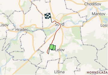
Trail On foot of 3.7 km to be discovered at Southwest, Plzeňský kraj, Stod. This trail is proposed by SityTrail - itinéraires balisés pédestres.
Trail created by cz:KČT.
![Trail On foot Stod - [Ž] Stod - Vytůň - Photo 1](https://media.geolcdn.com/t/2048/auto/bc262338-003f-4ebd-9ad6-d42567757265.jpeg&format=jpg&maxdim=0 "Trail On foot Stod - [Ž] Stod - Vytůň - Photo 1")
![Trail On foot Stod - [Ž] Stod - Vytůň - Photo 2](https://media.geolcdn.com/t/2048/auto/61ffdd6c-2e3b-4fe7-8e2f-7c2578c6be13.jpeg&format=jpg&maxdim=0 "Trail On foot Stod - [Ž] Stod - Vytůň - Photo 2")
![Trail On foot Stod - [Ž] Stod - Vytůň - Photo 3](https://media.geolcdn.com/t/2048/auto/de67b957-8e98-44ce-a96b-33ef0370f892.jpeg&format=jpg&maxdim=0 "Trail On foot Stod - [Ž] Stod - Vytůň - Photo 3")
![Trail On foot Stod - [Ž] Stod - Vytůň - Photo 4](https://media.geolcdn.com/t/2048/auto/c2e57d01-24ba-44cf-a308-4c6525dd79c8.jpeg&format=jpg&maxdim=0 "Trail On foot Stod - [Ž] Stod - Vytůň - Photo 4")
![Trail On foot Stod - [Ž] Stod - Vytůň - Photo 5](https://media.geolcdn.com/t/2048/auto/72d5e1dc-acec-4f29-af63-fc05660a48c0.jpeg&format=jpg&maxdim=0 "Trail On foot Stod - [Ž] Stod - Vytůň - Photo 5")
![Trail On foot Stod - [Ž] Stod - Vytůň - Photo 6](https://media.geolcdn.com/t/2048/auto/05bb1e46-db2a-408f-bc23-de1b80ce7c55.jpeg&format=jpg&maxdim=0 "Trail On foot Stod - [Ž] Stod - Vytůň - Photo 6")
![Trail On foot Stod - [Ž] Stod - Vytůň - Photo 7](https://media.geolcdn.com/t/2048/auto/a3478829-a5ec-4ead-b468-4b090c72f891.jpeg&format=jpg&maxdim=0 "Trail On foot Stod - [Ž] Stod - Vytůň - Photo 7")
![Trail On foot Stod - [Ž] Stod - Vytůň - Photo 8](https://media.geolcdn.com/t/2048/auto/e1c874d3-6644-451b-aeb8-20ed107729d3.jpeg&format=jpg&maxdim=0 "Trail On foot Stod - [Ž] Stod - Vytůň - Photo 8")
![Trail On foot Stod - [Ž] Stod - Vytůň - Photo 9](https://media.geolcdn.com/t/2048/auto/79150c6c-808a-4195-9370-d04a4b017290.jpeg&format=jpg&maxdim=0 "Trail On foot Stod - [Ž] Stod - Vytůň - Photo 9")
![Trail On foot Stod - [Ž] Stod - Vytůň - Photo 10](https://media.geolcdn.com/t/2048/auto/5f465939-ef20-4d07-aeae-d7b7b507e19b.jpeg&format=jpg&maxdim=0 "Trail On foot Stod - [Ž] Stod - Vytůň - Photo 10")
![Trail On foot Hradec - [Z] Hradec - Vytůň - Photo](https://media.geolcdn.com/t/375/260/36372a90-b81a-4a71-9876-a3bf9f884ffe.jpeg&format=jpg&maxdim=2)
On foot
![Trail On foot Chotěšov - [Z] Chotěšov - Chudenice - Photo](https://media.geolcdn.com/t/375/260/db6e0667-71ef-4d53-8b64-8b347f6d468d.jpeg&format=jpg&maxdim=2)
On foot
![Trail On foot Holýšov - [Č] Stod - Holýšov - Photo](https://media.geolcdn.com/t/375/260/90aeb2c9-5fc5-41c2-ad60-4fffca584599.jpeg&format=jpg&maxdim=2)
On foot