![](/images/other/stat-length.png)
![Trail On foot Nalžovice - CZ-6035 - Photo](https://media.geolcdn.com/t/1900/400/c20361bb-e243-426a-b85a-368efdf65b8b.jpeg&format=pjpeg&maxdim=2)
CZ-6035
SityTrail - itinéraires balisés pédestres
Tous les sentiers balisés d’Europe GUIDE+
![Length](/images/other/stat-length.png)
Length
5.2 km
![Max alt](https://static1.geolcdn.com/siteimages/upload/files/1508320355ic_sort_altitude_max_24dp.png)
Max alt
412 m
![Uphill gradient](https://static1.geolcdn.com/siteimages/upload/files/1508320355ic_sort_den_pos_24dp.png)
Uphill gradient
186 m
![Km-Effort](/images/other/stat-length.png)
Km-Effort
7.5 km
![Min alt](https://static1.geolcdn.com/siteimages/upload/files/1508320355ic_sort_altitude_min_24dp.png)
Min alt
275 m
![Downhill gradient](https://static1.geolcdn.com/siteimages/upload/files/1508320355ic_sort_den_neg_24dp.png)
Downhill gradient
125 m
![Boucle](https://static1.geolcdn.com/siteimages/upload/files/16400158638029165_repeat_loop_refresh_sync_direction_icon.png)
Boucle
No
Signpost
Creation date :
2025-02-07 00:03:42.505
Updated on :
2025-02-07 00:03:42.505
![On foot](https://static1.geolcdn.com/sitytour/trail-icons/100.png)
1h42
Difficulty : Easy
![Scan this QR Code to open this trail in the SityTrail application](https://capi.geolives.com/qq0zvz2zws4bq2lad0pu/sitytour/trails/4344303/qr.png?size=200)
FREE GPS app for hiking
About
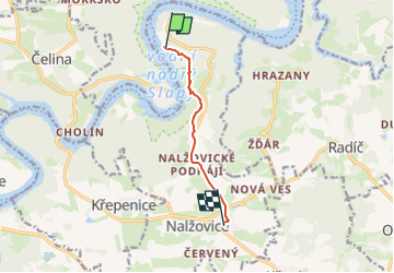
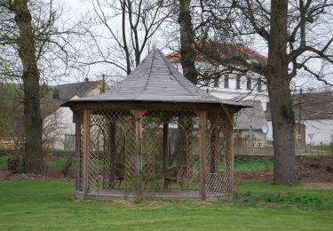
Trail On foot of 5.2 km to be discovered at Central Bohemia, Unknown, Nalžovice. This trail is proposed by SityTrail - itinéraires balisés pédestres.
Description
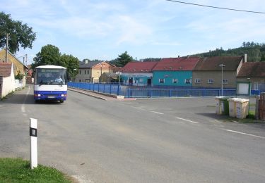
Trail created by cz:KČT.
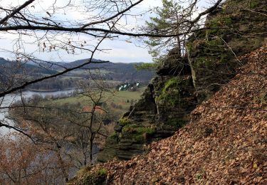
[Ž] Chlum - Častoboř
Positioning
Country:
Czech Republic
Region :
Central Bohemia
Department/Province :
Unknown
Municipality :
Nalžovice
Location:
Unknown
Start:(Dec)
Start:(UTM)
453940 ; 5509353 (33U) N.
Comments
Trails nearby
![Trail On foot Nový Knín - NS Kozí Hory - Libčice - Photo](https://media.geolcdn.com/t/375/260/7a471425-5ce5-45fe-a068-06f04c6f48cc.jpeg&format=jpg&maxdim=2)
![On foot On foot](https://static1.geolcdn.com/sitytour/trail-icons/100.png)
NS Kozí Hory - Libčice
On foot
Easy
Nový Knín,
Central Bohemia,
Unknown,
Czech Republic
![](/images/other/stat-length.png)
10.1 km | 13.5 km-effort
3h 3min
![](https://static1.geolcdn.com/siteimages/upload/files/16400158638029165_repeat_loop_refresh_sync_direction_icon.png)
Yes
![Trail On foot Křepenice - CZ-6050 - Photo](https://media.geolcdn.com/t/375/260/f4a084d0-0027-482f-af2f-f7308f08960b.jpeg&format=jpg&maxdim=2)
![On foot On foot](https://static1.geolcdn.com/sitytour/trail-icons/100.png)
CZ-6050
On foot
Easy
Křepenice,
Central Bohemia,
Unknown,
Czech Republic
![](/images/other/stat-length.png)
3.1 km | 4 km-effort
54min
![](https://static1.geolcdn.com/siteimages/upload/files/16400158638029165_repeat_loop_refresh_sync_direction_icon.png)
No
![Trail On foot Radíč - Radíč - Křečovice - Photo](https://media.geolcdn.com/t/375/260/f0dafbfe-5aad-4577-be75-77d1f63b561c.jpeg&format=jpg&maxdim=2)
![On foot On foot](https://static1.geolcdn.com/sitytour/trail-icons/100.png)
Radíč - Křečovice
On foot
Easy
Radíč,
Central Bohemia,
Unknown,
Czech Republic
![](/images/other/stat-length.png)
5.8 km | 7.3 km-effort
1h 40min
![](https://static1.geolcdn.com/siteimages/upload/files/16400158638029165_repeat_loop_refresh_sync_direction_icon.png)
No
![Trail On foot Nalžovice - NS Drbákov - Albertovy skály - Photo](https://media.geolcdn.com/t/375/260/63b54c67-425b-421e-9dc0-938859cf3b77.jpeg&format=jpg&maxdim=2)
![On foot On foot](https://static1.geolcdn.com/sitytour/trail-icons/100.png)
NS Drbákov - Albertovy skály
On foot
Easy
Nalžovice,
Central Bohemia,
Unknown,
Czech Republic
![](/images/other/stat-length.png)
5.9 km | 8.9 km-effort
2h 1min
![](https://static1.geolcdn.com/siteimages/upload/files/16400158638029165_repeat_loop_refresh_sync_direction_icon.png)
Yes
![Trail On foot Radíč - CZ-6035 - Photo](https://media.geolcdn.com/t/375/260/a7e4ef27-b1b9-446e-871f-6a0a782428a3.jpeg&format=jpg&maxdim=2)
![On foot On foot](https://static1.geolcdn.com/sitytour/trail-icons/100.png)
CZ-6035
On foot
Easy
Radíč,
Central Bohemia,
Unknown,
Czech Republic
![](/images/other/stat-length.png)
12.6 km | 16.3 km-effort
3h 42min
![](https://static1.geolcdn.com/siteimages/upload/files/16400158638029165_repeat_loop_refresh_sync_direction_icon.png)
No
![Trail On foot Chotilsko - [Z] Nahoruby - Živohošťský most - Photo](https://media.geolcdn.com/t/375/260/fa260171-e240-419e-a8d3-5f7efb5b52f4.jpeg&format=jpg&maxdim=2)
![On foot On foot](https://static1.geolcdn.com/sitytour/trail-icons/100.png)
[Z] Nahoruby - Živohošťský most
On foot
Easy
Chotilsko,
Central Bohemia,
Unknown,
Czech Republic
![](/images/other/stat-length.png)
7.1 km | 10.3 km-effort
2h 19min
![](https://static1.geolcdn.com/siteimages/upload/files/16400158638029165_repeat_loop_refresh_sync_direction_icon.png)
No
![Trail On foot Křečovice - [Ž] Psané skály - Třebsín - Photo](https://media.geolcdn.com/t/375/260/3cd7229a-258b-4497-bbf4-a53a3dbe60e8.jpeg&format=jpg&maxdim=2)
![On foot On foot](https://static1.geolcdn.com/sitytour/trail-icons/100.png)
[Ž] Psané skály - Třebsín
On foot
Difficult
Křečovice,
Central Bohemia,
Unknown,
Czech Republic
![](/images/other/stat-length.png)
24 km | 32 km-effort
7h 11min
![](https://static1.geolcdn.com/siteimages/upload/files/16400158638029165_repeat_loop_refresh_sync_direction_icon.png)
No
![Trail On foot Chotilsko - [Ž] Živohošť-Hříměždice - Photo](https://media.geolcdn.com/t/375/260/ext.jpg?maxdim=2&url=https%3A%2F%2Fstatic1.geolcdn.com%2Fsiteimages%2Fupload%2Ffiles%2F1545311037marcheuse_200dpi.jpg)
![On foot On foot](https://static1.geolcdn.com/sitytour/trail-icons/100.png)
[Ž] Živohošť-Hříměždice
On foot
Easy
Chotilsko,
Central Bohemia,
Unknown,
Czech Republic
![](/images/other/stat-length.png)
11.8 km | 16.6 km-effort
3h 46min
![](https://static1.geolcdn.com/siteimages/upload/files/16400158638029165_repeat_loop_refresh_sync_direction_icon.png)
No
![Trail On foot Chotilsko - NS Vymyšlenská pěšina - Photo](https://media.geolcdn.com/t/375/260/ext.jpg?maxdim=2&url=https%3A%2F%2Fstatic1.geolcdn.com%2Fsiteimages%2Fupload%2Ffiles%2F1545311037marcheuse_200dpi.jpg)
![On foot On foot](https://static1.geolcdn.com/sitytour/trail-icons/100.png)
NS Vymyšlenská pěšina
On foot
Easy
Chotilsko,
Central Bohemia,
Unknown,
Czech Republic
![](/images/other/stat-length.png)
4.1 km | 4.9 km-effort
1h 6min
![](https://static1.geolcdn.com/siteimages/upload/files/16400158638029165_repeat_loop_refresh_sync_direction_icon.png)
No