![](/images/other/stat-length.png)
![Trail On foot Mariánské Lázně - CZ-6694 - Photo](https://media.geolcdn.com/t/1900/400/392254fc-cc20-433d-ae28-5405adbf730c.jpeg&format=pjpeg&maxdim=2)
CZ-6694
SityTrail - itinéraires balisés pédestres
Tous les sentiers balisés d’Europe GUIDE+
![Length](/images/other/stat-length.png)
Length
16.6 km
![Max alt](https://static1.geolcdn.com/siteimages/upload/files/1508320355ic_sort_altitude_max_24dp.png)
Max alt
683 m
![Uphill gradient](https://static1.geolcdn.com/siteimages/upload/files/1508320355ic_sort_den_pos_24dp.png)
Uphill gradient
329 m
![Km-Effort](/images/other/stat-length.png)
Km-Effort
21 km
![Min alt](https://static1.geolcdn.com/siteimages/upload/files/1508320355ic_sort_altitude_min_24dp.png)
Min alt
543 m
![Downhill gradient](https://static1.geolcdn.com/siteimages/upload/files/1508320355ic_sort_den_neg_24dp.png)
Downhill gradient
290 m
![Boucle](https://static1.geolcdn.com/siteimages/upload/files/16400158638029165_repeat_loop_refresh_sync_direction_icon.png)
Boucle
No
Signpost
Creation date :
2025-02-06 22:51:56.964
Updated on :
2025-02-06 22:51:56.964
![On foot](https://static1.geolcdn.com/sitytour/trail-icons/100.png)
4h44
Difficulty : Medium
![Scan this QR Code to open this trail in the SityTrail application](https://capi.geolives.com/qq0zvz2zws4bq2lad0pu/sitytour/trails/4344215/qr.png?size=200)
FREE GPS app for hiking
About
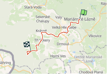
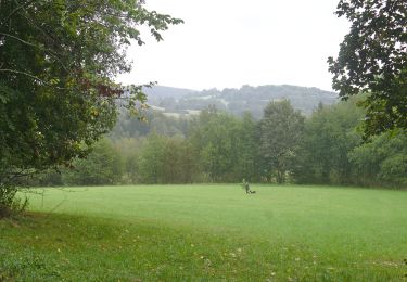
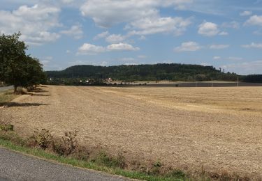
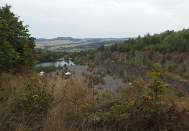
Trail On foot of 16.6 km to be discovered at Northwest, Karlovarský kraj, Mariánské Lázně. This trail is proposed by SityTrail - itinéraires balisés pédestres.
Description
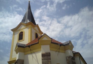
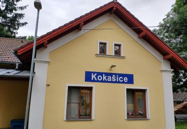
Trail created by cz:KČT.
Positioning
Country:
Czech Republic
Region :
Northwest
Department/Province :
Karlovarský kraj
Municipality :
Mariánské Lázně
Location:
Unknown
Start:(Dec)
Start:(UTM)
335319 ; 5538218 (33U) N.
Comments
Trails nearby
![Trail On foot Neualbenreuth - Neualbenreuth: Auf stillen Waldpfaden zur Grenze - Photo](https://media.geolcdn.com/t/375/260/da23ae0e-15a2-4ebb-81d9-23741e0bbc84.jpeg&format=jpg&maxdim=2)
![On foot On foot](https://static1.geolcdn.com/sitytour/trail-icons/100.png)
Neualbenreuth: Auf stillen Waldpfaden zur Grenze
On foot
Medium
Neualbenreuth,
Bavaria,
Landkreis Tirschenreuth,
Germany
![](/images/other/stat-length.png)
14.8 km | 20 km-effort
4h 36min
![](https://static1.geolcdn.com/siteimages/upload/files/16400158638029165_repeat_loop_refresh_sync_direction_icon.png)
Yes
![Trail On foot Neualbenreuth - Alter Herrgott - Granatbrunnen - Photo](https://media.geolcdn.com/t/375/260/f00bb44f-3a31-494e-b91b-cb23ec59b052.jpeg&format=jpg&maxdim=2)
![On foot On foot](https://static1.geolcdn.com/sitytour/trail-icons/100.png)
Alter Herrgott - Granatbrunnen
On foot
Easy
Neualbenreuth,
Bavaria,
Landkreis Tirschenreuth,
Germany
![](/images/other/stat-length.png)
5.7 km | 7.6 km-effort
1h 43min
![](https://static1.geolcdn.com/siteimages/upload/files/16400158638029165_repeat_loop_refresh_sync_direction_icon.png)
No
![Trail On foot Obora - NS Branka - Photo](https://media.geolcdn.com/t/375/260/4d9387c3-0da2-4db9-88c2-e5f4ace45396.jpeg&format=jpg&maxdim=2)
![On foot On foot](https://static1.geolcdn.com/sitytour/trail-icons/100.png)
NS Branka
On foot
Medium
Obora,
Southwest,
Plzeňský kraj,
Czech Republic
![](/images/other/stat-length.png)
17.5 km | 23 km-effort
5h 12min
![](https://static1.geolcdn.com/siteimages/upload/files/16400158638029165_repeat_loop_refresh_sync_direction_icon.png)
Yes
![Trail On foot Bezdružice - CZ-3694 - Photo](https://media.geolcdn.com/t/375/260/204f6e9b-baf4-471a-af05-8ac601086f65.jpeg&format=jpg&maxdim=2)
![On foot On foot](https://static1.geolcdn.com/sitytour/trail-icons/100.png)
CZ-3694
On foot
Easy
Bezdružice,
Southwest,
Plzeňský kraj,
Czech Republic
![](/images/other/stat-length.png)
3.4 km | 3.9 km-effort
52min
![](https://static1.geolcdn.com/siteimages/upload/files/16400158638029165_repeat_loop_refresh_sync_direction_icon.png)
No
![Trail On foot Bezdružice - [M] Bezdružice - Nezdický potok - Photo](https://media.geolcdn.com/t/375/260/99283623-6ece-47c8-b538-fc6145a60aa3.jpeg&format=jpg&maxdim=2)
![On foot On foot](https://static1.geolcdn.com/sitytour/trail-icons/100.png)
[M] Bezdružice - Nezdický potok
On foot
Easy
Bezdružice,
Southwest,
Plzeňský kraj,
Czech Republic
![](/images/other/stat-length.png)
5.1 km | 6.6 km-effort
1h 30min
![](https://static1.geolcdn.com/siteimages/upload/files/16400158638029165_repeat_loop_refresh_sync_direction_icon.png)
No
![Trail On foot Kokašice - NS Ovčí vrch - Photo](https://media.geolcdn.com/t/375/260/a1226c15-5840-4419-b4e5-488648204228.jpeg&format=jpg&maxdim=2)
![On foot On foot](https://static1.geolcdn.com/sitytour/trail-icons/100.png)
NS Ovčí vrch
On foot
Easy
Kokašice,
Southwest,
Plzeňský kraj,
Czech Republic
![](/images/other/stat-length.png)
9.9 km | 12.6 km-effort
2h 52min
![](https://static1.geolcdn.com/siteimages/upload/files/16400158638029165_repeat_loop_refresh_sync_direction_icon.png)
Yes
![Trail On foot Černošín - [Ž] Pod Třebelí - Volfštejn - Černošín - Krasíkov - Photo](https://media.geolcdn.com/t/375/260/42da8eaf-ff34-45f0-a1bf-8ecf2b3765a4.jpeg&format=jpg&maxdim=2)
![On foot On foot](https://static1.geolcdn.com/sitytour/trail-icons/100.png)
[Ž] Pod Třebelí - Volfštejn - Černošín - Krasíkov
On foot
Medium
Černošín,
Southwest,
Plzeňský kraj,
Czech Republic
![](/images/other/stat-length.png)
18.6 km | 25 km-effort
5h 44min
![](https://static1.geolcdn.com/siteimages/upload/files/16400158638029165_repeat_loop_refresh_sync_direction_icon.png)
No
![Trail On foot Konstantinovy Lázně - NS Hradišťský vrch - Photo](https://media.geolcdn.com/t/375/260/d3b2d03b-29ac-4a1f-a91f-7939b8056734.jpeg&format=jpg&maxdim=2)
![On foot On foot](https://static1.geolcdn.com/sitytour/trail-icons/100.png)
NS Hradišťský vrch
On foot
Easy
Konstantinovy Lázně,
Southwest,
Plzeňský kraj,
Czech Republic
![](/images/other/stat-length.png)
5.1 km | 7.1 km-effort
1h 36min
![](https://static1.geolcdn.com/siteimages/upload/files/16400158638029165_repeat_loop_refresh_sync_direction_icon.png)
Yes
![Trail On foot Konstantinovy Lázně - NS Studánka lásky - Photo](https://media.geolcdn.com/t/375/260/a6bd583d-c47c-4699-90d4-d531ac079404.jpeg&format=jpg&maxdim=2)
![On foot On foot](https://static1.geolcdn.com/sitytour/trail-icons/100.png)
NS Studánka lásky
On foot
Easy
Konstantinovy Lázně,
Southwest,
Plzeňský kraj,
Czech Republic
![](/images/other/stat-length.png)
7 km | 9 km-effort
2h 2min
![](https://static1.geolcdn.com/siteimages/upload/files/16400158638029165_repeat_loop_refresh_sync_direction_icon.png)
Yes