![](/images/other/stat-length.png)
![Trail On foot Mladá Boleslav - CZ-3031 - Photo](https://media.geolcdn.com/t/1900/400/1cba082c-b08e-4727-af1f-b0e5b0f93ea2.jpeg&format=pjpeg&maxdim=2)
CZ-3031
SityTrail - itinéraires balisés pédestres
Tous les sentiers balisés d’Europe GUIDE+
![Length](/images/other/stat-length.png)
Length
4.5 km
![Max alt](https://static1.geolcdn.com/siteimages/upload/files/1508320355ic_sort_altitude_max_24dp.png)
Max alt
295 m
![Uphill gradient](https://static1.geolcdn.com/siteimages/upload/files/1508320355ic_sort_den_pos_24dp.png)
Uphill gradient
107 m
![Km-Effort](/images/other/stat-length.png)
Km-Effort
5.7 km
![Min alt](https://static1.geolcdn.com/siteimages/upload/files/1508320355ic_sort_altitude_min_24dp.png)
Min alt
213 m
![Downhill gradient](https://static1.geolcdn.com/siteimages/upload/files/1508320355ic_sort_den_neg_24dp.png)
Downhill gradient
43 m
![Boucle](https://static1.geolcdn.com/siteimages/upload/files/16400158638029165_repeat_loop_refresh_sync_direction_icon.png)
Boucle
No
Signpost
Creation date :
2025-02-06 22:08:49.91
Updated on :
2025-02-06 22:08:49.91
![On foot](https://static1.geolcdn.com/sitytour/trail-icons/100.png)
1h17
Difficulty : Easy
![Scan this QR Code to open this trail in the SityTrail application](https://capi.geolives.com/qq0zvz2zws4bq2lad0pu/sitytour/trails/4344166/qr.png?size=200)
FREE GPS app for hiking
About
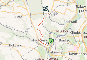
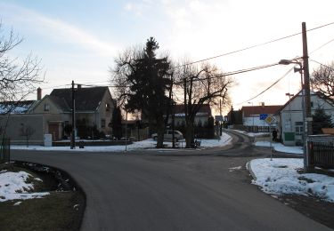
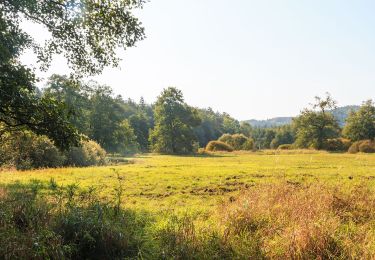
Trail On foot of 4.5 km to be discovered at Central Bohemia, Unknown, Mladá Boleslav. This trail is proposed by SityTrail - itinéraires balisés pédestres.
Description
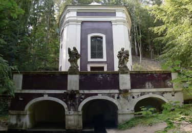
Trail created by cz:KČT.
Positioning
Country:
Czech Republic
Region :
Central Bohemia
Department/Province :
Unknown
Municipality :
Mladá Boleslav
Location:
Unknown
Start:(Dec)
Start:(UTM)
491974 ; 5588234 (33U) N.
Comments
Trails nearby
![Trail On foot Kněžmost - Drhleny - Pod Malou Sněhurkou - Photo](https://media.geolcdn.com/t/375/260/38132064-3812-4ace-977c-2c2b255b8718.jpeg&format=jpg&maxdim=2)
![On foot On foot](https://static1.geolcdn.com/sitytour/trail-icons/100.png)
Drhleny - Pod Malou Sněhurkou
On foot
Easy
Kněžmost,
Central Bohemia,
Unknown,
Czech Republic
![](/images/other/stat-length.png)
4.4 km | 5.5 km-effort
1h 14min
![](https://static1.geolcdn.com/siteimages/upload/files/16400158638029165_repeat_loop_refresh_sync_direction_icon.png)
No
![Trail On foot Okna - CZ-3955 - Photo](https://media.geolcdn.com/t/375/260/ef3f6ad6-5c16-42c0-a05d-38e66d8df5a6.jpeg&format=jpg&maxdim=2)
![On foot On foot](https://static1.geolcdn.com/sitytour/trail-icons/100.png)
CZ-3955
On foot
Easy
Okna,
Northeast,
Liberecký kraj,
Czech Republic
![](/images/other/stat-length.png)
4.2 km | 5.7 km-effort
1h 17min
![](https://static1.geolcdn.com/siteimages/upload/files/16400158638029165_repeat_loop_refresh_sync_direction_icon.png)
No
![Trail On foot Nepřevázka - NS PP Chlum - Photo](https://media.geolcdn.com/t/375/260/d4c5be34-3834-4ac2-829f-9a826c7dc87a.jpeg&format=jpg&maxdim=2)
![On foot On foot](https://static1.geolcdn.com/sitytour/trail-icons/100.png)
NS PP Chlum
On foot
Easy
Nepřevázka,
Central Bohemia,
Unknown,
Czech Republic
![](/images/other/stat-length.png)
7.3 km | 9.7 km-effort
2h 12min
![](https://static1.geolcdn.com/siteimages/upload/files/16400158638029165_repeat_loop_refresh_sync_direction_icon.png)
No
![Trail On foot Bakov nad Jizerou - Bělá p. Bezdězem (žst., rozc.) - Klokočka - Photo](https://media.geolcdn.com/t/375/260/21932d23-f317-41e3-970d-a5fa4f1651af.jpeg&format=jpg&maxdim=2)
![On foot On foot](https://static1.geolcdn.com/sitytour/trail-icons/100.png)
Bělá p. Bezdězem (žst., rozc.) - Klokočka
On foot
Easy
Bakov nad Jizerou,
Central Bohemia,
Unknown,
Czech Republic
![](/images/other/stat-length.png)
9.3 km | 11.3 km-effort
2h 34min
![](https://static1.geolcdn.com/siteimages/upload/files/16400158638029165_repeat_loop_refresh_sync_direction_icon.png)
No
![Trail On foot Bělá pod Bezdězem - NS Březinské studánky - Photo](https://media.geolcdn.com/t/375/260/d631307e-373d-4417-a2d6-191b26017c78.jpeg&format=jpg&maxdim=2)
![On foot On foot](https://static1.geolcdn.com/sitytour/trail-icons/100.png)
NS Březinské studánky
On foot
Easy
Bělá pod Bezdězem,
Central Bohemia,
Unknown,
Czech Republic
![](/images/other/stat-length.png)
7.1 km | 8.5 km-effort
1h 56min
![](https://static1.geolcdn.com/siteimages/upload/files/16400158638029165_repeat_loop_refresh_sync_direction_icon.png)
No
![Trail On foot Košátky - NS Byšice - Photo](https://media.geolcdn.com/t/375/260/9c738d9c-aa7b-4648-9e62-fd68b011a319.jpeg&format=jpg&maxdim=2)
![On foot On foot](https://static1.geolcdn.com/sitytour/trail-icons/100.png)
NS Byšice
On foot
Easy
Košátky,
Central Bohemia,
Unknown,
Czech Republic
![](/images/other/stat-length.png)
9.1 km | 10.1 km-effort
2h 17min
![](https://static1.geolcdn.com/siteimages/upload/files/16400158638029165_repeat_loop_refresh_sync_direction_icon.png)
No
![Trail On foot Ralsko - naučná stezka Jeřáb - Photo](https://media.geolcdn.com/t/375/260/117fe431-d1ec-4e00-89fe-5287e3f96880.jpeg&format=jpg&maxdim=2)
![On foot On foot](https://static1.geolcdn.com/sitytour/trail-icons/100.png)
naučná stezka Jeřáb
On foot
Easy
Ralsko,
Northeast,
Liberecký kraj,
Czech Republic
![](/images/other/stat-length.png)
4.1 km | 5.2 km-effort
1h 10min
![](https://static1.geolcdn.com/siteimages/upload/files/16400158638029165_repeat_loop_refresh_sync_direction_icon.png)
Yes
![Trail On foot Chorušice - [M] Mělnická Vrutice - Zahájí - Photo](https://media.geolcdn.com/t/375/260/5bbe73f2-35ef-41ee-977d-f53953a5ded4.jpeg&format=jpg&maxdim=2)
![On foot On foot](https://static1.geolcdn.com/sitytour/trail-icons/100.png)
[M] Mělnická Vrutice - Zahájí
On foot
Easy
Chorušice,
Central Bohemia,
Unknown,
Czech Republic
![](/images/other/stat-length.png)
12.3 km | 14.7 km-effort
3h 20min
![](https://static1.geolcdn.com/siteimages/upload/files/16400158638029165_repeat_loop_refresh_sync_direction_icon.png)
No
![Trail On foot Jabkenice - [M] Smetanova procházka - okruh 3,5 Km - Photo](https://media.geolcdn.com/t/375/260/ad5da183-bff2-4fd7-ae6a-7c04cd8cd51f.jpeg&format=jpg&maxdim=2)
![On foot On foot](https://static1.geolcdn.com/sitytour/trail-icons/100.png)
[M] Smetanova procházka - okruh 3,5 Km
On foot
Easy
Jabkenice,
Central Bohemia,
Unknown,
Czech Republic
![](/images/other/stat-length.png)
3.7 km | 4.3 km-effort
58min
![](https://static1.geolcdn.com/siteimages/upload/files/16400158638029165_repeat_loop_refresh_sync_direction_icon.png)
Yes