


7.6 km | 9.5 km-effort
![Trail On foot Holýšov - [Č] Stod - Holýšov - Photo](https://media.geolcdn.com/t/1900/400/90aeb2c9-5fc5-41c2-ad60-4fffca584599.jpeg&format=pjpeg&maxdim=2)

Tous les sentiers balisés d’Europe GUIDE+


FREE GPS app for hiking
 SityTrail
IGN / Geographical institutes
SityTrail World
The world is yours!
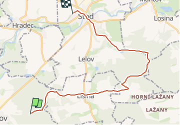
Trail On foot of 13.5 km to be discovered at Southwest, Plzeňský kraj, Holýšov. This trail is proposed by SityTrail - itinéraires balisés pédestres.
Trail created by cz:KČT.
![Trail On foot Holýšov - [Č] Stod - Holýšov - Photo 1](https://media.geolcdn.com/t/2048/auto/68bd38e1-3d5b-4456-bfd8-3832e341dd0f.jpeg&format=jpg&maxdim=0 "Trail On foot Holýšov - [Č] Stod - Holýšov - Photo 1")
![Trail On foot Holýšov - [Č] Stod - Holýšov - Photo 2](https://media.geolcdn.com/t/2048/auto/73a76965-1ceb-4437-a7cd-2cae917fbba4.jpeg&format=jpg&maxdim=0 "Trail On foot Holýšov - [Č] Stod - Holýšov - Photo 2")
![Trail On foot Holýšov - [Č] Stod - Holýšov - Photo 3](https://media.geolcdn.com/t/2048/auto/856b1078-28f6-4d18-9d7a-2e33092dc2f3.jpeg&format=jpg&maxdim=0 "Trail On foot Holýšov - [Č] Stod - Holýšov - Photo 3")
![Trail On foot Holýšov - [Č] Stod - Holýšov - Photo 4](https://media.geolcdn.com/t/2048/auto/05bb1e46-db2a-408f-bc23-de1b80ce7c55.jpeg&format=jpg&maxdim=0 "Trail On foot Holýšov - [Č] Stod - Holýšov - Photo 4")
![Trail On foot Holýšov - [Č] Stod - Holýšov - Photo 5](https://media.geolcdn.com/t/2048/auto/d60b7b98-b4c1-4fb9-83a1-45064b2e0987.jpeg&format=jpg&maxdim=0 "Trail On foot Holýšov - [Č] Stod - Holýšov - Photo 5")
![Trail On foot Holýšov - [Č] Stod - Holýšov - Photo 6](https://media.geolcdn.com/t/2048/auto/5ec2b8f3-6106-4353-b779-7b933e0b90af.jpeg&format=jpg&maxdim=0 "Trail On foot Holýšov - [Č] Stod - Holýšov - Photo 6")
![Trail On foot Holýšov - [Č] Stod - Holýšov - Photo 7](https://media.geolcdn.com/t/2048/auto/c3910cdf-5f07-4d1a-8e08-21ebe50d5555.jpeg&format=jpg&maxdim=0 "Trail On foot Holýšov - [Č] Stod - Holýšov - Photo 7")
![Trail On foot Holýšov - [Č] Stod - Holýšov - Photo 8](https://media.geolcdn.com/t/2048/auto/de67b957-8e98-44ce-a96b-33ef0370f892.jpeg&format=jpg&maxdim=0 "Trail On foot Holýšov - [Č] Stod - Holýšov - Photo 8")
![Trail On foot Holýšov - [Č] Stod - Holýšov - Photo 9](https://media.geolcdn.com/t/2048/auto/02cad982-cb2a-45cf-9033-2b4084b3fb92.jpeg&format=jpg&maxdim=0 "Trail On foot Holýšov - [Č] Stod - Holýšov - Photo 9")
![Trail On foot Holýšov - [Č] Stod - Holýšov - Photo 10](https://media.geolcdn.com/t/2048/auto/90aeb2c9-5fc5-41c2-ad60-4fffca584599.jpeg&format=jpg&maxdim=0 "Trail On foot Holýšov - [Č] Stod - Holýšov - Photo 10")
![Trail On foot Horní Kamenice - [Ž] Holubí hlava - Hráz - Photo](https://media.geolcdn.com/t/375/260/9dc1522f-4ee1-48b9-9358-e28f17cc2b31.jpeg&format=jpg&maxdim=2)
On foot
![Trail On foot Hradec - [Z] Hradec - Vytůň - Photo](https://media.geolcdn.com/t/375/260/36372a90-b81a-4a71-9876-a3bf9f884ffe.jpeg&format=jpg&maxdim=2)
On foot
![Trail On foot Stod - [Ž] Stod - Vytůň - Photo](https://media.geolcdn.com/t/375/260/5f465939-ef20-4d07-aeae-d7b7b507e19b.jpeg&format=jpg&maxdim=2)
On foot