![](/images/other/stat-length.png)
![Trail On foot Zábrodí - CZ-4324 - Photo](https://media.geolcdn.com/t/1900/400/5d4bcf87-eb48-4a78-b732-6f7124147590.jpeg&format=pjpeg&maxdim=2)
CZ-4324
SityTrail - itinéraires balisés pédestres
Tous les sentiers balisés d’Europe GUIDE+
![Length](/images/other/stat-length.png)
Length
4.2 km
![Max alt](https://static1.geolcdn.com/siteimages/upload/files/1508320355ic_sort_altitude_max_24dp.png)
Max alt
484 m
![Uphill gradient](https://static1.geolcdn.com/siteimages/upload/files/1508320355ic_sort_den_pos_24dp.png)
Uphill gradient
62 m
![Km-Effort](/images/other/stat-length.png)
Km-Effort
5.1 km
![Min alt](https://static1.geolcdn.com/siteimages/upload/files/1508320355ic_sort_altitude_min_24dp.png)
Min alt
409 m
![Downhill gradient](https://static1.geolcdn.com/siteimages/upload/files/1508320355ic_sort_den_neg_24dp.png)
Downhill gradient
82 m
![Boucle](https://static1.geolcdn.com/siteimages/upload/files/16400158638029165_repeat_loop_refresh_sync_direction_icon.png)
Boucle
No
Signpost
Creation date :
2025-02-06 20:49:28.89
Updated on :
2025-02-06 20:49:28.89
![On foot](https://static1.geolcdn.com/sitytour/trail-icons/100.png)
1h09
Difficulty : Easy
![Scan this QR Code to open this trail in the SityTrail application](https://capi.geolives.com/qq0zvz2zws4bq2lad0pu/sitytour/trails/4344070/qr.png?size=200)
FREE GPS app for hiking
About
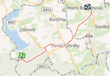
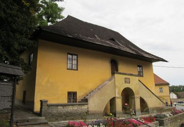
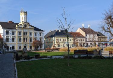
Trail On foot of 4.2 km to be discovered at Northeast, Královéhradecký kraj, Zábrodí. This trail is proposed by SityTrail - itinéraires balisés pédestres.
Description
Trail created by cz:KČT.
Positioning
Country:
Czech Republic
Region :
Northeast
Department/Province :
Královéhradecký kraj
Municipality :
Zábrodí
Location:
Unknown
Start:(Dec)
Start:(UTM)
578625 ; 5589000 (33U) N.
Comments
Trails nearby
![Trail On foot Náchod - CZ-4225 - Photo](https://media.geolcdn.com/t/375/260/c82a2084-61ad-4eb7-a3db-44b765f2d123.jpeg&format=jpg&maxdim=2)
![On foot On foot](https://static1.geolcdn.com/sitytour/trail-icons/100.png)
CZ-4225
On foot
Easy
Náchod,
Northeast,
Královéhradecký kraj,
Czech Republic
![](/images/other/stat-length.png)
7.3 km | 11.4 km-effort
2h 35min
![](https://static1.geolcdn.com/siteimages/upload/files/16400158638029165_repeat_loop_refresh_sync_direction_icon.png)
No
![Trail On foot Náchod - CZ-7253 - Photo](https://media.geolcdn.com/t/375/260/4d5382e2-c73a-40de-8881-cb72d14ac6b3.jpeg&format=jpg&maxdim=2)
![On foot On foot](https://static1.geolcdn.com/sitytour/trail-icons/100.png)
CZ-7253
On foot
Easy
Náchod,
Northeast,
Královéhradecký kraj,
Czech Republic
![](/images/other/stat-length.png)
5.5 km | 7 km-effort
1h 36min
![](https://static1.geolcdn.com/siteimages/upload/files/16400158638029165_repeat_loop_refresh_sync_direction_icon.png)
No
![Trail On foot Červený Kostelec - [Ž] Červený Kostelec - Nad Chlívci - Photo](https://media.geolcdn.com/t/375/260/40db9a42-8d1e-4935-8aa7-910b001912d3.jpeg&format=jpg&maxdim=2)
![On foot On foot](https://static1.geolcdn.com/sitytour/trail-icons/100.png)
[Ž] Červený Kostelec - Nad Chlívci
On foot
Easy
Červený Kostelec,
Northeast,
Královéhradecký kraj,
Czech Republic
![](/images/other/stat-length.png)
6.4 km | 9 km-effort
2h 2min
![](https://static1.geolcdn.com/siteimages/upload/files/16400158638029165_repeat_loop_refresh_sync_direction_icon.png)
No
![Trail On foot Slatina nad Úpou - CZ-7252 - Photo](https://media.geolcdn.com/t/375/260/edf4ebe4-37a6-44a5-be73-91b8eccd44df.jpeg&format=jpg&maxdim=2)
![On foot On foot](https://static1.geolcdn.com/sitytour/trail-icons/100.png)
CZ-7252
On foot
Easy
Slatina nad Úpou,
Northeast,
Královéhradecký kraj,
Czech Republic
![](/images/other/stat-length.png)
4.8 km | 6.5 km-effort
1h 28min
![](https://static1.geolcdn.com/siteimages/upload/files/16400158638029165_repeat_loop_refresh_sync_direction_icon.png)
No
![Trail On foot Slatina nad Úpou - CZ-1830 - Photo](https://media.geolcdn.com/t/375/260/ac4f7420-03bb-41f7-86bb-a90af4096779.jpeg&format=jpg&maxdim=2)
![On foot On foot](https://static1.geolcdn.com/sitytour/trail-icons/100.png)
CZ-1830
On foot
Easy
Slatina nad Úpou,
Northeast,
Královéhradecký kraj,
Czech Republic
![](/images/other/stat-length.png)
7 km | 8.7 km-effort
1h 58min
![](https://static1.geolcdn.com/siteimages/upload/files/16400158638029165_repeat_loop_refresh_sync_direction_icon.png)
No
![Trail On foot Žernov - NS Jakuba Míly - Photo](https://media.geolcdn.com/t/375/260/8275cd8c-9a35-4e3d-b309-f332c68eb50a.jpeg&format=jpg&maxdim=2)
![On foot On foot](https://static1.geolcdn.com/sitytour/trail-icons/100.png)
NS Jakuba Míly
On foot
Easy
Žernov,
Northeast,
Královéhradecký kraj,
Czech Republic
![](/images/other/stat-length.png)
3.7 km | 5.1 km-effort
1h 9min
![](https://static1.geolcdn.com/siteimages/upload/files/16400158638029165_repeat_loop_refresh_sync_direction_icon.png)
No
![Trail On foot Červený Kostelec - Justynčina stezka - Photo](https://media.geolcdn.com/t/375/260/25dc8a5d-e2c0-44a8-80f0-42e3a5b7ea83.jpeg&format=jpg&maxdim=2)
![On foot On foot](https://static1.geolcdn.com/sitytour/trail-icons/100.png)
Justynčina stezka
On foot
Easy
Červený Kostelec,
Northeast,
Královéhradecký kraj,
Czech Republic
![](/images/other/stat-length.png)
7.1 km | 9.7 km-effort
2h 12min
![](https://static1.geolcdn.com/siteimages/upload/files/16400158638029165_repeat_loop_refresh_sync_direction_icon.png)
Yes
![Trail On foot Havlovice - naučná stezka Po stopách erbu zlatého třmene - Photo](https://media.geolcdn.com/t/375/260/bd68f25c-d77a-4f30-8c11-8b2e3926b914.jpeg&format=jpg&maxdim=2)
![On foot On foot](https://static1.geolcdn.com/sitytour/trail-icons/100.png)
naučná stezka Po stopách erbu zlatého třmene
On foot
Medium
Havlovice,
Northeast,
Královéhradecký kraj,
Czech Republic
![](/images/other/stat-length.png)
17.1 km | 21 km-effort
4h 48min
![](https://static1.geolcdn.com/siteimages/upload/files/16400158638029165_repeat_loop_refresh_sync_direction_icon.png)
No
![Trail On foot Žernov - naučná stezka Babiččino údolí - Photo](https://media.geolcdn.com/t/375/260/221ce6cd-5c9c-4ac8-ad07-b9124714d62b.jpeg&format=jpg&maxdim=2)
![On foot On foot](https://static1.geolcdn.com/sitytour/trail-icons/100.png)
naučná stezka Babiččino údolí
On foot
Easy
Žernov,
Northeast,
Královéhradecký kraj,
Czech Republic
![](/images/other/stat-length.png)
6.9 km | 8.2 km-effort
1h 51min
![](https://static1.geolcdn.com/siteimages/upload/files/16400158638029165_repeat_loop_refresh_sync_direction_icon.png)
No