


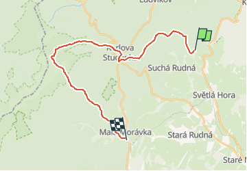

20 km | 29 km-effort
![Trail On foot Andělská Hora - [Ž] Ovčárna - Brantice - Photo](https://media.geolcdn.com/t/1900/400/56802721-ae92-4609-a4ba-e69adace9f31.jpeg&format=pjpeg&maxdim=2)

Tous les sentiers balisés d’Europe GUIDE+


FREE GPS app for hiking
 SityTrail
IGN / Geographical institutes
SityTrail World
The world is yours!
Trail On foot of 23 km to be discovered at Moravia-Silesia, Moravskoslezský kraj, Andělská Hora. This trail is proposed by SityTrail - itinéraires balisés pédestres.
Trail created by cz:KČT.
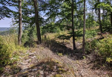
![Trail On foot Andělská Hora - [Ž] Ovčárna - Brantice - Photo 1](https://media.geolcdn.com/t/2048/auto/f42836f1-fac9-4781-8615-13af5d0daca7.jpeg&format=jpg&maxdim=0 "Trail On foot Andělská Hora - [Ž] Ovčárna - Brantice - Photo 1")
![Trail On foot Andělská Hora - [Ž] Ovčárna - Brantice - Photo 2](https://media.geolcdn.com/t/2048/auto/09036e7d-00d8-4c99-8dfb-55fcde90da09.jpeg&format=jpg&maxdim=0 "Trail On foot Andělská Hora - [Ž] Ovčárna - Brantice - Photo 2")
![Trail On foot Andělská Hora - [Ž] Ovčárna - Brantice - Photo 3](https://media.geolcdn.com/t/2048/auto/fc42d528-6001-45ba-be52-11a89ea88fbd.jpeg&format=jpg&maxdim=0 "Trail On foot Andělská Hora - [Ž] Ovčárna - Brantice - Photo 3")
![Trail On foot Andělská Hora - [Ž] Ovčárna - Brantice - Photo 4](https://media.geolcdn.com/t/2048/auto/34b1cfb1-1acb-4e9d-9bb1-d1fec02132ee.jpeg&format=jpg&maxdim=0 "Trail On foot Andělská Hora - [Ž] Ovčárna - Brantice - Photo 4")
![Trail On foot Andělská Hora - [Ž] Ovčárna - Brantice - Photo 5](https://media.geolcdn.com/t/2048/auto/cb6af40d-e296-439b-933c-417a49b3c1d1.jpeg&format=jpg&maxdim=0 "Trail On foot Andělská Hora - [Ž] Ovčárna - Brantice - Photo 5")
![Trail On foot Andělská Hora - [Ž] Ovčárna - Brantice - Photo 6](https://media.geolcdn.com/t/2048/auto/5555d37b-3ee6-4e5e-a3f1-3e3c75dc251f.jpeg&format=jpg&maxdim=0 "Trail On foot Andělská Hora - [Ž] Ovčárna - Brantice - Photo 6")
![Trail On foot Andělská Hora - [Ž] Ovčárna - Brantice - Photo 7](https://media.geolcdn.com/t/2048/auto/50a9815d-34d7-4641-a70e-056fd5517a26.jpeg&format=jpg&maxdim=0 "Trail On foot Andělská Hora - [Ž] Ovčárna - Brantice - Photo 7")
![Trail On foot Andělská Hora - [Ž] Ovčárna - Brantice - Photo 8](https://media.geolcdn.com/t/2048/auto/8f1218a2-f146-49a7-b15e-990a73a615d8.jpeg&format=jpg&maxdim=0 "Trail On foot Andělská Hora - [Ž] Ovčárna - Brantice - Photo 8")
![Trail On foot Andělská Hora - [Ž] Ovčárna - Brantice - Photo 9](https://media.geolcdn.com/t/2048/auto/56802721-ae92-4609-a4ba-e69adace9f31.jpeg&format=jpg&maxdim=0 "Trail On foot Andělská Hora - [Ž] Ovčárna - Brantice - Photo 9")
![Trail On foot Andělská Hora - [Ž] Ovčárna - Brantice - Photo 10](https://media.geolcdn.com/t/2048/auto/5c29a5a5-0f85-41bd-aba3-362902d5eee2.jpeg&format=jpg&maxdim=0 "Trail On foot Andělská Hora - [Ž] Ovčárna - Brantice - Photo 10")
![Trail On foot Vrbno pod Pradědem - [M] Vrbno pod Pradědem - U Obrázku - Photo](https://media.geolcdn.com/t/375/260/71a2ca10-9765-44fa-b01a-89152dd82c9d.jpeg&format=jpg&maxdim=2)
On foot
On foot