


70 km | 82 km-effort
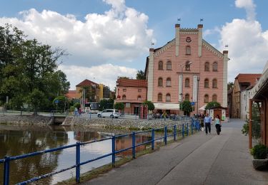
![Trail On foot Jistebnice - [Č] Padařov - Brtný - Photo](https://media.geolcdn.com/t/1900/400/a1483124-2afc-449b-93fd-195f985d667b.jpeg&format=pjpeg&maxdim=2)

Tous les sentiers balisés d’Europe GUIDE+


FREE GPS app for hiking
 SityTrail
IGN / Geographical institutes
SityTrail World
The world is yours!
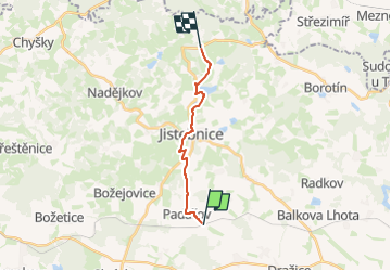
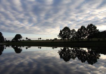
Trail On foot of 11.1 km to be discovered at Southwest, Jihočeský kraj, Jistebnice. This trail is proposed by SityTrail - itinéraires balisés pédestres.
Trail created by cz:KČT.
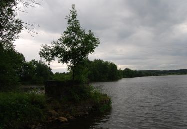
![Trail On foot Jistebnice - [Č] Padařov - Brtný - Photo 1](https://media.geolcdn.com/t/2048/auto/c112c139-c0c4-493f-890e-e7be22a7e09f.jpeg&format=jpg&maxdim=0 "Trail On foot Jistebnice - [Č] Padařov - Brtný - Photo 1")
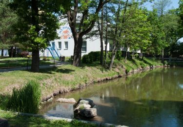
![Trail On foot Jistebnice - [Č] Padařov - Brtný - Photo 2](https://media.geolcdn.com/t/2048/auto/af00b7ba-7b2e-4f51-8d2c-c21c94921fce.jpeg&format=jpg&maxdim=0 "Trail On foot Jistebnice - [Č] Padařov - Brtný - Photo 2")
![Trail On foot Jistebnice - [Č] Padařov - Brtný - Photo 3](https://media.geolcdn.com/t/2048/auto/8871ead0-3d2c-4484-9c79-5d8113bae9aa.jpeg&format=jpg&maxdim=0 "Trail On foot Jistebnice - [Č] Padařov - Brtný - Photo 3")
![Trail On foot Jistebnice - [Č] Padařov - Brtný - Photo 4](https://media.geolcdn.com/t/2048/auto/31f997a4-8160-408e-a50c-d5f123379f23.jpeg&format=jpg&maxdim=0 "Trail On foot Jistebnice - [Č] Padařov - Brtný - Photo 4")
![Trail On foot Jistebnice - [Č] Padařov - Brtný - Photo 5](https://media.geolcdn.com/t/2048/auto/6cfdf591-36d9-4b31-987e-9e8a5cb577fe.jpeg&format=jpg&maxdim=0 "Trail On foot Jistebnice - [Č] Padařov - Brtný - Photo 5")
![Trail On foot Jistebnice - [Č] Padařov - Brtný - Photo 6](https://media.geolcdn.com/t/2048/auto/b627fd3f-a380-441c-8dd2-d4b752cbb946.jpeg&format=jpg&maxdim=0 "Trail On foot Jistebnice - [Č] Padařov - Brtný - Photo 6")
![Trail On foot Jistebnice - [Č] Padařov - Brtný - Photo 7](https://media.geolcdn.com/t/2048/auto/54a32540-d2c7-442d-8edf-0d98b178738c.jpeg&format=jpg&maxdim=0 "Trail On foot Jistebnice - [Č] Padařov - Brtný - Photo 7")
![Trail On foot Jistebnice - [Č] Padařov - Brtný - Photo 8](https://media.geolcdn.com/t/2048/auto/c4a89fea-cc1a-4707-ad97-fae37c876486.jpeg&format=jpg&maxdim=0 "Trail On foot Jistebnice - [Č] Padařov - Brtný - Photo 8")
![Trail On foot Jistebnice - [Č] Padařov - Brtný - Photo 9](https://media.geolcdn.com/t/2048/auto/a1483124-2afc-449b-93fd-195f985d667b.jpeg&format=jpg&maxdim=0 "Trail On foot Jistebnice - [Č] Padařov - Brtný - Photo 9")
![Trail On foot Jistebnice - [Č] Padařov - Brtný - Photo 10](https://media.geolcdn.com/t/2048/auto/9c97a21a-1e65-41ff-8615-8f61d0410f18.jpeg&format=jpg&maxdim=0 "Trail On foot Jistebnice - [Č] Padařov - Brtný - Photo 10")
Other activity
On foot
![Trail On foot Týn nad Vltavou - [M] Bechyně - Židova strouha - Photo](https://media.geolcdn.com/t/375/260/6448b7c9-0f0e-42ec-b862-9acf38988c27.jpeg&format=jpg&maxdim=2)
On foot
![Trail On foot Střezimíř - [Ž] Střezimíř-Vestec - Photo](https://media.geolcdn.com/t/375/260/741f7653-64d2-46f3-ad9c-bd79bc7c5f08.jpeg&format=jpg&maxdim=2)
On foot
![Trail On foot Sezimovo Ústí - [M] Sezimovo Ústí - Planá nad Lužnicí - Photo](https://media.geolcdn.com/t/375/260/5b6d0c4e-5d11-4cd9-9c2c-b6cbb176e445.jpeg&format=jpg&maxdim=2)
On foot
On foot
![Trail On foot Chotoviny - [Ž] U Obrázku - Sudoměřice - Chotoviny - Photo](https://media.geolcdn.com/t/375/260/f7339841-f981-41ea-8ead-dcdc4c14e1ae.jpeg&format=jpg&maxdim=2)
On foot
On foot
![Trail On foot Sezimovo Ústí - [M] Choustník - Sezimovo Ústí - Photo](https://media.geolcdn.com/t/375/260/ext.jpg?maxdim=2&url=https%3A%2F%2Fstatic1.geolcdn.com%2Fsiteimages%2Fupload%2Ffiles%2F1545311037marcheuse_200dpi.jpg)
On foot